Categories
Bucknell/Local Interest General GIS GIS in Women's Studies Map Apps Slideshow

Simple tool for creating KML-based thematic maps

As someone who has one foot in the ArcGIS world and another in the GoogleEarth/GoogleMaps world, I’m continually annoyed at how cumbersome it is to shuffle data back and forth between the two product lines.  I’ll skip the diatribe for now and instead just point out a cool new tool that I ran across last week when I was getting ready to talk to a Women’s Studies class that will be using GoogleMaps for a class project.

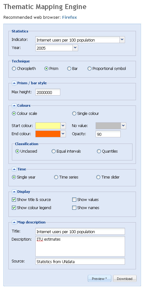
The website, thematicmapping.org, features a blog with tips and tricks for creating KML-based thematic maps. But more importantly, it provides a tool that you can use to create KML-based thematic maps for a variety of global data indicators. Although the selection of indicators is rather limited, thematicmapping.org also makes its API available so that you can create thematic maps from your own data sources.  Now if I just had a programmer at my beck and call…

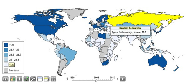
Below is a screen shot of the Thematic Mapping Engine interface along with a snapshot of the resulting KML file


Categories
Data General GIS GIS in Environmental Studies GIS in Geography GIS in Humanities GIS in Political Science GIS in Public Health GIS in Sociology Map Apps Slideshow

3 global data visualization tools to use in your class

Last fall the World Bank launched a contest aimed at challenging web developers to create web-based tools using the data available through the World Bank’s Open Data Initiative. Click here to read an article from Programmable Web about the contest winners (excerpt below).

You can visualize nearly every indicator of economic, social and human development on StatPlanet World Bank, the winner of World Bank’s ambitious developer contest launched last October challenging new uses of the World Bank API. After voting from distinguished judges and the public, the organization announced the top three apps at an event in Washington, D.C., this afternoon.

StatPlanet is already a platform used by non-profits and other groups to map and visualize data. Its creator Frank van Cappelle said the application is aimed toward “evidence-based decision making.” For the World Bank contest, van Cappelle connected his platform to World Bank’s API. Where one of the challenges with World Bank’s data is how much of it there is, StatPlanet does a great job of helping users zero in on and visualize what interests them.

StatPlanet enables users to visualize global development indicators via customizeable maps and charts – and also provides a data download tool.  StatPlanet could be used in combination with WorldMapper and Gapminder – two other web-based global data visualization tools – for in-class demos and/or as a resource for student projects.  Click here to go to the StatPlanet main landing page or here to go directly to the tool.

Categories
Bucknell/Local Interest Crisis-Mapping Events/Calendar General GIS GIS by Academic Discipline GIScience, Pedagogy & Spatial Thinking Slideshow

Peer-reviewed articles on spatial thinking & GIS

Diana Sinton, Director of Spatial Curriculum and Research for the University of RedlandsLENS Initiative, recently tipped me off to a website with full-text PDFs of peer-reviewed papers that are being presented this week at the Spatial Thinking & GIS conference being held in Tokyo, Japan.  The papers  (including one from GIS Hall of Fame-r – yes, there is such a thing – Michael Goodchild from UCSB) cover a variety of topics related to spatial thinking and GIS. Quite a few of them present methods for integrating spatial thinking and GIS into different disciplines in the higher ed curriculum.

Click here to browse the paper abstracts and download free, full-text copies. I’ve also downloaded all of the papers to the GIS Server – contact me at jlg046@bucknell.edu if you don’t yet have access to the server. Below is a list of the paper titles.

  • Spatial Thinking & the GIS User Interface (Michael Goodchild)
  • Modeling and Simulation in Geographic Information Science: Integrated Models and Grand Challenges (Michael Batty)
  • Understanding and nurturing spatial literacy (Sarah Witham Bednarz, Karen Kemp)
  • Collaborative mobility: using geographic information science to cultivate cooperative transportation systems (Harvey J. Millera)
  • About the International Master‘s Program in Cartography (Jukka Krisp, Stefen Peters, Liqiu Meng)
  • Addressing Structural Instability in Housing Market Segmentation of the Used Houses of Tokyo, Japan (Kazi Saiful Islam, Yasushi Asami)
  • Analysis of Scenic Perception and Its Spatial Tendency: Using Digital Cameras, GPS loggers, and GIS (Koun Sugimoto)
  • An Approach to Modeling Spatial Perception for Geovisualization (Kenan Bektaş, Arzu Çöltekin)
  • Assessing College Students’ Spatial Concept Knowledge in Complexity Levels (Katsuhiko Oda)
  • Beyond geo-spatial technologies: promoting spatial thinking through local disaster risk management planning (Kristoffer B. Berse, Fouad Bendimerad, Yasushi Asami)
  • Classification and feature extraction of criminal occurrence points using CAEP with transductive clustering (Atushi Takizawa)
  • A Collaborative Process for Developing Map Symbol Standards (Anthony C. Robinson, Robert E. Roth, Justine Blanford, Scott Pezanowski, Alan M. MacEachren)
  • The components of spatial thinking: empirical evidence (Robert S. Bednarz, Jongwon Lee)
  • Ecotourism Development and Security Restructuring: A GI Based Planning for Peaceful Dissuasion of Anarchism in Forest Provinces of India (Abhisek Chakrabarty)
  • Effectiveness of Digital Educational Materials for Developing Spatial Thinking of Elementary School Students (Minori Yuda)
  • Empirical Comparison of the Various Spatial Prediction Models: in Spatial Econometrics, Spatial Statistics, and Semiparametric Statistics (Hajime Seya, Morito Tsutsumi, Yasushi Yoshida, Yuichiro Kawaguchi)
  • Enable Spatial Thinking Using GIS and Satellite Remote Sensing – A Teacher-Friendly Approach (Yick Cheung, Matthew Pang, Hui Lin, Chi Kin John Lee)
  • Geographic Information Science: Building a Doctoral Programme Integrating Interdisciplinary Concepts and Methods (Thomas Blaschke, Josef Strobl, Karl Donert)
  • Hedonic Analysis for Estimation of Condominium Rent Utilizing WEB Information (Takafumi Miura, Yasuhi Asami)
  • Implementation of a Flow Map Demonstrator for Analyzing Commuting and Migration Flow Statistics Data (Quan Ho, Phong H. Nguyen, Tobias Åström, Mikael Jern)
  • The Implications of Using a Gravity Model to Determine Territory in a Circular Domain (Hidenori Tamagawa)
  • Importance of considering grain and extent for the analysis on spatial dynamics: perspectives from comparison between theory and empirical example on seagrass bed dynamics in Tokyo Bay (Takehisa Yamakita, Masahiro Nakaoka)
  • Intraregional Flow Problem in Spatial Econometric Model for Origin-destination Flows (Morito Tsutsumi, Kazuki Tamesue)
  • Land price maps of Tokyo Metropolitan Area (Morito Tsutsumi, Akira Shimada, Daisuke Murakami)
  • Land use/cover change detection and analysis for Dzalanyama forest reserve, Lilongwe, Malawi (Kondwani G. Munthali, Yuji Murayama)
  • Land use land cover change in National Capital Region of India: A remote sensing & GIS based two decadal spatial-temporal analyses (Kianoush Suzanchi, Ravinder Kaur)
  • MeAdian robust spatial filtering on satellite images (Didier Josselin, Julio Rojas-Mora, Alexandre Ulmer)
  • A New Areal Interpolation Method Based on Spatial Statistics (Daisuke Murakami, Morito Tsutsumi)
  • Optimizing the groundwater monitoring network using MSN theory (Yangsha Guo, J.F. Wang, X.L. Yin)
  • Scenarios and Indicators Supporting Urban Regional Planning (Petrov Laura Oana, Shahunyan Harutyun, Williams Brendan, Convery Sheila)
  • Sequencing spatial concepts in problem-based GIS instruction (Jeffrey T. Howarth, Diana Sinton)
  • Shocks, spillovers and the location of firms (Andrés Artal-Tur, José Miguel Navarro-Azorín, Luisa Alamá-Sabater, Antonio García-Sánchez)
  • Site Suitability Evaluation for Ecotourism Using GIS & AHP: A Case Study of Surat Thani Province, Thailand (Khwanruthai Bunruamkaew, Yuji Murayam)
  • Spatial concentrations of surnames in Great Britain (James Cheshire, Paul Longley)
  • Spatial index of educational opportunities: Rio de Janeiro and Belo Horizonte (Wolfram Lange, Fatima Alves)
  • Spatial Literacy and the Postgraduate GIS Curriculum (Claire H. Jarvis)
  • Spatial mismatch problem of childcare in Tokyo (Mizuki Kawabata)
  • Spatial thinking in geographic information science: a review of past studies and prospects for the future (Yoshiki Wakabayashi, Toru Ishikawa)
  • Spatiotemporal Types of HFMD and Climate (JF Wang, G Christakos, YS Guo, WZ Yang, YL Liao, XZ Wang)
  • Spatio-Temporal Clustering of Road Accidents: GIS Based Analysis and Assessment (V. Prasannakumar, H. Vijith, R. Charutha, N. Geetha)
  • Spatio-Temporal Urban Land Use/Cover Change Analysis in a Hill Station: The Case of Baguio City, Philippines (Ronald C. Estoque, Yuji Murayama)
  • Stability tests of urban physical form indicators: The case of European cities (Amon Boontore)
  • Techniques for Highlighting Relief on Orthoimaginery (Miguel A. Bernabé-Poveda, Iván Sánchez-Ortega, Arzu Çöltekin)
  • The Use of Geospatial Information and Spatial Cognition of Taxi Drivers in Tokyo (Yoshiki Wakabayashi, Shuichi Itoh, Yota Nagami)
  • Using GIS for Linguistic Study: A Case of Dialect Change in the Northeastern Region of Thailand (Sirivilai Teerarojanarat, Kalaya Tingsabadh)
  • Using video case studies to assess the impact of the use of GIS on secondary students’ spatial thinking skills Robert (A. Kolvoord, David H. Uttal, Nathaniel G. Meadow)
  • Visualization through GIS of Residents’ Conscious, Attitude and Activities to Prevent Disasters (Masahiro Arima, Michitaka Arima)
Categories
Bucknell/Local Interest Data Environment Events/Calendar General GIS GIS in Computer Science GIS in Engineering GIS in Environmental Studies GIS in Geology Miller Run Restoration Project Slideshow

Physics Dept coffee talk on using the Flying Bison drone to collect aerial imagery

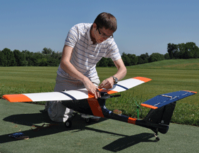
Come hear Nick Urban, Computer Science ’12, talk about designing, building and flying the remote-controlled Flying Bison drone. Nick will be presenting on Monday, 9/26 at noon (Olin 364) as part of the Physics department’s coffee talk series.  He’ll have the plane with him and will be showing some new video that will be captured by the drone in test flights he’s conducting this week.

Below are links to some previous blog posts about Nick’s Flying Bison and the Miller Run Restoration project that the drone collected data for.

1. Article by Julia Ferrante from Bucknell Communications office

2. A short video about the Miller Run Restoration project and the Flying Bison

3. An overview of the Miller Run Restoration project, including the role of the Flying Bison in collecting high resolution aerial imagery.

4. Some background on the spring 2011 competition that Nick flew the Flying Bison

Categories
Bucknell/Local Interest General GIS GIS in Geography Slideshow Videos

More web tools for helping students understand scale

In previous posts here, here and here I’ve mentioned different resources that can be useful in helping students understand scale.  Joseph Kerski, ESRI’s Education Curriculum Development Manager, recently posted to one of the GIS in higher ed listserves about some new web-based tools for teaching students about scale.

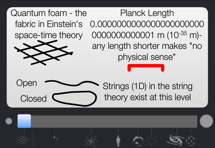
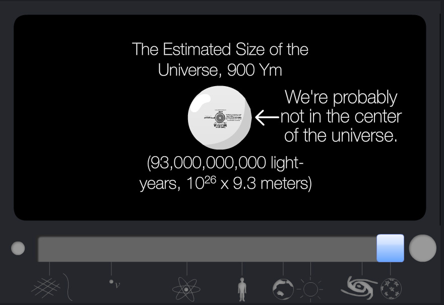
One of the websites, Scale of the Universe (created by Primaxstudio.com), features an interactive graphic that enables users to toggle a slider bar to zoom out from quantum to galactic scales while viewing where a variety of objects and measurements (quarks, bacteria, ostrich eggs, Redwood Trees, Marathon distance, planets, a light year)  fall along that spectrum.

Min                                                                                                   Mid

Max

Max

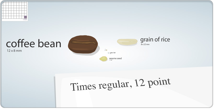
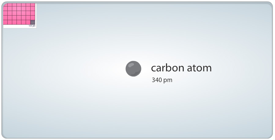
The other site, Cell Size and Scale (from the Genetics Science Learning Center at the University of Utah), uses the same slider bar device but starts with a 1 square millimeter cell size, a coffee bean and 12 pt Times font and then zooms in – passing an X chromosome, Baker’s yeast, hemoglobin and glucose on the way – until it eventually reaches the size of a carbon atom.


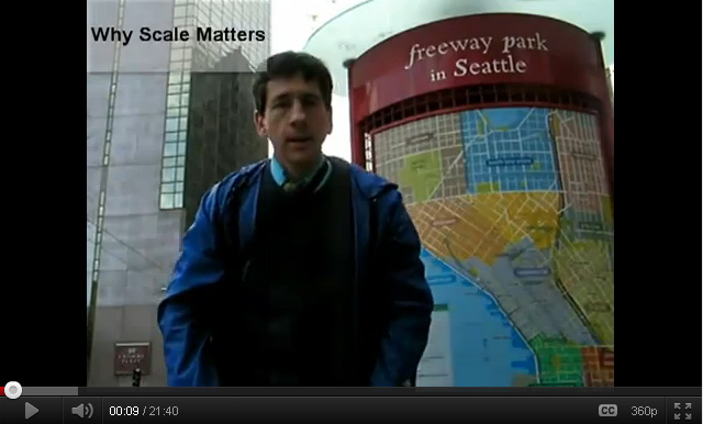
Joseph also shared a link to a movie he created, entitled “Why Scale Matters,” that illustrates concepts related to scale in geography:

httpv://youtu.be/blF0fXMCFZU