Categories
Bucknell/Local Interest Environment GIS in Engineering GIS in Environmental Studies GIS Jobs, Internships, Scholarships & Grad Programs Slideshow

GIS in research (and the classroom): modeling sea level rise inundation

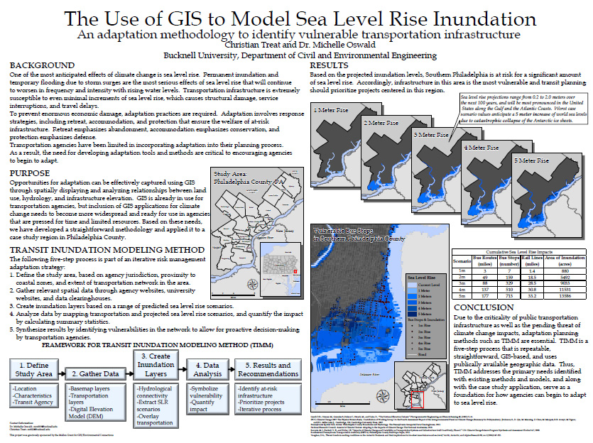
During Summer 2012, Prof. Michelle Oswald (Civil Engineering) and student Christian Treat ’13 (Animal Behavior) used GIS to model seal level rise inundation and identify vulnerable transportation infrastructure in the Philadelphia metropolitian area. Christian’s stipend for this summer research project was paid for out of Bucknell’s GIS student assistant fund (funded in part by the Mellon grant we got a few years ago… stay tuned for details on summer 2013 paid research opportunities).

Over the course of the 2012-13 academic year, Christian has continued developing this research project as an independent study and is listed as a co-author in an upcoming publication in the Journal of Public Transportation. At some point this spring I’ll post an interview with Christian discussing his work on this project – but for now, you can check out the poster he presented at last November’s ‘GIS & Spatial Thinking‘ conference.


¨Christian Treat ’13 (Animal Behavior)/Prof. Michelle Oswald (Civil Engineering) (Bucknell), ‘Using GIS to Model Seal Level Rise Inundation’

SLR_Treat

Categories
Environment GIS in Environmental Studies GIS in Geography GIS in Social Science GIS Jobs, Internships, Scholarships & Grad Programs Slideshow

Another summer 2013 GIS student research opportunity

Here’s info on another GIS student research opportunity for summer 2013. This one is hosted by Georgia State University. It’s part of the same NSF-funded ‘Research Experiences for Undergraduates (REU) program as the California State Long Beach program we posted about a few weeks ago.  The Geogria State program focuses on addressing social/environmental disparities through community geography and provides a stipend, housing and expenses. Deadline to apply is Friday, March 1st – so move fast!  More info from the announcement below.

Georgia State University will be hosting   This summer at Georgia State University in Atlanta, we are pleased to host the second year of our “Research Experiences for Undergraduates (REU) Site: Addressing Social and Environmental Disparities through Community Geography and Geographic Information Systems”.  The project is funded by the National Science Foundation.  The program runs June 10th – July 25th 2013.   The flier and application form are attached.

Research Interests: Working with faculty mentors in one of three research tracks, selectedundergraduates will engage in community-based research and fieldwork to quantitatively and qualitatively examine neighborhood change, property markets, social geographies, air and soil quality, urban green spaces, and neighborhood visioning in partnership with neighborhood residents and community groups in Atlanta, Georgia.

Compensation: Each REU student will receive a competitive funding package, including: a $3000 stipend, up to $250 in travel support to/from Atlanta, up to $750 for conference presentations, free room and most meals at GSU, and 3 required texts.

Application Process: Applications are due Friday, March 1st @ 5 PM EST.  Complete application instructions and the application form can be found at http://csaw.gsu.edu/nsf-reu/application-instructions/

To Learn More:  Visit http://csaw.gsu.edu/nsf-reu/

Any questions can be directed to the Dr. Timothy Hawthorne (PI) at thawthorne@gsu.edu or Dr. Katherine Hankins (Co-PI) at khankins@gsu.edu


Categories
Bucknell/Local Interest GIS in Geography GIS in History GIS in Humanities GIS Jobs, Internships, Scholarships & Grad Programs Slideshow

Summer 2013 GIS student research opportunities in Connecticut, California and Hawaii

Yes, we’re in the middle of a deep freeze, but it’s not too early to start thinking about summer 2013. Here are two opportunities for undergraduate students to do GIS research and field work. Both programs provide a stipend, housing and expenses. Deadlines are approaching fast so get moving if you want to apply for these!

(1) GIS Approach to Water Level Change – Keck Geology Consortium. Application deadline February 1, 2013. 

This project funds three students on a GIS project analyzing water levels, island area, and plant species richness for a study site in the Great Lakes. The students then continue with the project independently into the fall semester and present their work at the Keck Geology Consortium Undergraduate Research Symposium in the spring.

What: Investigation of spatiotemporal changes in island shorelines due to water-level changes using the mapping and analytical tools of a geographic information system (GIS). Study area is The Massasauga Provincial Park archipelago (Georgian Bay, Lake Huron, Ontario)

When: July 10 – August 7

Where: Wesleyan University. The project consists mainly of spatial analyses using ArcGIS but will also include training in field data collection.

(2) NSF REU – Geospatial Research and Mapping (GRAM) program. Application deadline March 1st, 2013

Geography and Archaeology undergraduates, as well as others interested in the study of landscapes, may be interested in our summer 2013 field program on geospatial research and mapping (GRAM) that will take place at both California State University Long Beach and at the famous* Kualoa Ranch in the picturesque Ka’a’awa valley on the north shore of O’ahu.

This field research program is a joint effort between faculty in the Department of Geography and Anthropology at CSULB and is focused on the use of cutting edge geospatial techniques (e.g., satellite and aerial imagery, the use of UAVs, geographic information systems, spectral analyses, topography generation, landscape analyses, and near surface remote sensing).   The research being undertaken by GRAM includes the study of prehistoric landscapes as well as contemporary resources and environments.

Our website (http://www.csulb.edu/colleges/cla/departments/geography/nsf-reu/) describes the overall program and include the research of last year’s students, the application form and additional program information. This is the second year of our 3 year project funded by the National Science Foundation (NSF) under their Research Experience for Undergraduates (REU) program.

This year’s GRAM project will take place June 2 to June 30 and include training in Long Beach and on Oahu. The NSF-REU program provides funding for student to cover travel, housing, tuition costs as well as a small stipend. Applications are competitive and open to undergraduates across the country.

The site of the field work is famously known as the location of the filming for Lost, Jurassic Park, among other TV shows and films.

Categories
Bucknell/Local Interest Digital Humanities Events/Calendar GIS & Environmental Justice GIS by Academic Discipline GIS in Art GIS in Biology GIS in Computer Science GIS in Economics GIS in Engineering GIS in Environmental Studies GIS in Film Studies GIS in Geography GIS in Geology GIS in History GIS in Humanities GIS in Political Science GIS in Psychology GIS in Public Health GIS in Social Science GIS in Sociology GIS in Women's Studies GIScience, Pedagogy & Spatial Thinking Slideshow

Register & Submit Presentations for Bucknell-hosted GIS conference

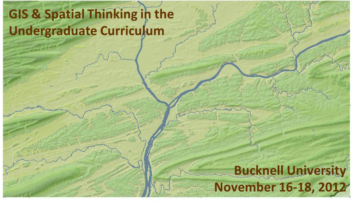
We recently launched the conference website for the upcoming Bucknell-hosted conference GIS & Spatial Thinking in the Undergraduate Curriculum.  Basic info is shown below, but please check out the conference website for details and updates as they become available.

About the Conference:

  • When: November 16-18, 2012
  • Where: Bucknell University, Lewisburg, PA. Click here for a map.
  • Details: Click on the pages shown on the menu above to access information onregistrationlodging, conference schedule, and submitting presentations and maps.
  • Deadlines:  Deadline for early bird registration is September 15, 2012. Deadline forsubmitting presentations and maps is September 21, 2012.
  • Format:  We have chosen a work-group format for the conference in order to maximize opportunities for discussion and brain-storming amongst participants. The main day of the conference will feature five work-group sessions. Each session will consist of 45 minutes of presentations and 45 minutes of open discussion organized around a theme. We are seeking 3 presenters and 1 chairperson for each of the 5 sessions. See the submissions page for a detailed description of each of the session topics:
    • 1a (Concurrent with 1b) – Mapping Human Activity – Qualitative Analysis GIS
    • 1b (Concurrent with 1a) – Quantitative Analysis & Technical Applications of GIS
    • 2   (Single group) – GIS in Pedagogy
    • 3a (Concurrent with 3b) – GIS in Community Outreach & Service Learning
    • 3b (Concurrent with 3a) – Software & Data Issues in GIS Instruction
  • Goals: Desired outcomes include: (1) providing mutual support for imaginative and challenging applications of spatial technology in undergraduate education; (2) fostering potential collaborative efforts between and within participant schools, such as joint research initiatives and/or shared resources for data, web maps and teaching materials, and; (3) creating a regional community of faculty and GIS/IT staff to interact on a regular basis, share information, and exchange ideas about the priorities identified during the conference.

This event is sponsored by Library & Information Technology at Bucknell University. Should you have any questions, please contact Janine Glathar at jlg046@bucknell.edu or (570) 577-1990.


Categories
Bucknell/Local Interest Digital Humanities General GIS GIS in History Slideshow

Faculty GIS Profiles: Song Chen, Assistant Professor of Chinese History

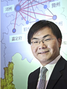
The following is a guest post by Prof. Song Chen, Assistant Professor of Chinese History, who arrived on campus in fall 2011. Click here to read the profile of Prof. Chen that was posted on the Bucknell website. In addition to his use of GIS for research purposes, Prof. Chen is planning to integrate GIS into a Spring 2013 quantitative methods course for history majors. Below is Prof. Chen’s description of how he uses GIS in his research on connections between the imperial state and local elites in 10th-13th century China:

My research combines GIS, network analysis, and prosopographical research. To understand the relationship between the imperial state and local elites in China, I use GIS to map out geographical patterns of civil servants and their marriage networks. Though my recent work relies primarily on a dataset I have personally built from a collection of several hundred funerary biographies from the 10th to the 13th century, I have also benefited significantly from other existing data collections and databases. I owe much to the China Biographical Database (CBDB) and China Historical GIS (CHGIS) projects.

CBDB is an online relational database under development but already contains about 120,000 historical figures. It contains massive geo-biographical data points, which are easily cross-queried and exported. CHGIS provides the most complete and authoritative point and polygon files for places in Chinese history. In future projects, I also plan to use GIS tools to visualize and analyze patterns of demographic settlement, economic activities, and social and intellectual interactions. I have also found G. William Skinner’s datasets on China tremendously useful.

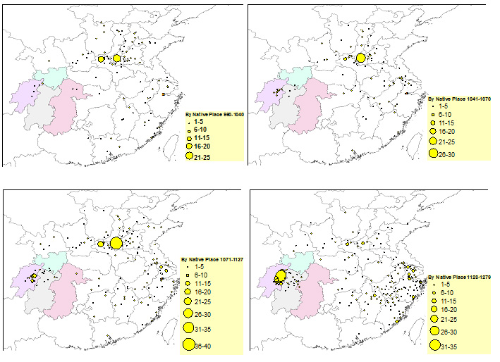
The following maps, for example, are generated by combining CBDB data and CHGIS polygon files and coordinates, with graduated symbology in ArcGIS. They show the native places of civil officials who were in the Sichuan region (the four highlighted administrative divisions) between 960 and 1279. These maps allow me to discover macrohistorical patterns of local governance during these centuries: a growing tendency of having native men staffing local offices in the Sichuan region.

Click image below for larger view.