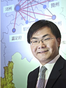
The following is a guest post by Prof. Song Chen, Assistant Professor of Chinese History, who arrived on campus in fall 2011. Click here to read the profile of Prof. Chen that was posted on the Bucknell website. In addition to his use of GIS for research purposes, Prof. Chen is planning to integrate GIS into a Spring 2013 quantitative methods course for history majors. Below is Prof. Chen’s description of how he uses GIS in his research on connections between the imperial state and local elites in 10th-13th century China:
My research combines GIS, network analysis, and prosopographical research. To understand the relationship between the imperial state and local elites in China, I use GIS to map out geographical patterns of civil servants and their marriage networks. Though my recent work relies primarily on a dataset I have personally built from a collection of several hundred funerary biographies from the 10th to the 13th century, I have also benefited significantly from other existing data collections and databases. I owe much to the China Biographical Database (CBDB) and China Historical GIS (CHGIS) projects.
CBDB is an online relational database under development but already contains about 120,000 historical figures. It contains massive geo-biographical data points, which are easily cross-queried and exported. CHGIS provides the most complete and authoritative point and polygon files for places in Chinese history. In future projects, I also plan to use GIS tools to visualize and analyze patterns of demographic settlement, economic activities, and social and intellectual interactions. I have also found G. William Skinner’s datasets on China tremendously useful.
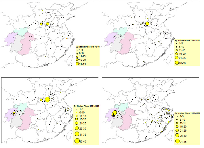
The following maps, for example, are generated by combining CBDB data and CHGIS polygon files and coordinates, with graduated symbology in ArcGIS. They show the native places of civil officials who were in the Sichuan region (the four highlighted administrative divisions) between 960 and 1279. These maps allow me to discover macrohistorical patterns of local governance during these centuries: a growing tendency of having native men staffing local offices in the Sichuan region.
Click image below for larger view.