Categories
Bucknell/Local Interest Environment GIS in Engineering GIS in Environmental Studies GIS Jobs, Internships, Scholarships & Grad Programs Slideshow

GIS in research (and the classroom): modeling sea level rise inundation

During Summer 2012, Prof. Michelle Oswald (Civil Engineering) and student Christian Treat ’13 (Animal Behavior) used GIS to model seal level rise inundation and identify vulnerable transportation infrastructure in the Philadelphia metropolitian area. Christian’s stipend for this summer research project was paid for out of Bucknell’s GIS student assistant fund (funded in part by the Mellon grant we got a few years ago… stay tuned for details on summer 2013 paid research opportunities).

Over the course of the 2012-13 academic year, Christian has continued developing this research project as an independent study and is listed as a co-author in an upcoming publication in the Journal of Public Transportation. At some point this spring I’ll post an interview with Christian discussing his work on this project – but for now, you can check out the poster he presented at last November’s ‘GIS & Spatial Thinking‘ conference.
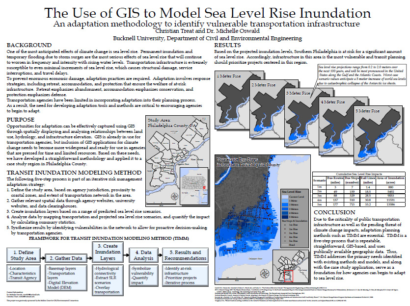
 

¨Christian Treat ’13 (Animal Behavior)/Prof. Michelle Oswald (Civil Engineering) (Bucknell), ‘Using GIS to Model Seal Level Rise Inundation’

SLR_Treat

Categories
Environment GIS in Environmental Studies GIS in Geography GIS in Social Science GIS Jobs, Internships, Scholarships & Grad Programs Slideshow

Another summer 2013 GIS student research opportunity

Here’s info on another GIS student research opportunity for summer 2013. This one is hosted by Georgia State University. It’s part of the same NSF-funded ‘Research Experiences for Undergraduates (REU) program as the California State Long Beach program we posted about a few weeks ago.  The Geogria State program focuses on addressing social/environmental disparities through community geography and provides a stipend, housing and expenses. Deadline to apply is Friday, March 1st – so move fast!  More info from the announcement below.

Georgia State University will be hosting   This summer at Georgia State University in Atlanta, we are pleased to host the second year of our “Research Experiences for Undergraduates (REU) Site: Addressing Social and Environmental Disparities through Community Geography and Geographic Information Systems”.  The project is funded by the National Science Foundation.  The program runs June 10th – July 25th 2013.   The flier and application form are attached.

Research Interests: Working with faculty mentors in one of three research tracks, selectedundergraduates will engage in community-based research and fieldwork to quantitatively and qualitatively examine neighborhood change, property markets, social geographies, air and soil quality, urban green spaces, and neighborhood visioning in partnership with neighborhood residents and community groups in Atlanta, Georgia.

Compensation: Each REU student will receive a competitive funding package, including: a $3000 stipend, up to $250 in travel support to/from Atlanta, up to $750 for conference presentations, free room and most meals at GSU, and 3 required texts.

Application Process: Applications are due Friday, March 1st @ 5 PM EST.  Complete application instructions and the application form can be found at http://csaw.gsu.edu/nsf-reu/application-instructions/

To Learn More:  Visit http://csaw.gsu.edu/nsf-reu/

Any questions can be directed to the Dr. Timothy Hawthorne (PI) at thawthorne@gsu.edu or Dr. Katherine Hankins (Co-PI) at khankins@gsu.edu


Categories
Bucknell/Local Interest Digital Humanities Events/Calendar GIS & Environmental Justice GIS by Academic Discipline GIS in Art GIS in Biology GIS in Computer Science GIS in Economics GIS in Engineering GIS in Environmental Studies GIS in Film Studies GIS in Geography GIS in Geology GIS in History GIS in Humanities GIS in Political Science GIS in Psychology GIS in Public Health GIS in Social Science GIS in Sociology GIS in Women's Studies GIScience, Pedagogy & Spatial Thinking Slideshow

Register & Submit Presentations for Bucknell-hosted GIS conference

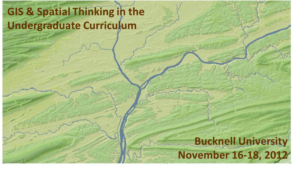
We recently launched the conference website for the upcoming Bucknell-hosted conference GIS & Spatial Thinking in the Undergraduate Curriculum.  Basic info is shown below, but please check out the conference website for details and updates as they become available.

About the Conference:

  • When: November 16-18, 2012
  • Where: Bucknell University, Lewisburg, PA. Click here for a map.
  • Details: Click on the pages shown on the menu above to access information onregistrationlodging, conference schedule, and submitting presentations and maps.
  • Deadlines:  Deadline for early bird registration is September 15, 2012. Deadline forsubmitting presentations and maps is September 21, 2012.
  • Format:  We have chosen a work-group format for the conference in order to maximize opportunities for discussion and brain-storming amongst participants. The main day of the conference will feature five work-group sessions. Each session will consist of 45 minutes of presentations and 45 minutes of open discussion organized around a theme. We are seeking 3 presenters and 1 chairperson for each of the 5 sessions. See the submissions page for a detailed description of each of the session topics:
    • 1a (Concurrent with 1b) – Mapping Human Activity – Qualitative Analysis GIS
    • 1b (Concurrent with 1a) – Quantitative Analysis & Technical Applications of GIS
    • 2   (Single group) – GIS in Pedagogy
    • 3a (Concurrent with 3b) – GIS in Community Outreach & Service Learning
    • 3b (Concurrent with 3a) – Software & Data Issues in GIS Instruction
  • Goals: Desired outcomes include: (1) providing mutual support for imaginative and challenging applications of spatial technology in undergraduate education; (2) fostering potential collaborative efforts between and within participant schools, such as joint research initiatives and/or shared resources for data, web maps and teaching materials, and; (3) creating a regional community of faculty and GIS/IT staff to interact on a regular basis, share information, and exchange ideas about the priorities identified during the conference.

This event is sponsored by Library & Information Technology at Bucknell University. Should you have any questions, please contact Janine Glathar at jlg046@bucknell.edu or (570) 577-1990.


Categories
Bucknell/Local Interest Digital Humanities Environment General GIS GIS in Environmental Studies Marcellus Shale Slideshow

GIS in the Classroom (and dorms): Environmental Residential College

In fall 2011, Professors Steve Jordan and Chris Daniels assigned a semester-long documentary project to students in Bucknell’s Environmental Residential College. The goal was to create video essays to tell the story of how the Marcellus Shale gas boom is impacting communities in northeastern Pennsylvania. Students visited communities impacted by the gas boom to conduct interviews and capture video footage that would help them tell the story of the local contexts in which the gas boom is taking place across the state.

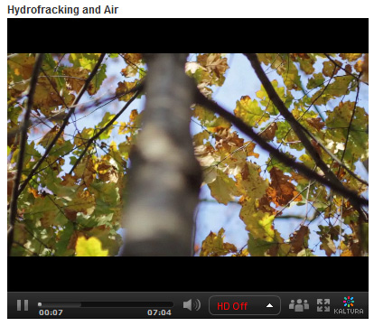
In addition to other research methods, the teams of students used GIS to explore the spatial footprint of the gas boom on different communities. Students were tasked with integrating the spatial aspect of the story into their video essays. The clip below is taken from the ‘Hydrofracking & Air’ video created by students Zoe Gaston, Claire Rapp, Sarah Baker, Thuyvan Luu, Colin Lind and Kyle Montgomery – all first-year students in Bucknell’s Environmental Residential College.

video platform video management video solutions video player

To create the map animation seen in the video, the students worked with me to visualize GIS data in ArcMap and export the data to a GoogleEarth KML format. Next, the students used GoogleEarth to draw the estimated pathway of the pipeline connecting several air compressor stations in their area of interest. Then the students created an animation in GoogleEarth that was spliced into the video essay to illustrate the point they were trying to make about air pollution associated with natural gas infrastructure. By the way… in a few months Bucknell GIS expects to have data on all infrastructure related to natural gas and electricity generation in Pennsylvania – including pipelines and transmission lines (so that next time we’ll be able to be more precise than we were with the ‘connect the dot’ approach we employed in this video).

Click here to see the full-length ‘Hydrofracking & Air’ video and other videos submitted by students in the class.


Categories
Bucknell/Local Interest Data Environment General GIS GIS in Engineering GIS in Environmental Studies Slideshow

GIS in the Classroom: Civil & Environmental Engineering 432

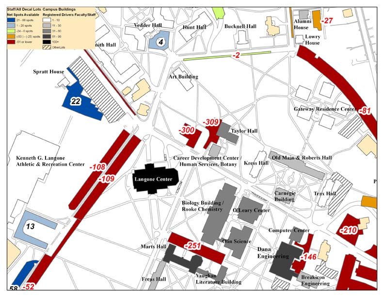
Last summer, Bucknell’s administration asked our GIS team to conduct an analysis of parking availability across campus.  The project was assigned to Dan Dougherty, Geography/History ’12 and is summarized in Dan’s guest post here. This spring, a team of four students in Prof. Michelle Oswald’s CENG 432 course, Sustainable Transportation Engineering, are picking up where Dan left off. The team – comprised of Meredith Menzel, Emily Liggett, Dennis Lee and Jordan Roder (all CENG majors from the class of 2012) – intends to add new data, extend the analysis and propose environmentally-friendly solutions to the parking shortages across campus. Says Menzel,

“We are planning on doing some of our own surveying to update these parking lot ratios and update the maps with any new parking lots, especially in relation to the current construction, the Bucknell South campus project, and the Master Plan.

We are also planning on surveying Bucknell students and staff to collect more information about who drives, walks, etc. to evaluate the parking demand which will help us propose new parking solutions. If some of these solutions involve physically redesigning the parking lots at Bucknell, we were planning on creating some new maps to present our solutions.”

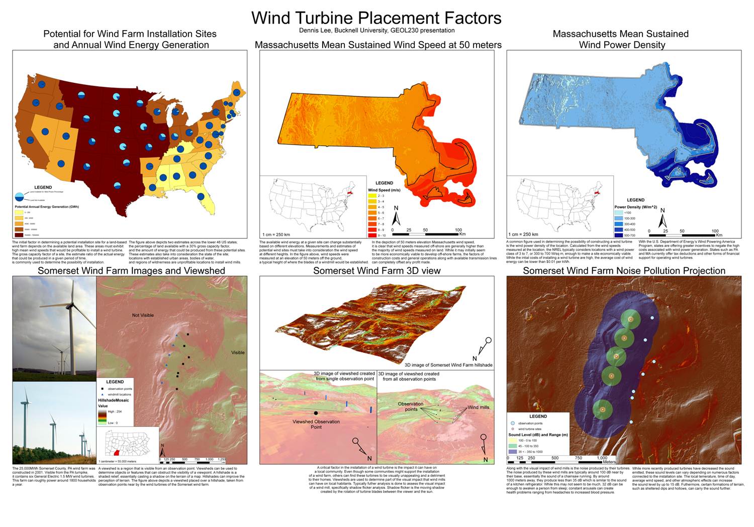
Incidentally, 3 of the 4 team members (Menzel, Liggett and Lee), are veterans of Prof. Carl Kirby’s GEOL230 class, Environmental GIS. Below are maps that each of the students produced for GEOL230 (click on the images to view them at full size). Stay tuned for updates for their work on the parking analysis.

Dennis Lee’s poster from GEOL230

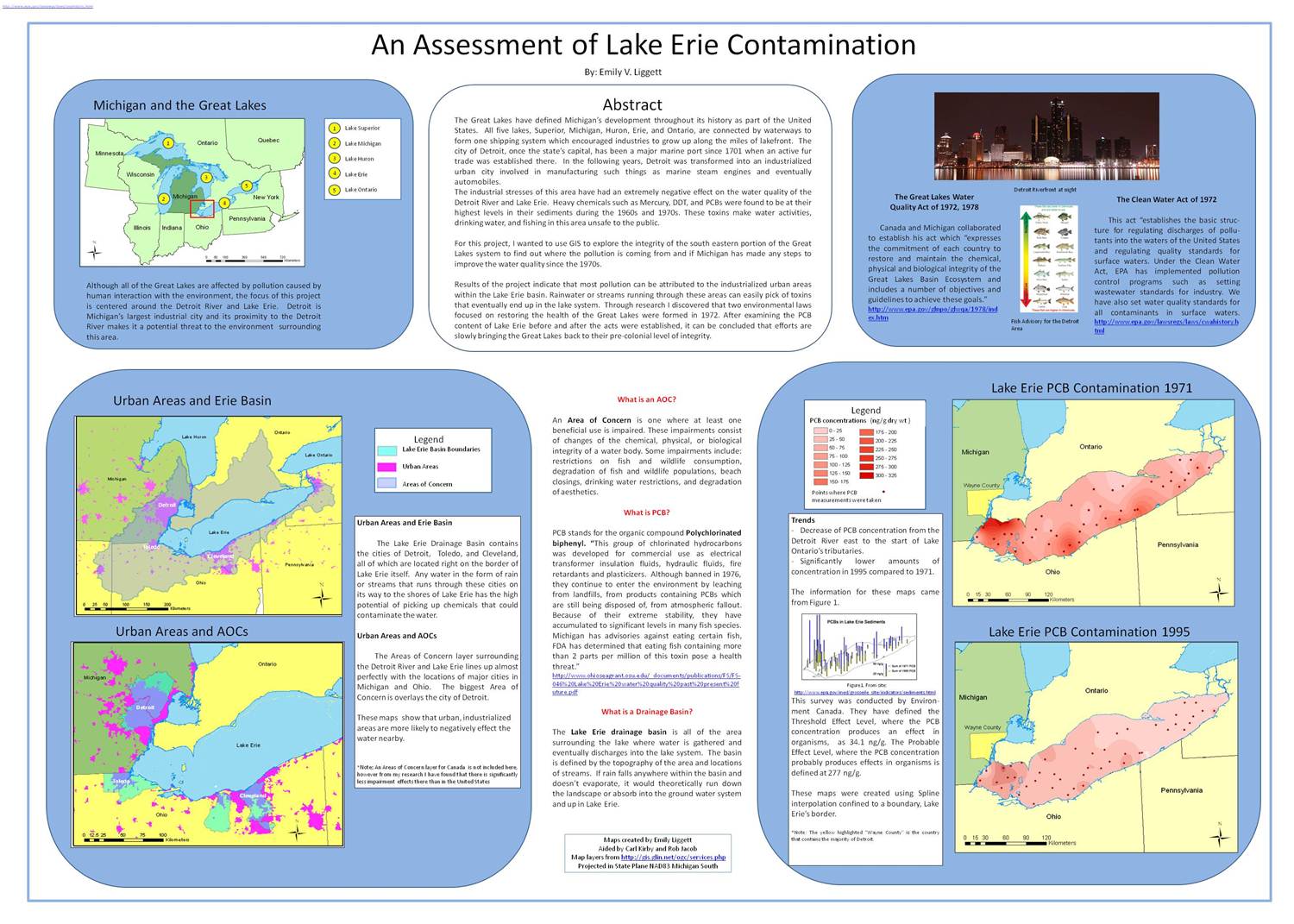
 Emily Liggett’s poster from GEOL230

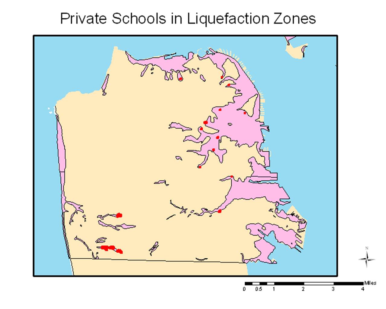
A map from Meredith Menzel’s GEOL230 presentation