Categories
Bucknell/Local Interest Digital Humanities Environment General GIS GIS in Environmental Studies Marcellus Shale Slideshow

GIS in the Classroom (and dorms): Environmental Residential College

In fall 2011, Professors Steve Jordan and Chris Daniels assigned a semester-long documentary project to students in Bucknell’s Environmental Residential College. The goal was to create video essays to tell the story of how the Marcellus Shale gas boom is impacting communities in northeastern Pennsylvania. Students visited communities impacted by the gas boom to conduct interviews and capture video footage that would help them tell the story of the local contexts in which the gas boom is taking place across the state.

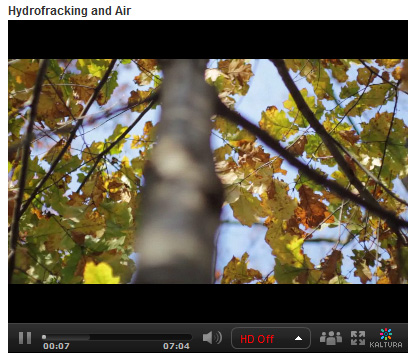
In addition to other research methods, the teams of students used GIS to explore the spatial footprint of the gas boom on different communities. Students were tasked with integrating the spatial aspect of the story into their video essays. The clip below is taken from the ‘Hydrofracking & Air’ video created by students Zoe Gaston, Claire Rapp, Sarah Baker, Thuyvan Luu, Colin Lind and Kyle Montgomery – all first-year students in Bucknell’s Environmental Residential College.

video platform video management video solutions video player

To create the map animation seen in the video, the students worked with me to visualize GIS data in ArcMap and export the data to a GoogleEarth KML format. Next, the students used GoogleEarth to draw the estimated pathway of the pipeline connecting several air compressor stations in their area of interest. Then the students created an animation in GoogleEarth that was spliced into the video essay to illustrate the point they were trying to make about air pollution associated with natural gas infrastructure. By the way… in a few months Bucknell GIS expects to have data on all infrastructure related to natural gas and electricity generation in Pennsylvania – including pipelines and transmission lines (so that next time we’ll be able to be more precise than we were with the ‘connect the dot’ approach we employed in this video).

Click here to see the full-length ‘Hydrofracking & Air’ video and other videos submitted by students in the class.
 

Categories
Bucknell/Local Interest Data Environment General GIS GIS in Engineering GIS in Environmental Studies Slideshow

GIS in the Classroom: Civil & Environmental Engineering 432

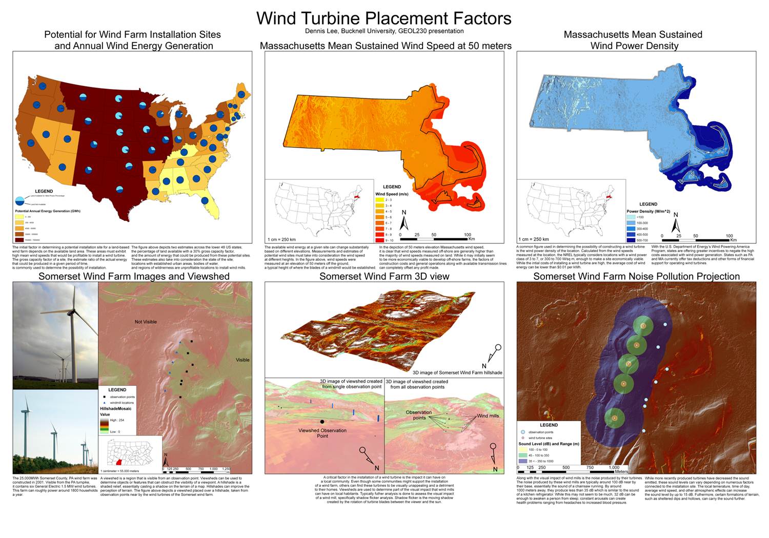
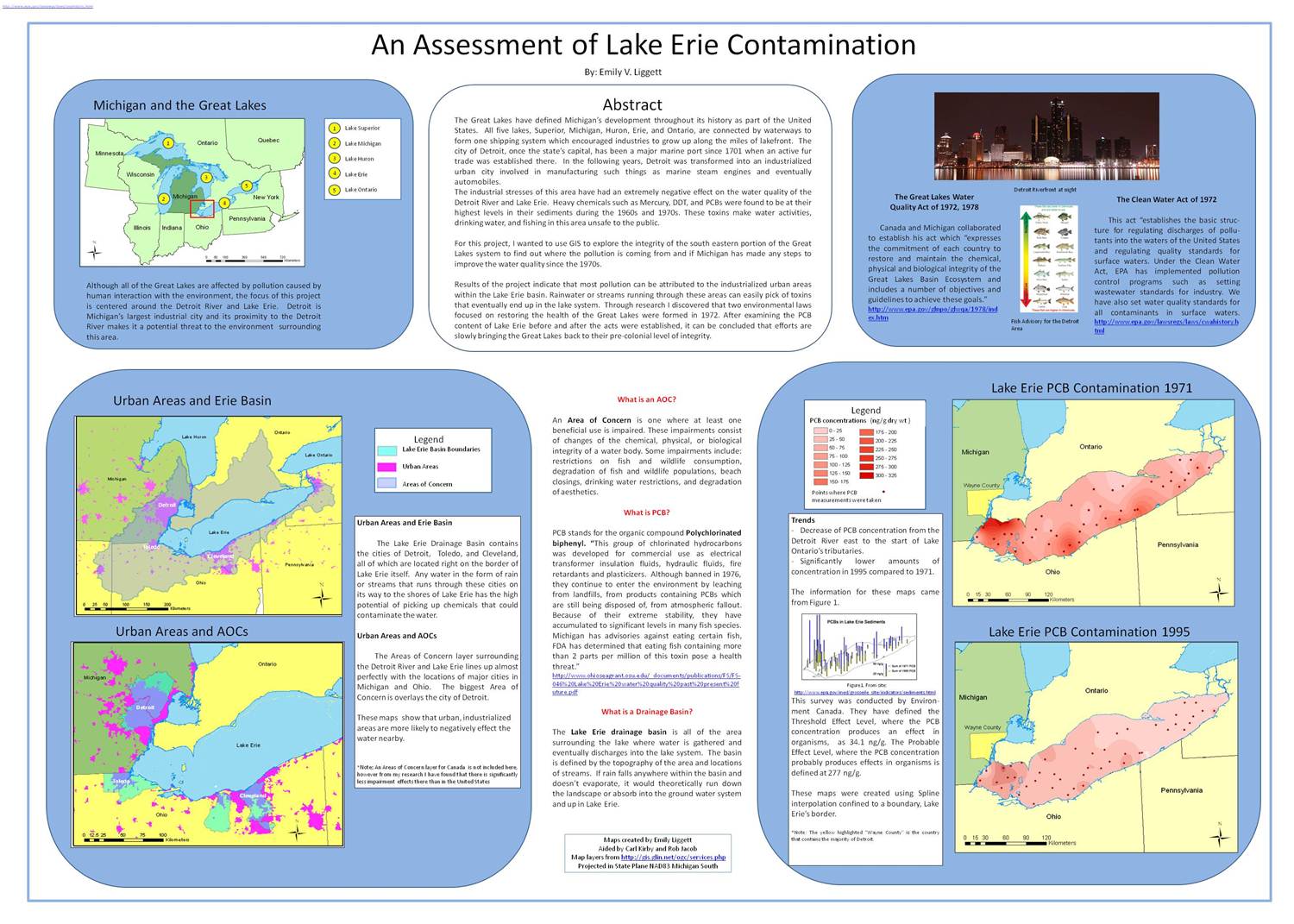
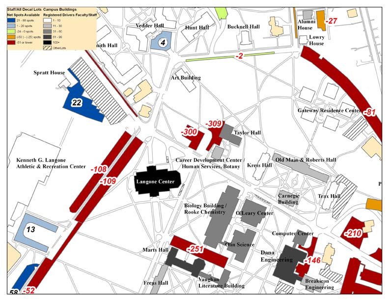
Last summer, Bucknell’s administration asked our GIS team to conduct an analysis of parking availability across campus.  The project was assigned to Dan Dougherty, Geography/History ’12 and is summarized in Dan’s guest post here. This spring, a team of four students in Prof. Michelle Oswald’s CENG 432 course, Sustainable Transportation Engineering, are picking up where Dan left off. The team – comprised of Meredith Menzel, Emily Liggett, Dennis Lee and Jordan Roder (all CENG majors from the class of 2012) – intends to add new data, extend the analysis and propose environmentally-friendly solutions to the parking shortages across campus. Says Menzel,

“We are planning on doing some of our own surveying to update these parking lot ratios and update the maps with any new parking lots, especially in relation to the current construction, the Bucknell South campus project, and the Master Plan.

We are also planning on surveying Bucknell students and staff to collect more information about who drives, walks, etc. to evaluate the parking demand which will help us propose new parking solutions. If some of these solutions involve physically redesigning the parking lots at Bucknell, we were planning on creating some new maps to present our solutions.”

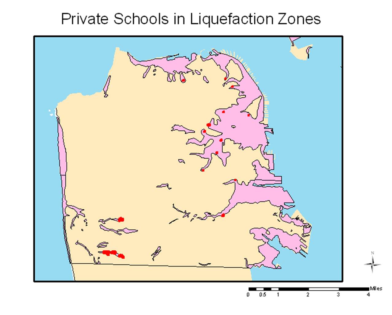
Incidentally, 3 of the 4 team members (Menzel, Liggett and Lee), are veterans of Prof. Carl Kirby’s GEOL230 class, Environmental GIS. Below are maps that each of the students produced for GEOL230 (click on the images to view them at full size). Stay tuned for updates for their work on the parking analysis.

Dennis Lee’s poster from GEOL230

 Emily Liggett’s poster from GEOL230

A map from Meredith Menzel’s GEOL230 presentation


Categories
Bucknell/Local Interest Environment General GIS GIS in Geography GIS in History GIS Jobs, Internships, Scholarships & Grad Programs Slideshow

GIS could help you get into grad school (and get funding!)

In recent posts I’ve given examples of how GIS can help you find an internship during your undergraduate years (click here to read more) and/or help you land a job once you have graduated from Bucknell (click herehere and here to read more).  Having experience with GIS as an undergraduate can also help you get into grad school (and get funding!).

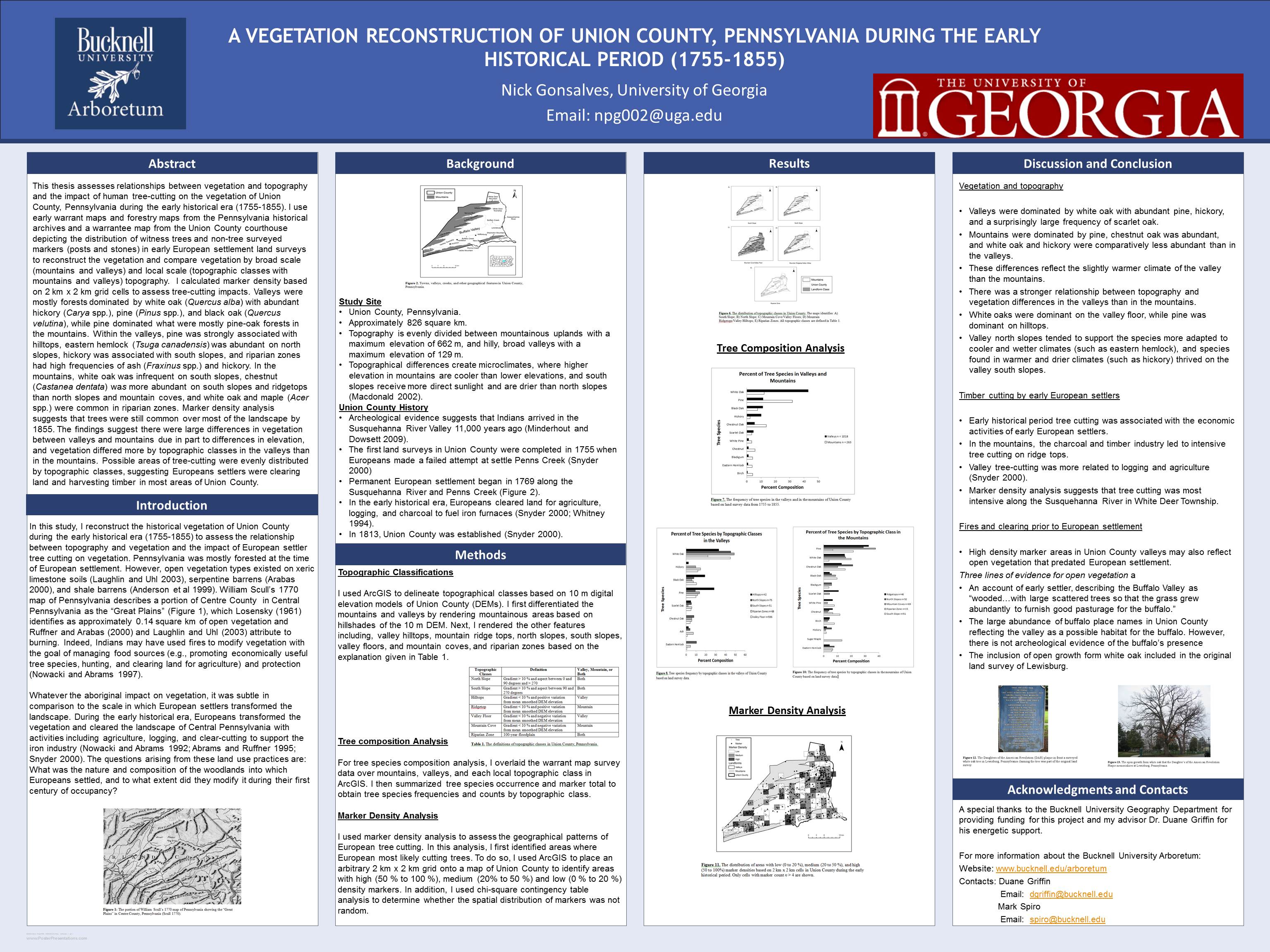
Nick Gonsalves, Geography ’11, is a great example. In addition to taking Prof. Duane Griffin’s GEOG204 ‘Applied GIS’ course, Nick used GIS as one of the key research methodologies for his senior honors thesis. For his thesis, Nick reconstructed the historical vegetation of Union County during the early historical era (1755-1855) to assess the relationship between topography and vegetation, as well as the impact of European settler tree cutting on vegetation. Nick’s undergraduate experience with GIS and his ability to apply the technology in developing his honors thesis was surely a factor in his acceptance and funding for graduate studies in the University of Georgia’s Geography Department.

Now that he’s in the graduate program at UGA, Nick continues to use GIS for class projects (such as researching the distance food travels from the farm to the farmer’s market in Athens, GA) and for developing his Master’s thesis.  He’s also continuing to present the results of his senior honors thesis from Bucknell – including participating in a poster session at this year’s American Association of Geographers conference in NYC (see below – click on image for a larger version of the poster).


Categories
Bucknell/Local Interest General GIS GIS & Environmental Justice GIS in Environmental Studies GIS in Geography GIS in Social Science GIS Jobs, Internships, Scholarships & Grad Programs Slideshow

GIS Job Opportunities – Summer 2012 paid GIS internship with REU

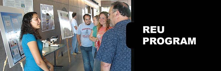
I’ve been posting a lot (here, here and here) about GIS job opportunities for Bucknell’s class of 2012 – but there are also lots of GIS internships out there for returning students. Are you interested in using GIS for research this summer? Do you want to get paid for it too?  If so, you should consider applying to the Research Experiences for Undergraduates (REU) program’s Georgia State University site.

The Research Experiences for Undergraduates (REU) program is funded by NSF and among the most competitive and prestigious summer research programs available to undergraduate students. REU targets students from various disciplines and hosts programs at sites all across the U.S.  (click here to see the full list). In Summer 2012 Georgia State University in Atlanta, GA will host an REU site focused on using GIS to do community-based research and fieldwork.  Check out the details below and be sure to tell me if you decide to apply for this.  BTW, having something like this on your resume would be incredibly helpful in any future job searches.

Research Experiences for Undergraduates (REU) Site: Addressing Social and Environmental Disparities through Community Geography and Geographic Information Systems.  The project is funded by the National Science Foundation.  The program runs June 18th – August 2nd.

Research Interests: Working with faculty mentors in one of three research tracks, 10 selected undergraduates will engage in community-based research and fieldwork to quantitatively and qualitatively examine neighborhood change, property markets, air and soil quality, urban green spaces, and neighborhood visioning in partnership with neighborhood residents and community groups.

Compensation: Each REU student will receive a competitive funding package, including: a $3000 stipend, up to $250 in travel support to/from Atlanta, up to $750 for conference presentations, free room and board at GSU, and 3 required texts.

Application Process: Applications are due Friday, March 23rd @ 5 PM EST.  Complete application instructions and the application form can be found at http://csaw.gsu.edu/nsf-reu/application-instructions/

To Learn More:  Visit http://csaw.gsu.edu/nsf-reu/

Any questions can be directed to the Dr. Timothy Hawthorne (PI) at thawthorne@gsu.edu or Dr. Katherine Hankins (Co-PI) at khankins@gsu.edu


Categories
Data Digital Humanities General GIS GIS in History Slideshow

Free, GIS-ready historic maps from New York Public Library

Here’s another treasure trove of data that’s ready and waiting to be added to your ArcMap session.

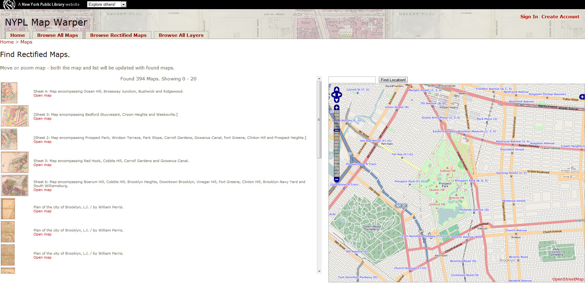
Over the last several years the New York Public Library has scanned more than 10,000 public domain historic maps and atlases of New York City and made digital copies of those maps available via its website. Recently NYPL took this project to the next level by creating a web tool that can be used (by NYPL staff as well as volunteers from the general public) to georeference the maps – i.e. pin the historic maps down to their location on a modern-day reference map.  Click here to check out their blog post about the project. Or click here to check out the do-it-yourself MapWarper tool and/or browse through the thousands of maps that have already been georectified.

What’s the big deal about being able to look at historic maps in GIS? Here’s an excerpt from the NYPL blog post on the project that does a great job of explaining how GIS can shed new light on old maps.

So, what does this all mean? If we have documents related to past times and past places (old maps), then we can create data to “rebuild” those past times and past places. And if we “rebuild” old places in virtual space, we can then organize a universe of other information around those old places. Wouldn’t it be great to haveyelp.com and menupages.com, but for old restaurants and with old menus and prices? Or to have at least a smattering of old photos in a historical street view? Or to search the National Newspaper Digitization Project using a map interface? At the core of all of these dream-like research futures is geographic information, in machine-readable format. And to get there, we need to warp, crop, mosaic, and trace our old maps. That’s why we’re doing what we’re doing. And as a positive byproduct, the maps just so happen to become more useful at each step along the way.

Using the NYPL website to find GIS-ready historic maps is incredibly easy. I used the ‘search by map’ option to zoom into Prospect Park in Brooklyn to find georectified historic maps that I could download and add straight to my ArcMap session. A whopping 394 maps were returned in the results – i.e. 394 maps that I could download as a KMZ file and add directly to ArcMap to explore how this small chunk of turf grew, changed and evolved through time to become the place that it is now.


If you find maps in the NYPL collection that have the historic places or events that you are interested in, but are not yet GIS-ready, you can use the MapWarper tool to georeference them yourself. Here’s a link to instructions for using the MapWarper – along with a YouTube video that describes the process.

httpv://youtu.be/G8ms_eBU8MQ