Categories
Environment Events/Calendar General GIS

Reminder – Flying Bison & free pizza today at noon

Reminder – the Flying Bison coffee talk will be in Olin 268 at noon today.  Here’s the message center listing for the event:

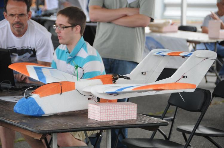
Dan Farrell ’12 and Nick Urban ’12 will be giving the coffee talk on Monday, September 26 at Noon in the Olin auditorium (Olin 268). The title of their talk is “The Flying Bison: A Student UAV Project.”

ABSTRACT: UAVs (Unmanned Aerial Vehicles) are becoming increasingly prominent in various fields of study and work. To better understand and explore these applications, we constructed a UAV to compete in the 9th Annual AUVSI Student Unmanned Air Systems Competition. Following the competition, we adapted our system to fill an experimental role in aerial photography, land surveying, and environmental restoration. We will discuss the design of our automated system and present video footage that displays the performance and potential for future operations of our UAV.

Pizza and drinks will be provided.
Categories
Bucknell/Local Interest Data Environment Events/Calendar General GIS GIS in Computer Science GIS in Engineering GIS in Environmental Studies GIS in Geology Miller Run Restoration Project Slideshow

Physics Dept coffee talk on using the Flying Bison drone to collect aerial imagery

Come hear Nick Urban, Computer Science ’12, talk about designing, building and flying the remote-controlled Flying Bison drone. Nick will be presenting on Monday, 9/26 at noon (Olin 364) as part of the Physics department’s coffee talk series.  He’ll have the plane with him and will be showing some new video that will be captured by the drone in test flights he’s conducting this week.

Below are links to some previous blog posts about Nick’s Flying Bison and the Miller Run Restoration project that the drone collected data for.

1. Article by Julia Ferrante from Bucknell Communications office

2. A short video about the Miller Run Restoration project and the Flying Bison

3. An overview of the Miller Run Restoration project, including the role of the Flying Bison in collecting high resolution aerial imagery.

4. Some background on the spring 2011 competition that Nick flew the Flying Bison

Categories
Bucknell/Local Interest Data Environment General GIS GIS in Computer Science GIS in Engineering GIS in Environmental Studies GIS in Geology Miller Run Restoration Project Slideshow

Keystone Edge story about the Flying Bison

The online journal, Keystone Edge, recently picked up the story of Nick Urban and the Flying Bison drone.  Published by Issue Media Group, the Keystone Edge

… tells the story of the new economy in Pennsylvania–a narrative of creative people and businesses, new development, cool places to live, and the best places to work and play. Each Thursday, the Web site and weekly online magazine presents original stories, video and photography to tell that story, from Pittsburgh to Philly.

An excerpt from the story is included below. Check out the full story here.

Innovation & Job News – Bucknell student’s remote-controlled plane captures imagery to aid creek restoration – THURSDAY, SEPTEMBER 01, 2011

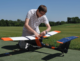
Remote-controlled cars and airplanes were a hobby of Nick Urban’s when he was a boy. That interest remained as he pursued a computer science degree atBucknell University, where he spent this summer building a remote-controlled plane that’s being used to map the landscape around a creek that runs through Bucknell’s campus and into the Susquehanna River. The plane, dubbed the “Flying Bison,” was built of foam, includes Geographic Information System technology and can navigate predetermined paths on autopilot. Digital still and video cameras were attached to the plane so it could capture images of the Miller Run Creek as it flew around the waterway.


Categories
Bucknell/Local Interest Environment Events/Calendar General GIS Slideshow

GIS posters at Sigma Xi summer research symposium

Come to the Sigma Xi summer research symposium on Wednesday, July 27th from 2-4pm at the Langone Center’s Terrace room to check out posters by student researchers.  There will be a variety of posters that feature GIS as a research methodology and/or visualization tool – including posters about the Flying Bison drone, community asset mapping, georeferencing historic maps, Marcellus Shale research, recycling & waste at Bucknell and other topics.