Categories
Bucknell/Local Interest Digital Humanities General GIS GIS Jobs, Internships, Scholarships & Grad Programs Map Apps Slideshow

2 new job openings in GIS/digital scholarship at Bucknell

Bucknell has created 2 new job positions – GIS/Web Application Specialist and Digital Scholarship Coordinator – to support digital scholarship initiatives on campus. Click here to apply. The new hires will be part of the ITEC group within the Library and IT Division and will join a team of instructional technology specialists who focus on integrating GIS, digital media and other technologies across the curriculum at Bucknell.

Our ideal candidate for the GIS/Web Application Specialist position will have strong tech skills in GIS and web development combined with an interest in visualization and data graphics in general. As the first person to fill this role, the GIS/Web Application Specialist will have an opportunity to set the tone for what digital scholarship projects will look like at Bucknell. We are looking for someone who is creative, innovative and thrives on learning new tools & technologies. In addition to GIS and application development, the GIS/Web Application Specialist will have an opportunity to delve into a wide range of other types of visualizations – including timelines, networks, interactive graphs/charts, etc. – to create highly-interactive sites that showcase faculty & student research and can serve as teaching/scholarship tools. 

We have a wide range of exciting teaching and research projects already underway and we’re looking for these new hires to help showcase those efforts and take digital scholarship to a new level at Bucknell. I’ve been here for 3 and a half years and can tell you that Bucknell is an amazing place to work. The atmosphere is both collegial and collaborative. The faculty have a deep commitment to engaging students in learning, both in the classroom and through faculty-led and independent student research projects. In the last 4 years, Bucknell has created five new positions (GIS Specialist, Video Specialist, Instructional Technology Specialist, GIS/Web Application Specialist and Digital Scholarship Coordinator) to support this type of work on campus. That alone speaks volumes about the high level of support we have from the university administration and Library & IT leadership for doing innovative work.

If you are interested in either of these jobs or know of someone who might be, please check out the job descriptions. Feel free to contact me if you have any questions. Click here to apply.


Categories
Bucknell/Local Interest Events/Calendar General GIS Map Apps Slideshow

Bucknell GIS brings home an IronSheep

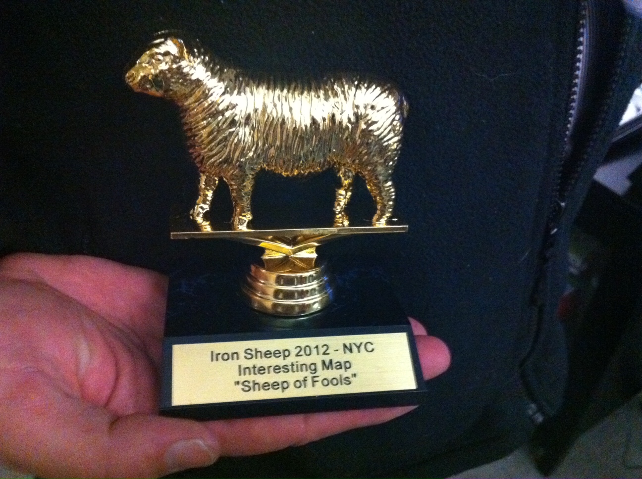
Over the holidays we posted about Prof. Duane Griffin’s victory in the FloatingSheep blog’s Christmas map contest. Well, Duane has once again brought glory (or infamy, depending on which way you look at it) to Bucknell GIS by winning the coveted ‘Sheep of Fools’ award at the first ever IronSheep contest.

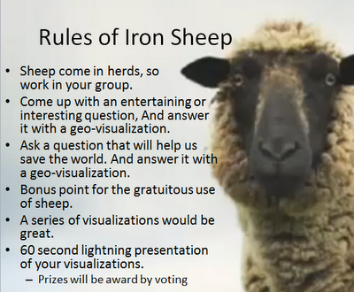
The contest, part of the slate of activities for the 2012 annual meeting of the American Association of Geographers, was hosted by Pivotal Labs near Union Square in NYC, and featured 7 teams of ‘lightning mappers’ comprised of geographers, GIS analysts, data hounds, web developers and other assorted mapping/data visualization enthusiasts. As described in the FloatingSheep blog’s announcement of the event, the premise of the IronSheep competition was to…

mimic the format of the “Iron Chef” television series. This workshop challenges participants (grouped into teams with members from diverse backgrounds and skill sets) to produce meaningful analysis and fun, evocative mash-ups from the same sets of user-generated, geo-coded data within a four hour time frame. The goal is to provide a semi-structured environment where participants can socialize and work in a fun yet socially meaningful project. Participants will be drawn from academic, industry and artistic communities from around the world… Teams will be assigned a targeted question…and use crowdsourced data to create a new geo-visualization.

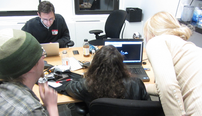
And that we did… for four hours the teams crunched, analyzed, mapped, visualized and animated datasets ranging from UFO sightings and WalMart store locations to Flickr geotags for “Redneck” and ‘Hippy.” Click here to read the FloatingSheep blog’s recap of the event and to see pictures from the event. See below for pictures of the teams hard at work.

Some interesting discussions about neo-geography (e.g. open geography/VGI/geoweb/web mapping services) vs. traditional GIS arose during the IronSheep debriefing session held on the final day of the AAG conference. Click here to read Jeremy Crampton’s overview of the debate or here to check out the Twitter stream about the topic.

Team Rambouillet (my team – we didn’t win any IronSheep awards but we had a lot of fun)


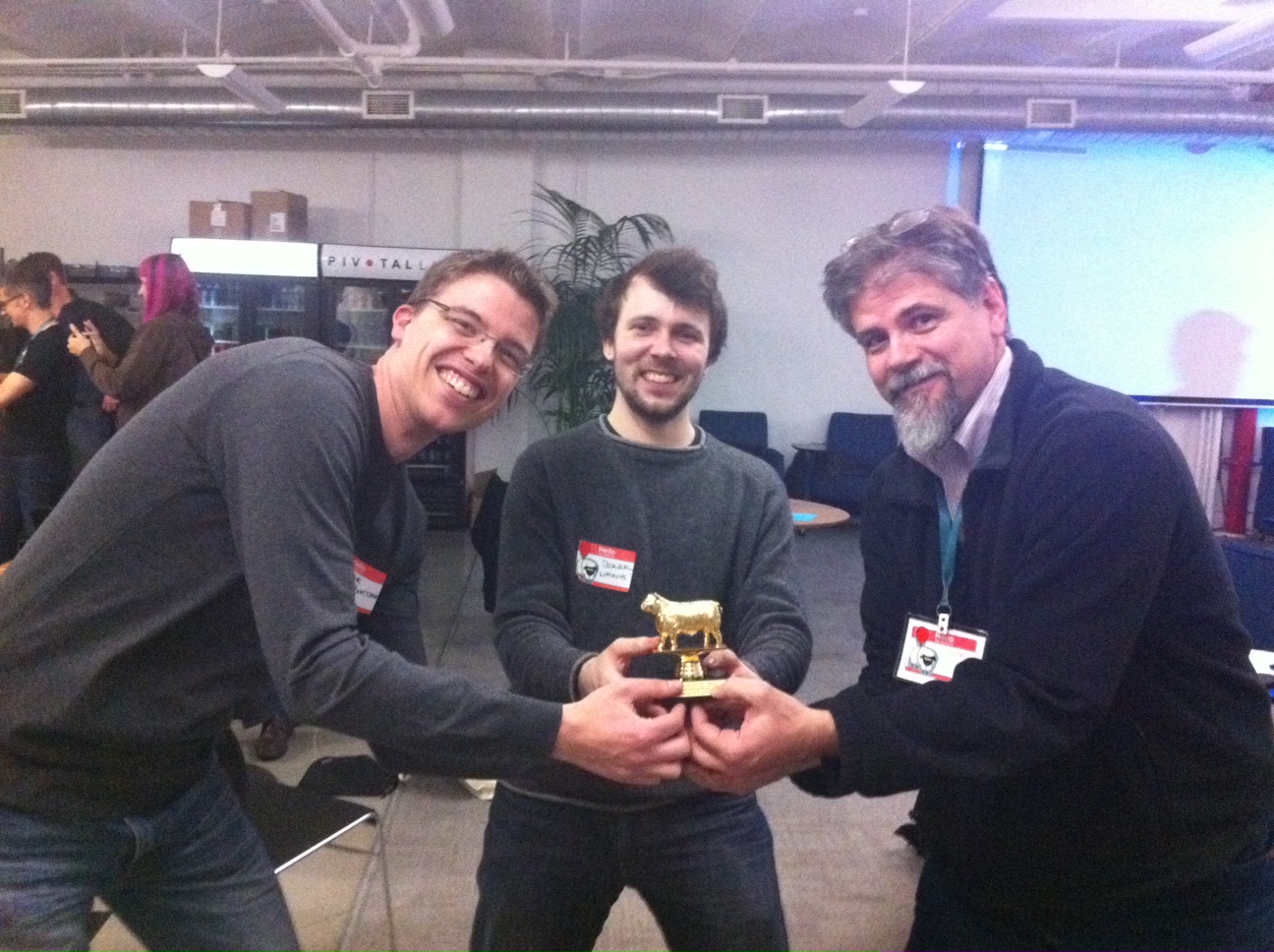
Team Haggis (Prof. Duane Griffin’s team – winners of the “Sheep of Fools” award)


This is one of Team Haggis’s entries. As described by Duane Griffin, “It’s the number of ‘Redneck’ and ‘Hippy’ Flikr geotags within 7.5 miles of a UFO sighting, to see who the aliens are most likely trying to target.”


Team Haggis showing off their IronSheep


The coveted “Sheep of Fools” award

Categories
Bucknell/Local Interest Crisis-Mapping Data Environment General GIS GIS Jobs, Internships, Scholarships & Grad Programs Map Apps Slideshow

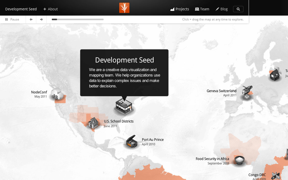
GIS Job Opportunities – DevelopmentSeed

Back in October I mentioned that developing GIS technical skills can help you land a job after graduation. Well, here’s the proof.  Recent Bucknell grad Chad Lawlis, Environmental Studies ’11, just got hired as the Mapping & Data intern for Development Seed, a Washington D.C.-based consulting/R&D company known for its innovative, open-source solutions for data visualization and mapping.

Chad never had a chance to take either of Bucknell’s intro GIS courses (GEOG204 – Applied GIS, taught by Duane Griffin and GEOL 230 – Environmental GIS, taught by Carl Kirby and Rob Jacob) at Bucknell, although I’m sure he wishes he had as both are phenomenal courses! Instead, he picked up GIS skills by working as a research assistant for Prof. Amanda Wooden, developing GIS datasets for her work on environmental activism in Kyrgyzstan. Chad also served as a GIS Student Assistant during Summer 2011 working on a variety of projects, including asset mapping for Lycoming County.  Chad writes:

“Currently I am working on the Atlas Project… compiling and processing a number of large demographic data sets for all of the US which will soon translate into making election maps using TileMill (DevelopmentSeed’s free, lightweight map design software). I am already learning so much about data cleaning and processing – using OpenOffice, TextMate, Google Refine, SQLite, and Terminal so far – and looking forward to what’s to come with map making in TileMill and hopefully a bit of web design as well. The office atmosphere is a lot of fun too, very much a startup vibe… in a small renovated apartment with foosball, pingpong, and even a bar in the basement and a few dogs running around as well.”

So… if you like your maps served up with foosball, beer and dogs (and would like to get paid for working in that kind of environment), you should definitely consider developing GIS skills during your time at Bucknell.  The Development Seed job and many others can be found on the GIS Jobs Clearinghouse website. Or feel free to schedule an appointment to come talk with me about GIS job options.

Chad Lawlis, Environmental Studies '11


Categories
Bucknell/Local Interest General GIS Map Apps Slideshow

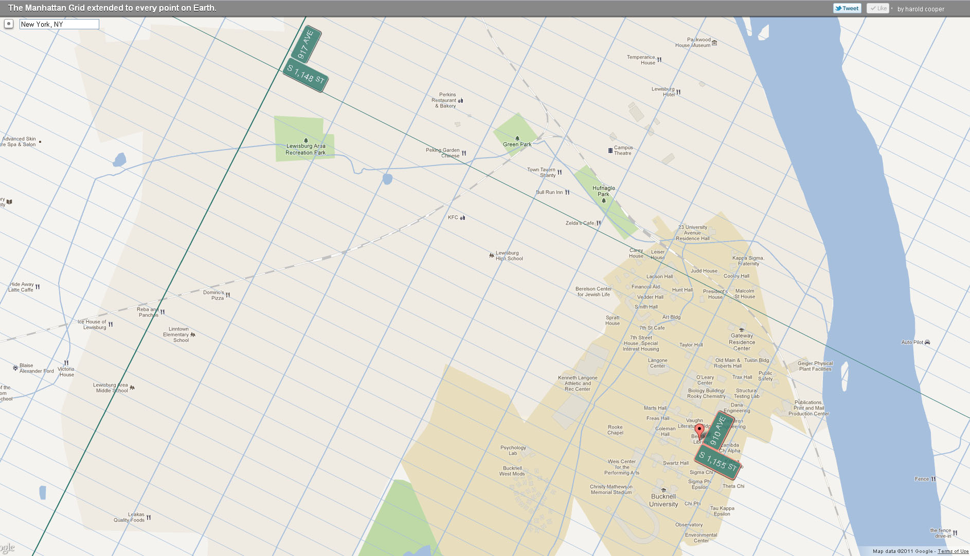
Bucknell’s campus in Central Park (way, way) West

Check out Harold Cooper’s ExtendNY map application to find out what your NYC address is – even if  you live in Topeka, KS or Vladivostok, Russia. More on the project from an article in yesterday’s Huffington Post:

Earlier this summer we marked the 200th anniversary of Manhattan’s grid plan, that easy-to-navigate layout of streets and avenues that gives us Manhattanhenge, drives Speed Levitch crazy, and might just be based off some ancient urban planning.

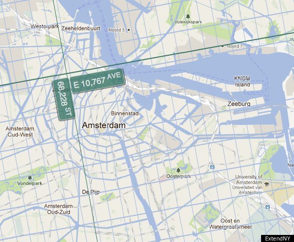
In celebration of that anniversary, Harold Cooper … has made this incredible interactive map that extends New York’s grid system to every single place on planet earth. San Francisco? Just walk West to 15,957th Avenue. London? Easy! Just take a stroll East to 10,896th Avenue on 63,708 Street.

The map allows you to scroll across the world, zooming in on different places to see where a walk way way East on 66,228th Street will take you (see photo below).

Click on the map below to see Bucknell”s NYC address.


Categories
Bucknell/Local Interest General GIS GIS in Women's Studies Map Apps Slideshow

Simple tool for creating KML-based thematic maps

As someone who has one foot in the ArcGIS world and another in the GoogleEarth/GoogleMaps world, I’m continually annoyed at how cumbersome it is to shuffle data back and forth between the two product lines.  I’ll skip the diatribe for now and instead just point out a cool new tool that I ran across last week when I was getting ready to talk to a Women’s Studies class that will be using GoogleMaps for a class project.

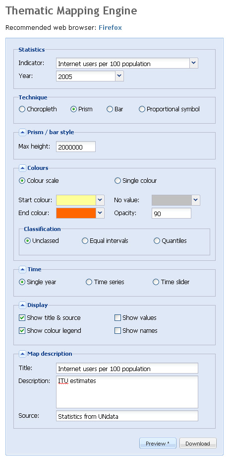
The website, thematicmapping.org, features a blog with tips and tricks for creating KML-based thematic maps. But more importantly, it provides a tool that you can use to create KML-based thematic maps for a variety of global data indicators. Although the selection of indicators is rather limited, thematicmapping.org also makes its API available so that you can create thematic maps from your own data sources.  Now if I just had a programmer at my beck and call…

Below is a screen shot of the Thematic Mapping Engine interface along with a snapshot of the resulting KML file