Categories
Bucknell/Local Interest Crisis-Mapping Digital Humanities General GIS GIS in Environmental Studies GIS in Geography GIS in History GIS in Humanities GIS in Political Science GIS in Public Health GIS in Sociology Map Apps Slideshow

How big is it really?

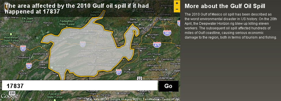
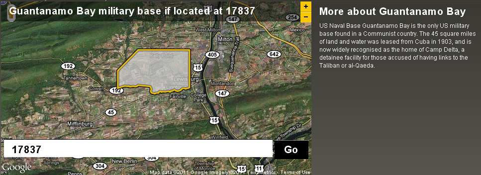
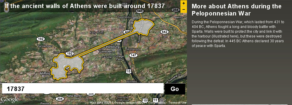
Back in December I posted about an NPR story about map scale.  I got so excited about the baseball on the moon map that I neglected to point out the other really interesting link from the story – to the BBC Dimensions website.  Dimensions (or, ‘howbigisitreally’) has a tool that lets you plug in any zip code or location and then choose from a list of events, places or things that you want to superimpose onto your area. See below for a map showing the area that the Guantanamo Bay Naval base would occupy if it was located in Lewisburg. I’ve also included maps showing what the ancient walls of Athens and the Gulf oil spill would look like if superimposed over the Lewisburg area. The Dimensions website has numerous places, events and things to choose from in making your map, including: the war on terror, ancient worlds, the industrial age, space, environmental disasters, depths, cities in history and more.
Categories
General GIS GIS in Public Health Slideshow

Mapping worlwide alcohol consumption

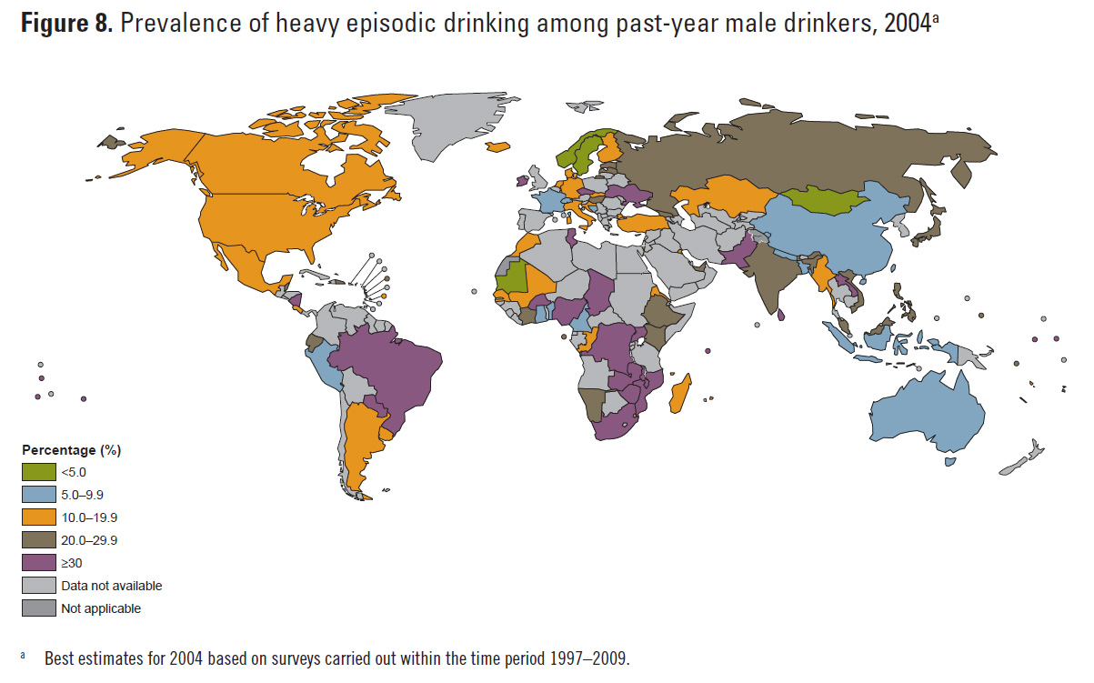
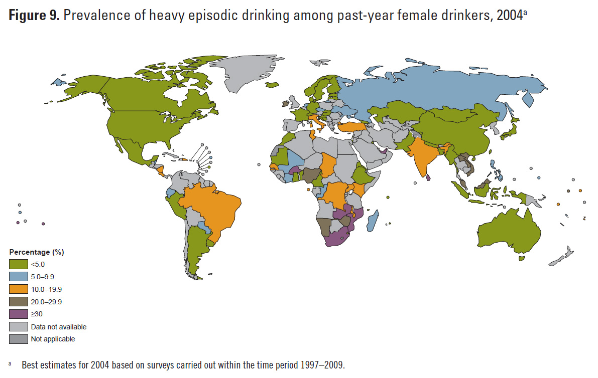
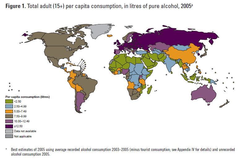
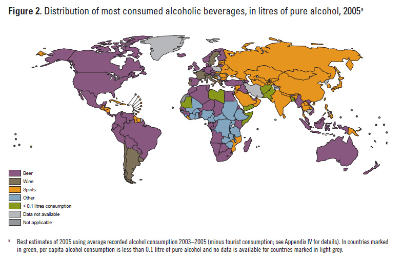
The World Health Organization’s recently released Global Status Report on Alcohol and Health includes some interesting maps on worldwide alcohol consumption. Click here to download WHO data and here to read the full report. Below are a few of the maps included in the report – including some interesting maps on binge drinking patterns.

Categories
Bucknell/Local Interest Digital Humanities General GIS GIS in History GIS in Humanities Slideshow Videos

Digital Gazetteer of the Song Dynasty

There are a million reasons I can think of for wanting to be in Santa Barbara, CA this week but one of them is that I’d love to attend UC Santa Barbara’s ‘Think Spatial’ forum. This week’s presentation features Ruth Mostern from UC Merced discussing her use of Google Earth for teaching undergraduate history courses. In Mostern’s upper division history course about the Silk Road, students read travel narratives and then use Google Earth to create digital atlases about their travelers’ journeys.  Here’s a short video that showcases some of her students’ work:

httpv://www.youtube.com/watch?v=_7I2BJBrLAU

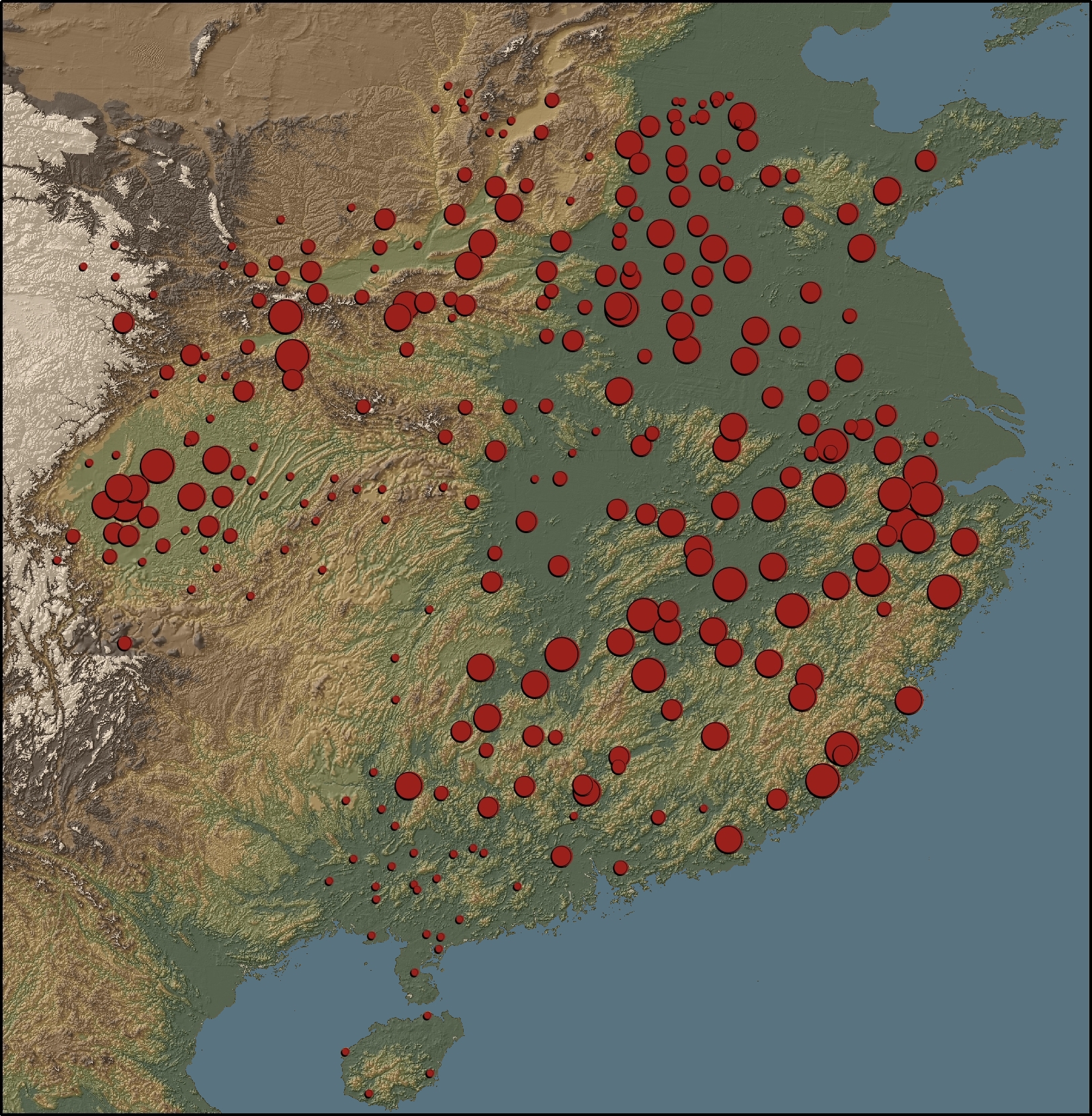
Mostern also makes extensive use of GIS in her research and is co-author of the Digital Gazetteer of the Song Dynasty. The website includes maps and downloadable data for counties and prefectures of the Song Dynasty. A sample map from the gazetteer is shown below.

“This map depicts the ratio of cantons to counties based on the data in the Song history. There is no county-level population data for the Song. The number of cantons in a county is the best proxy for its population. Red areas have a large number of cantons, and blue areas have a small number.”

Categories
General GIS GIS in Art Slideshow Videos

From the wilderness downtown to a Grammy win

In honor of Arcade Fire’s Grammy win last night for album of the year, here’s a link to their video/interactive map app for song ‘We Used to Wait’ from The Suburbs.  You’ll have to download Google Chrome to experience “The Wilderness Downtown” but it’s worth the couple of seconds it’ll take to do it. As mashable.com put it, “it’s basically one big ball of HTML5/Google Maps/musical goodness.”

Categories
General GIS GIS in Art

Map Your Music Memories

The Grammys and Music Is Life, Life is Music have launched  a new mobile app that allows you to tag locations on a map with a music marker – could be the club you’re going to see a show at later this weekend, the place you heard a song for the first time, or any other music-related comment or memory.

From the Grammys blog:

“You can share your tag by posting to your Facebook profile or Twitter account. The app integrates with Flickr and Foursquare data by highlighting concert venues via Foursquare, and promoting Flickr photo data of GRAMMY-related artists and venues.

As more users tag the map, you’re able to view what music inspires others at any given location, such as your neighborhood, a popular venue or your favorite travel destination. I’d argue the coolest part about the app is that several featured artists will be using the app and their tags are featured on the map by a special marker. For example, by filtering the map for music artists, you can see several tags and notes posted by Katy Perry. The Recording Academy says more artists will be featured within the app as we get closer to the 53rd GRAMMY Awards.”

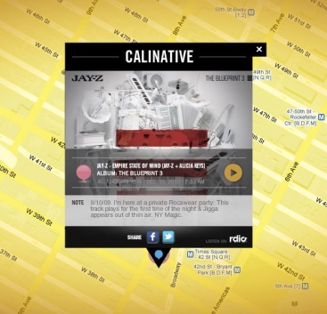
Here’s one of JayZ’s music memories: