There are a million reasons I can think of for wanting to be in Santa Barbara, CA this week but one of them is that I’d love to attend UC Santa Barbara’s ‘Think Spatial’ forum. This week’s presentation features Ruth Mostern from UC Merced discussing her use of Google Earth for teaching undergraduate history courses. In Mostern’s upper division history course about the Silk Road, students read travel narratives and then use Google Earth to create digital atlases about their travelers’ journeys. Here’s a short video that showcases some of her students’ work:
httpv://www.youtube.com/watch?v=_7I2BJBrLAU
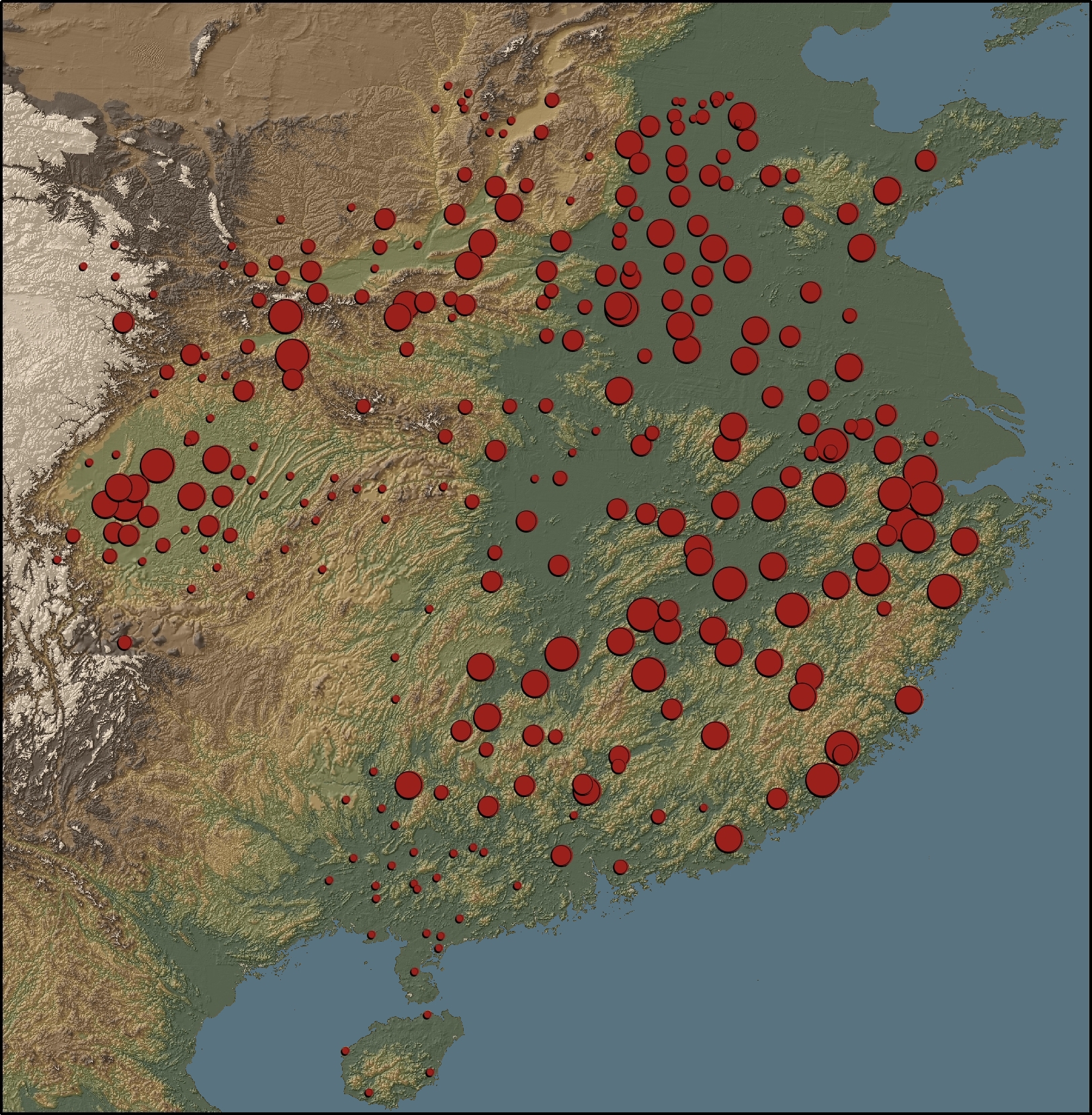
Mostern also makes extensive use of GIS in her research and is co-author of the Digital Gazetteer of the Song Dynasty. The website includes maps and downloadable data for counties and prefectures of the Song Dynasty. A sample map from the gazetteer is shown below.
“This map depicts the ratio of cantons to counties based on the data in the Song history. There is no county-level population data for the Song. The number of cantons in a county is the best proxy for its population. Red areas have a large number of cantons, and blue areas have a small number.”
