Categories
General GIS GIS in Computer Science Map Apps Slideshow Videos

Your iPhone is Tracking You

O’Reilly Media published a story yesterday (on the penultimate day of its Where2.0 conference no less…)  describing Alasdair Allan and Pete Warden’s discovery of a hidden file on your iPhone and 3G iPad that keeps a running record of your device’s whereabouts. The file, part of the iOS4 release, records both latitude/longitude and timestamps – making it possible to create a detailed map of any and all movements you’ve made while having the iPhone or 3G iPad on your person.

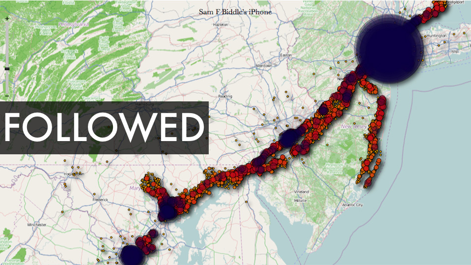
There is a debate underway about both the significance of this finding as well as how new a ”discovery’ it is  (see links below). But I’m kinda on the same page as Alexis Madrigal from the Atlantic – as much as I’m a little disturbed by the idea of a secret log of my whereabouts, I’m also fascinated by the idea of playing around with the data my iPhone has recorded and I’m curious to see what kinds of visualizations could be created out of it. If you’re curious about this too, you can visit Pete Warden’s website to download a free, open source app that will map the data from your iPhone or iPad tracking file.  See below for some sample ‘heat maps’ that were created using the tracking data from various user’s iPhones. Click here to see a video from Pete Warden’s website showing animation of tracking data from Warden’s iphone mapped by location and timestamp.

Story from O’Reilly Media:
Got an iPhone or 3G iPad? Apple is recording your moves

Story from Alex Levinson’s Blog:
Three Major Issues with the Latest iPhone ‘Discovery’

Story from The Atlantic:
My Life According To The iPhone’s Secret Tracking Log

Story from Gizmodo:
iSpy Conspiracy: Your iPhone is Secretly Tracking Everywhere You’ve Been, All the Time

Story from zdnet.com
Your iPhone is Tracking You (And Has Been for Awhile)

Two O’Reilly media researchers, Alasdair Allan and Pete Warden, caused quite a stir yesterday when they published an article about a hidden file in iOS 4 that regularly records the position of your device. All iPhones running iOS 4.0 or later log your location to a file called “consolidated.db” (a plain SQL file) which contains latitude-longitude coordinates and a timestamp.

Story from The Guardian:
iPhone Tracking Prompts Privacy Fears

Security researchers have discovered that Apple‘s iPhone keeps track of where you go – and saves every detail of it to a secret file on the device which is then copied to the owner’s computer when the two are synchronised. The file contains the latitude and longitude of the phone’s recorded coordinates along with a timestamp, meaning that anyone who stole the phone or the computer could discover details about the owner’s movements using a simple program.For some phones, there could be almost a year’s worth of data stored, as the recording of data seems to have started with Apple’s iOS 4 update to the phone’s operating system, released in June 2010.

YouTube Video of Pete Warden and Alastair Allan discussing the iPhone tracker at Where2.0:

httpv://www.youtube.com/watch?v=GynEFV4hsA0&p=0B2FEB8AACD826BE

Sample ‘heat map’ of Alexis Madrigal’s movements (created from data in the iPhone tracker file):
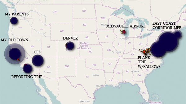
 

Sample ‘heat map’ from Sam Biddle’s iPhone:
 

Categories
Crisis-Mapping General GIS GIS in Political Science Map Apps Slideshow

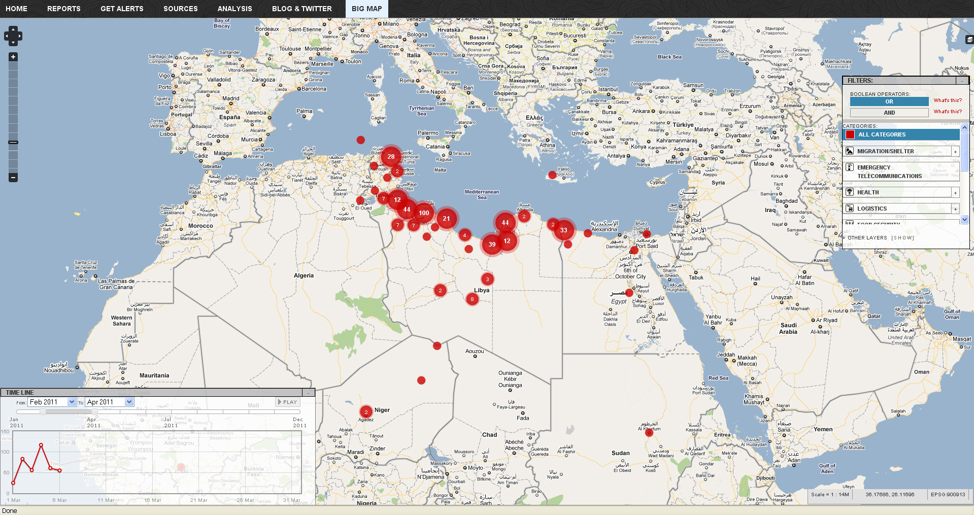
Libya crisis map

Click here to check out the new Libya Crisis Map.  Courtesy of Adena Schutzberg over at AllPointsBlog:

OCHA, UNOSAT and NetHope have been collaborating with the Volunteer Technical Community (VTC) specifically CrisisMappers, Crisis Commons, Open Street Map, and the Google Crisis Response Team over the past week.

The CrisisMappers Standby Task Force has been undertaking a mapping of social media, news reports and official situation reports from within Libya and along the borders at the request of OCHA. The Task Force is also aiding in the collection and mapping of 3W information for the response. UNOSAT is kindly hosting the Common Operational Datasets to be used during the emergency. Interaction with these groups is being coordinated by OCHA’s Information Services Section.

The public version of this map does not include personal identifiers and does not include descriptions for the reports mapped. This restriction is for security reasons. All information included on this map is derived from information that is already publicly available online


Categories
Bucknell/Local Interest Crisis-Mapping General GIS GIS in Political Science GIS in Public Health Slideshow Videos

Penn State releases episode 3 of “Geospatial Revolution” series

A new episode of Penn State’s “Geospatial Revolution” project was released today.  With the tagline “the location of anything is becoming everything” the Geospatial Revolution series is produced by Penn State’s public broadcasting group and described as an “an integrated public service media and outreach initiative about the world of digital mapping and how it is changing the way we think, behave, and interact.”  The new episode – part 3 in a 4 part series – focuses on using GIS for public safety and military/defense purposes. Episode 4 is due out on May 1, 2011. See below for the full-length videos for episodes 1, 2 and 3.  Videos are also available for individual chapters within each episode.

Episode 1:

  • Chapter 1 –  Welcome to the Geospatial Revolution
  • Chapter 2-  A look at what GPS is and how it works
  • Chapter 3 – A timeline of mapping and geospatial technology from stones to phones, including mobile technologies
  • Chapter 4 – A look at how crisis mapping and global crowd-sourcing was critical to aid and rescue during the 2010 Haiti earthquake

httpv://www.youtube.com/watch?v=poMGRbfgp38

Episode 2:

  • Chapter 1 – Creating an interactive city
  • Chapter 2 – Powering business
  • Chapter 3 – Finding a healthy future

httpv://www.youtube.com/watch?v=GXS0bsR0e7w

Episode 3:

  • Chapter 1 – Mapping the road to peace
  • Chapter 2 – Waging modern war
  • Chapter 3 – Serving and protecting
  • Chapter 4 – Staying safe

httpv://www.youtube.com/watch?v=OePOK6nzcaY

Categories
General GIS Slideshow

Map your Valentine

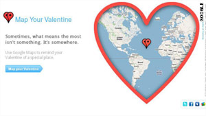
MapYourValentine from Google –  “sometimes, what means the most isn’t something. It’s somewhere.”

Update: to avoid confusing your Valentine, you might want to use the ‘preview’ feature before sending. I just tested the site on myself using ‘Kedainiai, Lithuania’ as my special location and in return I got a Valentine’s Day message with a cute little heart circling a spot in the middle of the Caribbean Sea!

Categories
General GIS GIS in Art

Map Your Music Memories

The Grammys and Music Is Life, Life is Music have launched  a new mobile app that allows you to tag locations on a map with a music marker – could be the club you’re going to see a show at later this weekend, the place you heard a song for the first time, or any other music-related comment or memory.

From the Grammys blog:

“You can share your tag by posting to your Facebook profile or Twitter account. The app integrates with Flickr and Foursquare data by highlighting concert venues via Foursquare, and promoting Flickr photo data of GRAMMY-related artists and venues.

As more users tag the map, you’re able to view what music inspires others at any given location, such as your neighborhood, a popular venue or your favorite travel destination. I’d argue the coolest part about the app is that several featured artists will be using the app and their tags are featured on the map by a special marker. For example, by filtering the map for music artists, you can see several tags and notes posted by Katy Perry. The Recording Academy says more artists will be featured within the app as we get closer to the 53rd GRAMMY Awards.”

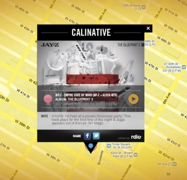
Here’s one of JayZ’s music memories: