Categories
Bucknell/Local Interest Environment General GIS Marcellus Shale Slideshow

Using GIS to analyze Marcellus Shale impacts in Pennsylvania

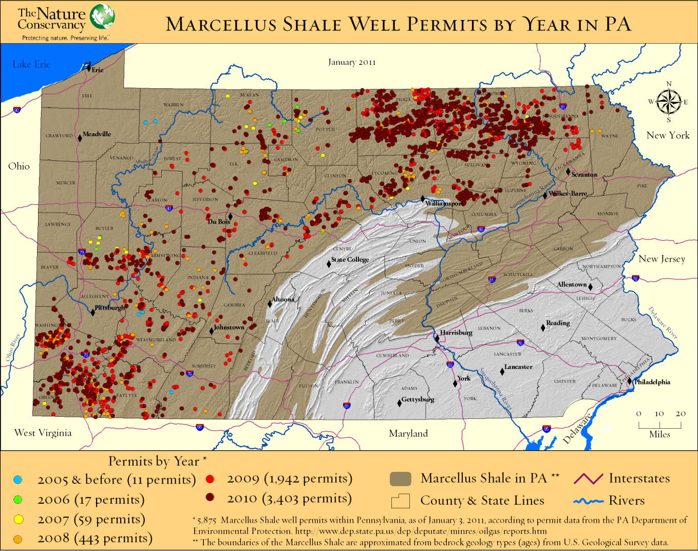
The Nature Conservancy recently released a study analyzing potential habitat impacts of energy development – including Marcellus Shale – in Pennsylvania over the next 20 years. Click here to watch a recorded presentation by the two lead researchers on the project. Click here for a copy of the full report.

The presentation includes discussion of how GIS and spatial analysis were used to project how much energy might be developed in PA during the next 20 years and where that development is more or less likely to occur.
Categories
Bucknell/Local Interest Digital Humanities General GIS Slideshow Videos

GIS and Digital Humanities – the History Engine and Hypercities

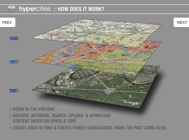
Click here (click on link for ‘Archived Program Recording’ in upper right hand corner) to watch a recorded presentation about two exciting digital humanities projects that have been built around GIS and other geospatial technologies.

The presentation, part of the NITLE next Digital Scholarship Seminar Series includes presentations by Scott Nesbit (Assoc. Director of the Digital Scholarship Lab) and Todd Presner (Director, Germanic Languages, Comparative Literature, and Digital Humanities, UCLA) onThe History Engine and Hypercities projects, respectively.

Categories
Bucknell/Local Interest Events/Calendar General GIS

GIS-T conference to be held in Hershey, PA this year

Attention all engineering students focusing on transportation: the AASHTO GIS for Transportation Symposium will be held March 28-March 30th in Hershey, PA this year.  The deadline for students to submit posters for the map gallery is March 18th.  Click here for more details on the conference and here for guidelines for poster submissions.

Categories
General GIS GIS in Geography Slideshow

Baseball on the moon? Not such a giant leap.

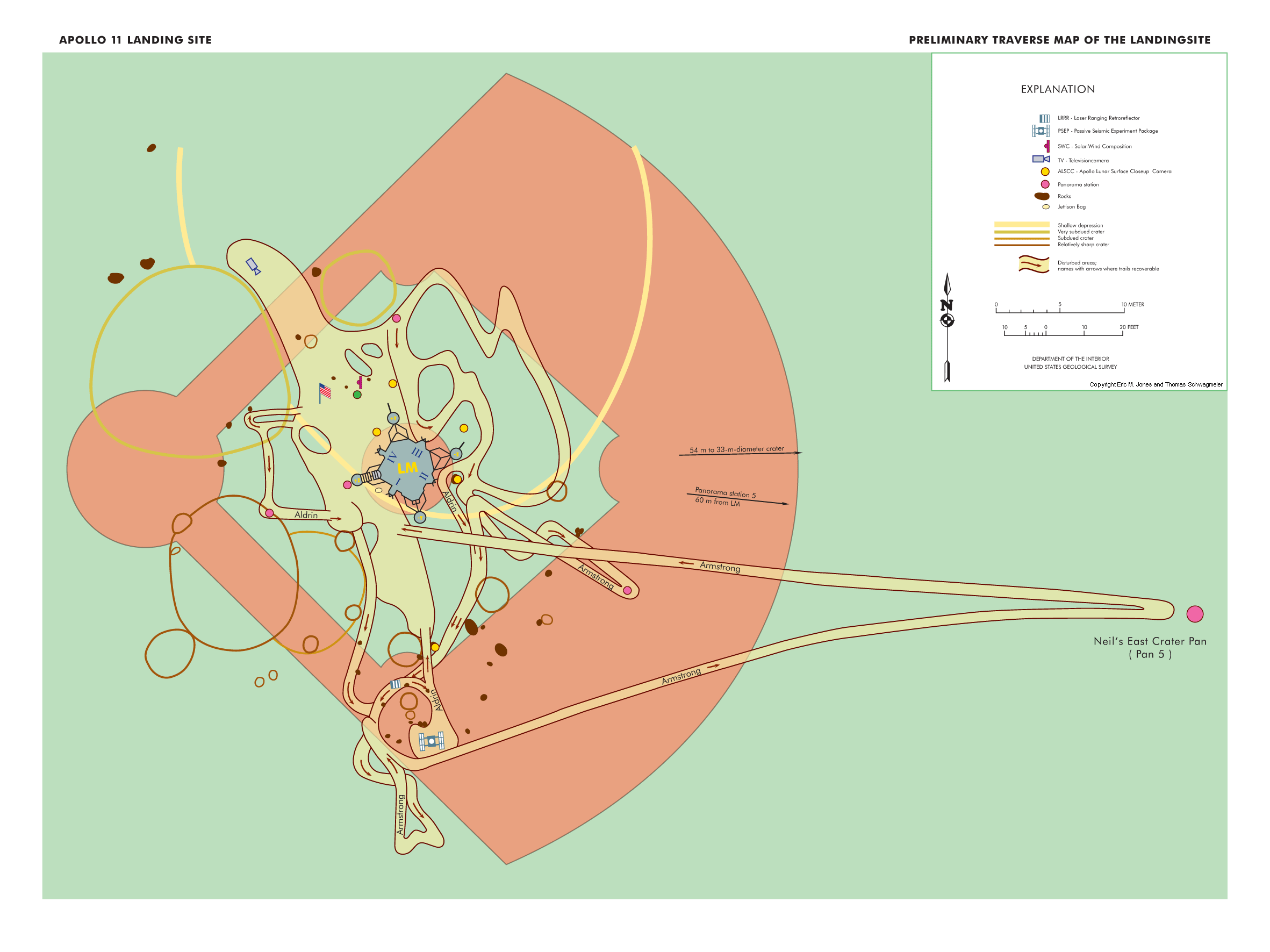
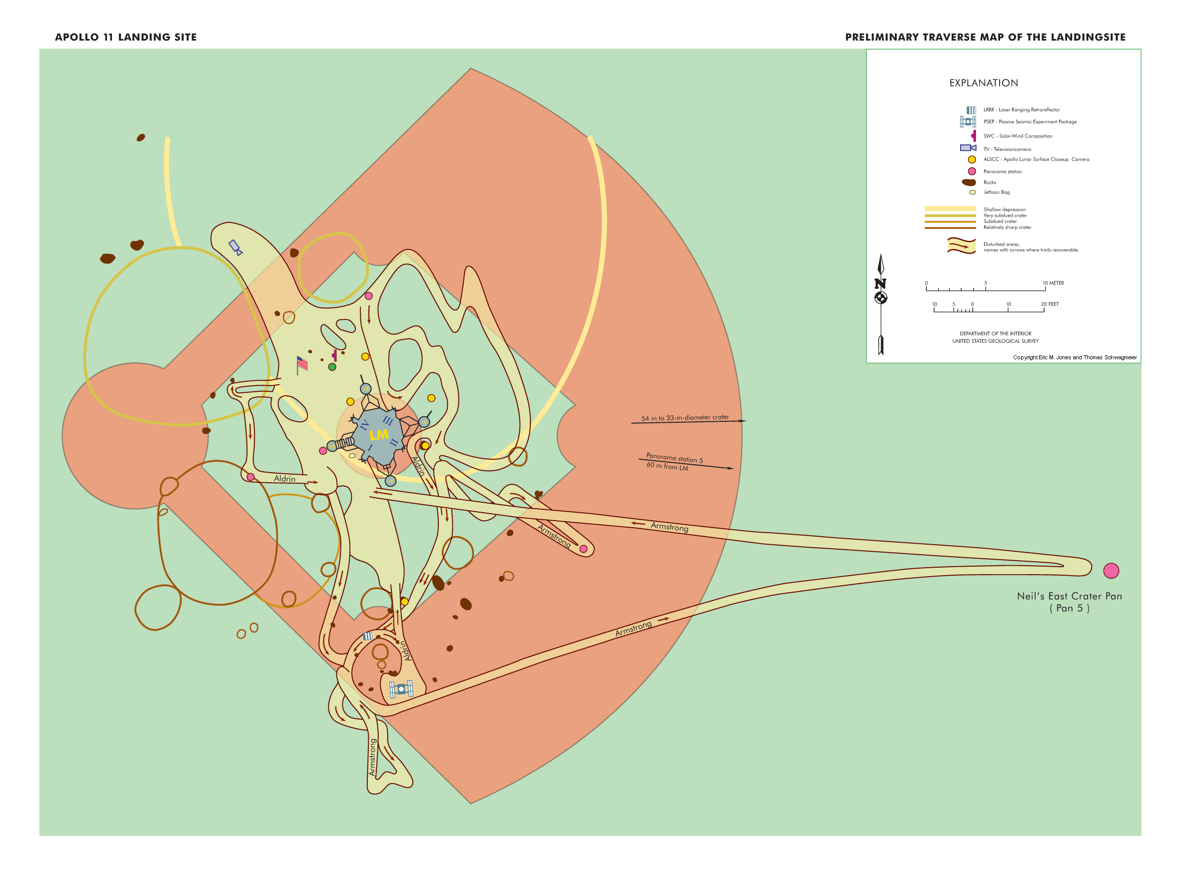
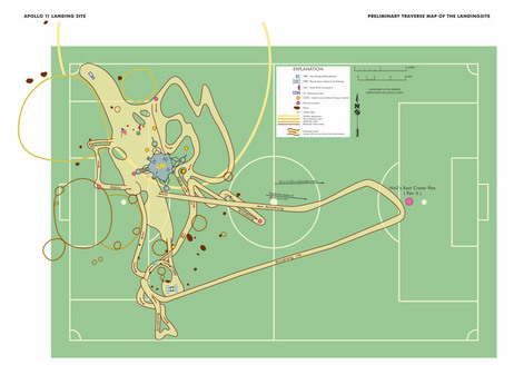
Here’s a link to an interesting NPR story about scale.  It highlights a new map from Frank Jacobs (from the Strange Maps blog) that superimposes a map of Neil Armstrong and Buzz Aldrin’s 1969 moon walks onto a baseball field to better convey the scale involved.  Jacobs’ map is actually a re-make of a NASA map that superimposed the moon walk route onto a soccer field (see below).

Categories
Bucknell/Local Interest General GIS GIS Jobs, Internships, Scholarships & Grad Programs

Bucknell GIS Student Assistant wins scholarship

Belated congratulations to Dan Ladd for winning a highly competitive scholarship from the United States Geospatial Intelligence Foundation (USGIF). Dan, a 2010 graduate of Lewisburg High School and a summer GIS Student Assistant at Bucknell, was one of only three high school seniors in the nation selected for the scholarship and is currently studying geography at Middlebury College in Vermont. Congratulations, Dan!