Categories
Bucknell/Local Interest General GIS

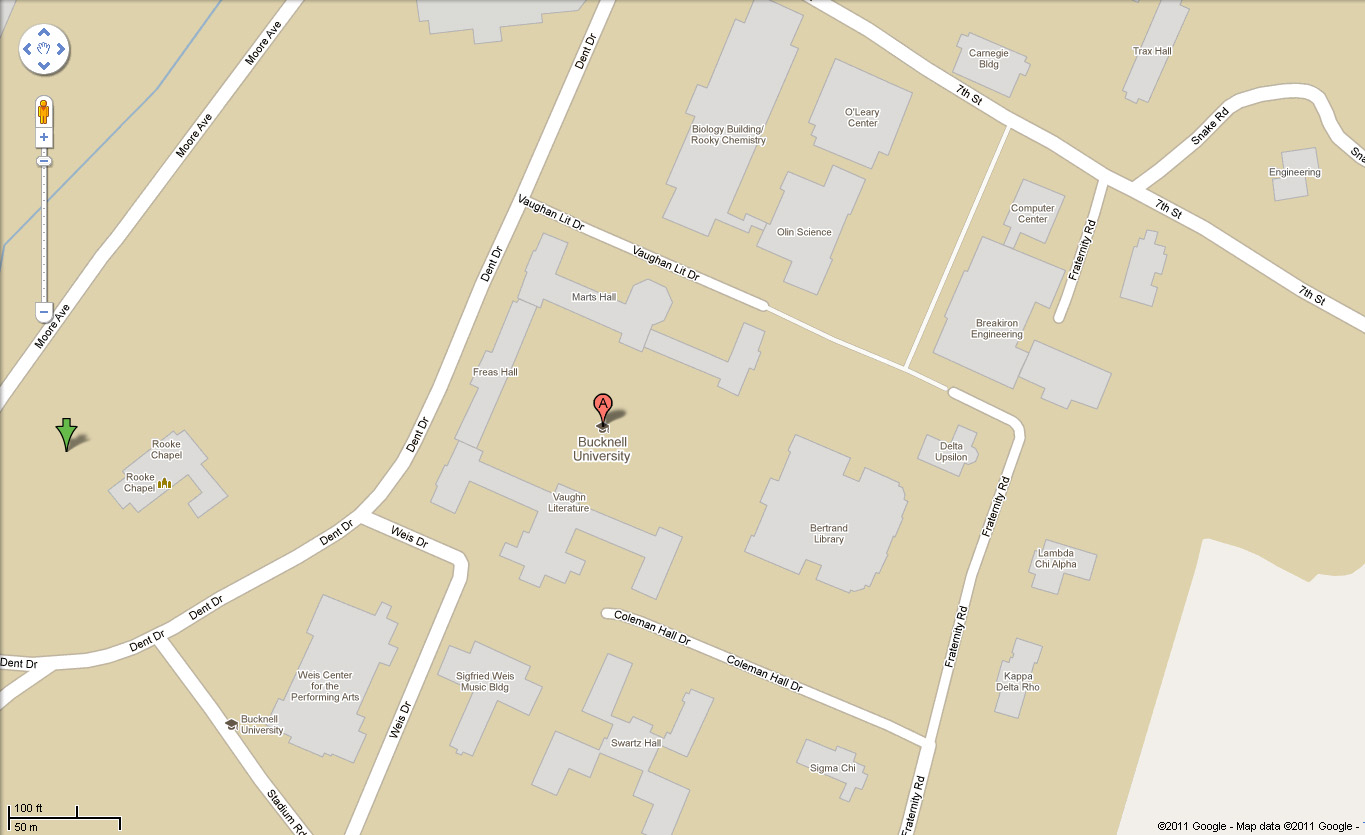
Bucknell campus buildings on Google Maps basemap

In other Google-related news, you can now see Bucknell’s campus buildings on the Google Maps basemap. Thanks to Dan Mancusi and Lisa Veloz for their help with this!  And to Google for finally getting around to adding it…

Check it out here.  You may notice… that the one building that’s mis-labelled is Coleman Hall, the home of the Geography Department…. More evidence of Google’s infamous sense of humor? Your guess is as good as mine – but we are working on the problem.
Categories
Bucknell/Local Interest Events/Calendar General GIS GIS in Computer Science

iExplorePAtrails Mobile Competition

Harrisburg University and the PADCNR recently announced the iExplorePAtrails Mobile Competition. The contest encourages developers from PA universities and beyond to develop mobile applications that combine data on PA trails with other data and user content. The goal is to create ‘mash-ups’ that encourage use of Pennsylvania’s 1,000s of miles of trails and enhance the fun that trail users can have. The contest deadline is April 15th – click here for more information.

Categories
Bucknell/Local Interest Data General GIS Slideshow

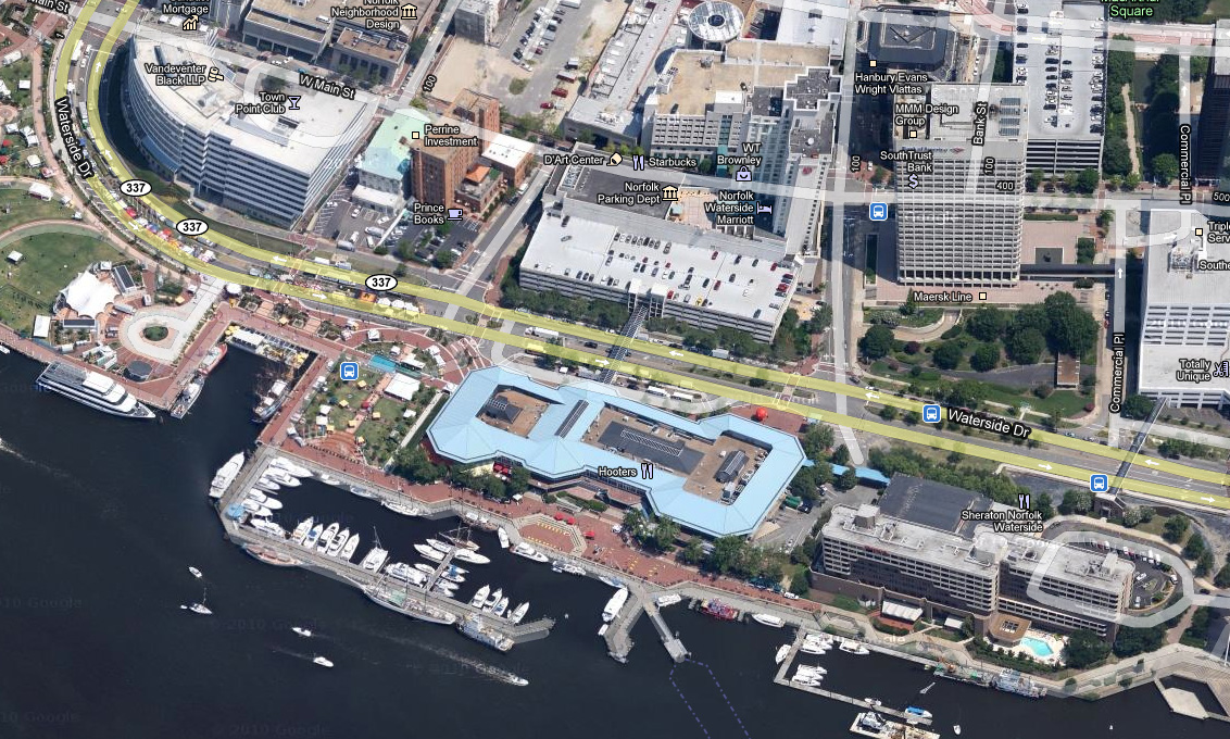
Google releases new oblique imagery in Google Maps

From the LatLong blog:
“We’re now well into the new year, and to kick off 2011, the Geo Imagery team has just rolled out some refreshed 45° imagery for a number of places in the United States. So whether you already miss the places you may have visited over the holiday season, or you’re looking for new vacation spots to travel to this year, you can now escape the winter weather and check them out virtually from the comfort of your warm and dry home.”
Check out some samples of the new data here.
Imagery from Norfolk, VA:
Categories
Bucknell/Local Interest Environment Events/Calendar General GIS Marcellus Shale

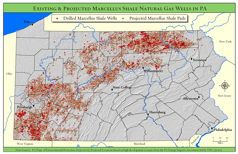
Upcoming presentation by The Nature Conservancy

Back in December I posted links to a new report and webinar by the Nature Conservancy describing their use of GIS to analyze potential Marcellus Shale impacts in PA.  At some point in April we’ll have the Nature Conservancy team here at Bucknell for a presentation of their work.  Stay tuned for more details…

Categories
Bucknell/Local Interest General GIS GIS in Geography GIS in Political Science GIS in Sociology

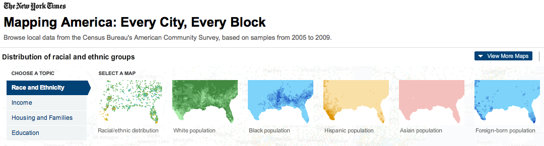
Mapping America block by block

The front page of yesterday’s New York Times featured maps and stories based on recently-released data from the U.S. Census Bureau’s American Community Survey. As described by the team at Social Explorer, “the latest [American Community Survey] figures are the single largest data release in the Census Bureau’s history, providing a look for the first time since 2000 at a variety of characteristics, including income, race, immigration and commuting habits for people in areas as small as just a few square blocks.”

A number of searchable, interactive maps – developed jointly by the New York Times and Social Explorer – accompany the articles. Click here to explore the maps. Click below to read the articles.

“Region is Reshaped as Minorities Go to Suburbs”
“Immigrants Make Paths to Suburbia, Not Cities”
“Samples of Highs and Lows from Around the Country”