Categories
General GIS GIS in Geography GIS in Sociology Map Apps Slideshow

The 12 States of America

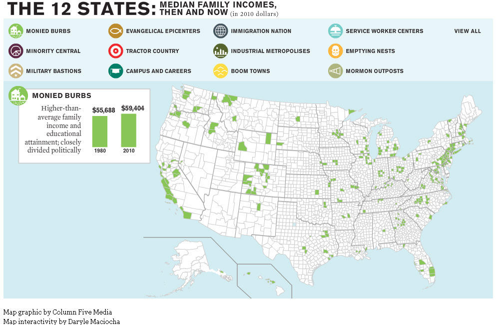
The website for The Atlantic magazine has an interesting new map graphic visualizing the ways in which income inequality has fractured the nation over the past 30 years.  The graphic breaks the nation into 12 different ‘states’ – monied burbs, minority central, military bastions, evangelical epicenters, tractor country, campuses and careers, immigration nation, industrial metropolises, boom towns, service worker centers, emptying nests and mormon outposts – based on a variety of different demographic characteristics.

For example, the Boom Town state is defined as relatively wealthy U.S. counties that saw rapid growth and increasing minority populations prior to the last recession. Whereas Monied Burbs have higher than average family income and educational attainment and are closely divided politically.

See map samples for the Boom Town and Monied Burb states below. Click here to see the interactive map graphic on The Atlantic’s website. Thanks to Ben Marsh for the heads up about this graphic!


Categories
Bucknell/Local Interest General GIS GIS in Geography GIS in Political Science GIS in Sociology

Mapping America block by block

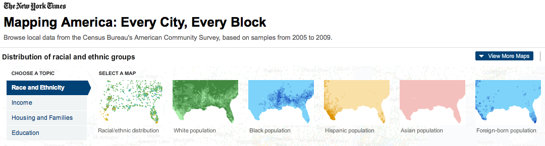
The front page of yesterday’s New York Times featured maps and stories based on recently-released data from the U.S. Census Bureau’s American Community Survey. As described by the team at Social Explorer, “the latest [American Community Survey] figures are the single largest data release in the Census Bureau’s history, providing a look for the first time since 2000 at a variety of characteristics, including income, race, immigration and commuting habits for people in areas as small as just a few square blocks.”

A number of searchable, interactive maps – developed jointly by the New York Times and Social Explorer – accompany the articles. Click here to explore the maps. Click below to read the articles.

“Region is Reshaped as Minorities Go to Suburbs”
“Immigrants Make Paths to Suburbia, Not Cities”
“Samples of Highs and Lows from Around the Country”

Categories
General GIS GIS in Geography Slideshow

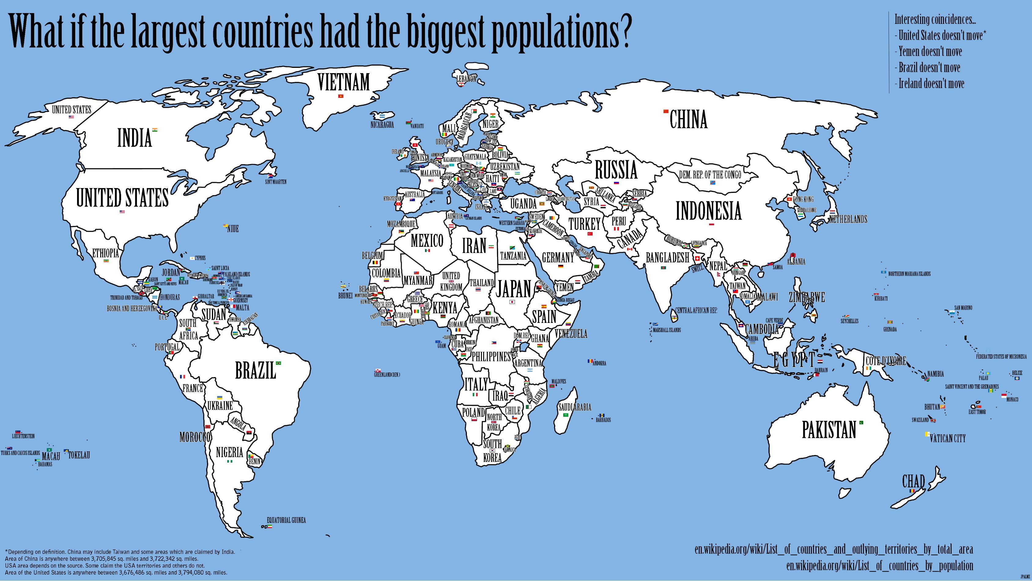
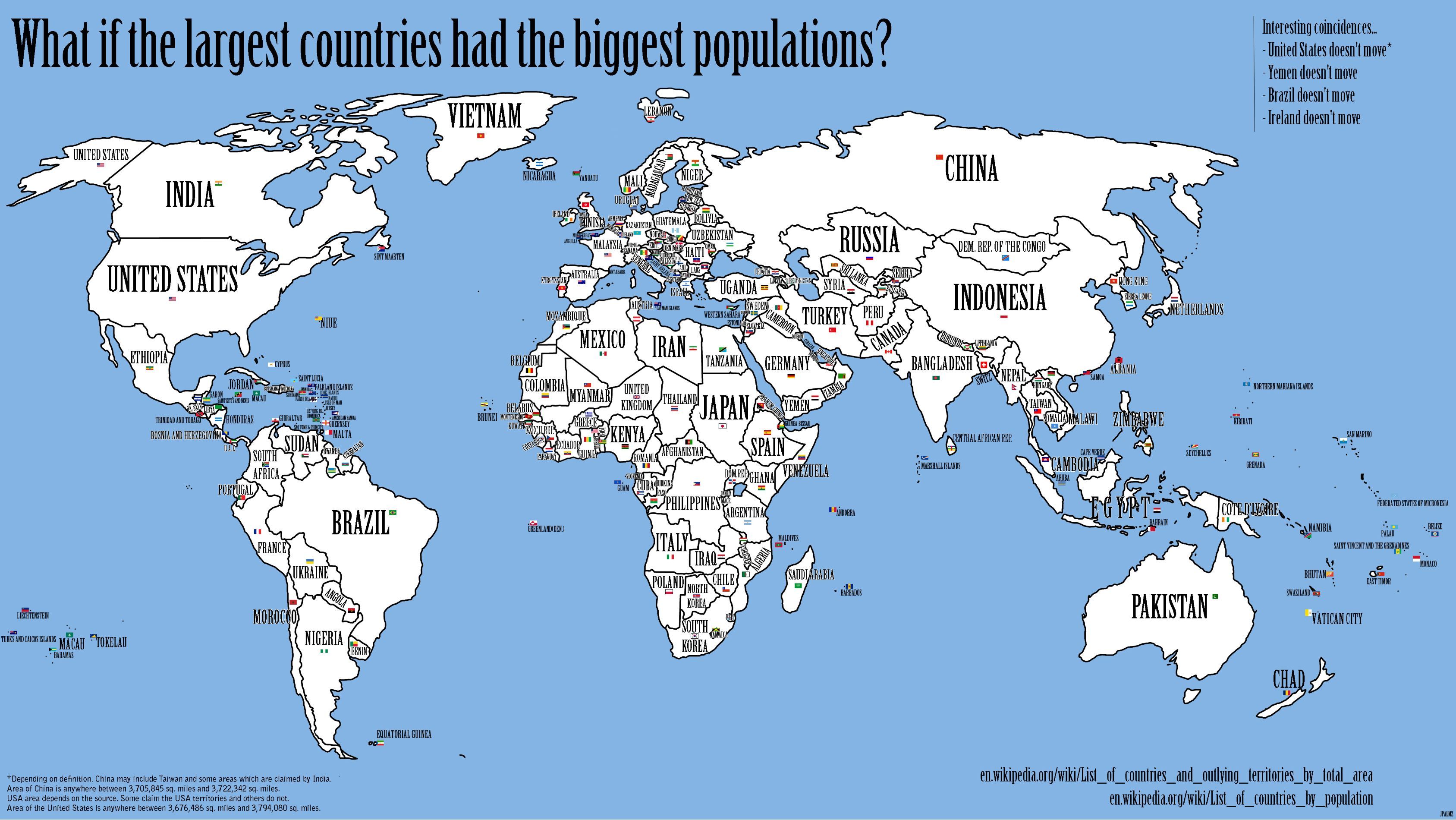
What if the largest countries had the biggest populations?

“What if the world were rearranged so that the inhabitants of the country with the largest population would move to the country with the largest area? And the second-largest population would migrate to the second-largest country, and so on?”

An interesting new map featured on the Strange Maps blog addresses this question.