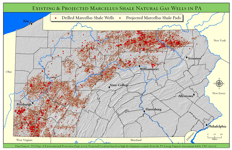
Amongst all of the Osama bin Laden news from the last few days there was a fascinating article from sciencemag.org about a ‘bin Laden Habitat Suitability Model’ created by geography students at UCLA using GIS and remote sensing data, tools and spatial analytical techniques.
Click here to read the article “Geographers Had Calculated 81% Chance That Osama Was in Abbottabad.” See below for an excerpt. Thanks to UT Austin Geography Professor Jennifer Miller for the heads up on this article!
Could Osama bin Laden have been found faster if the CIA had followed the advice of ecosystem geographers from the University of California, Los Angeles? Probably not, but the predictions of UCLA geographer Thomas Gillespie, who, along with colleague John Agnew and a class of undergraduates, authored a 2009 paper predicting the terrorist’s whereabouts, were none too shabby. According to a probabilistic model they created, there was an 80.9% chance that bin Laden was hiding out in Abbottabad, Pakistan, where he was killed last night.