The World Resources Institute has a new online map of global reefs classified by threat risk. Click here to explore the map and/or download the KML. Click here for additional data and maps on global reefs.


The World Resources Institute has a new online map of global reefs classified by threat risk. Click here to explore the map and/or download the KML. Click here for additional data and maps on global reefs.
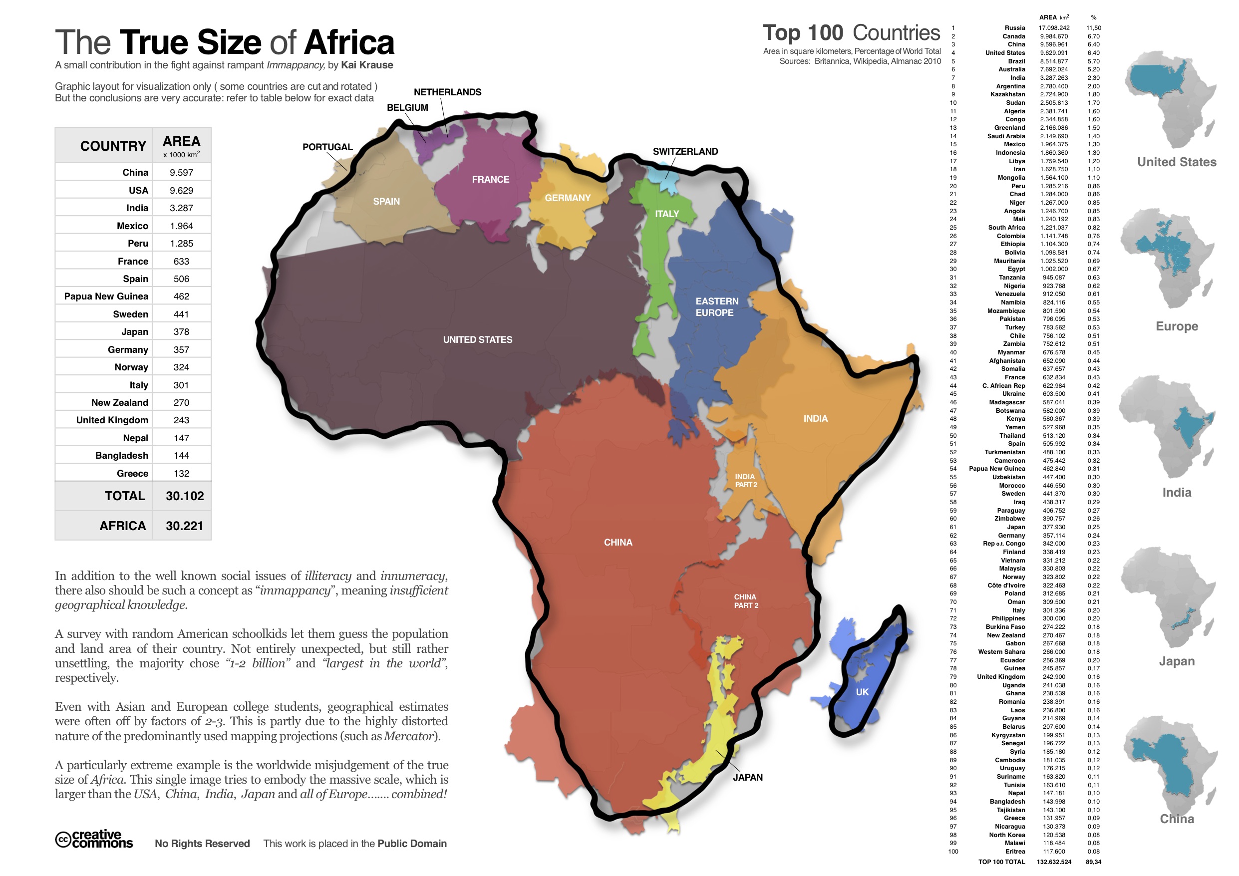
Here’s another in a series (see here and here) of interesting maps that address scale. Created by Kai Krause, the map aims to show the true size of Africa by visualizing all of the countries and regions that could fit inside the continent – including the U.S., China, India, Japan and all of Europe. Krause calls the map “a small contribution in the fight against rampant immapancy” – or insufficient geographical knowledge.
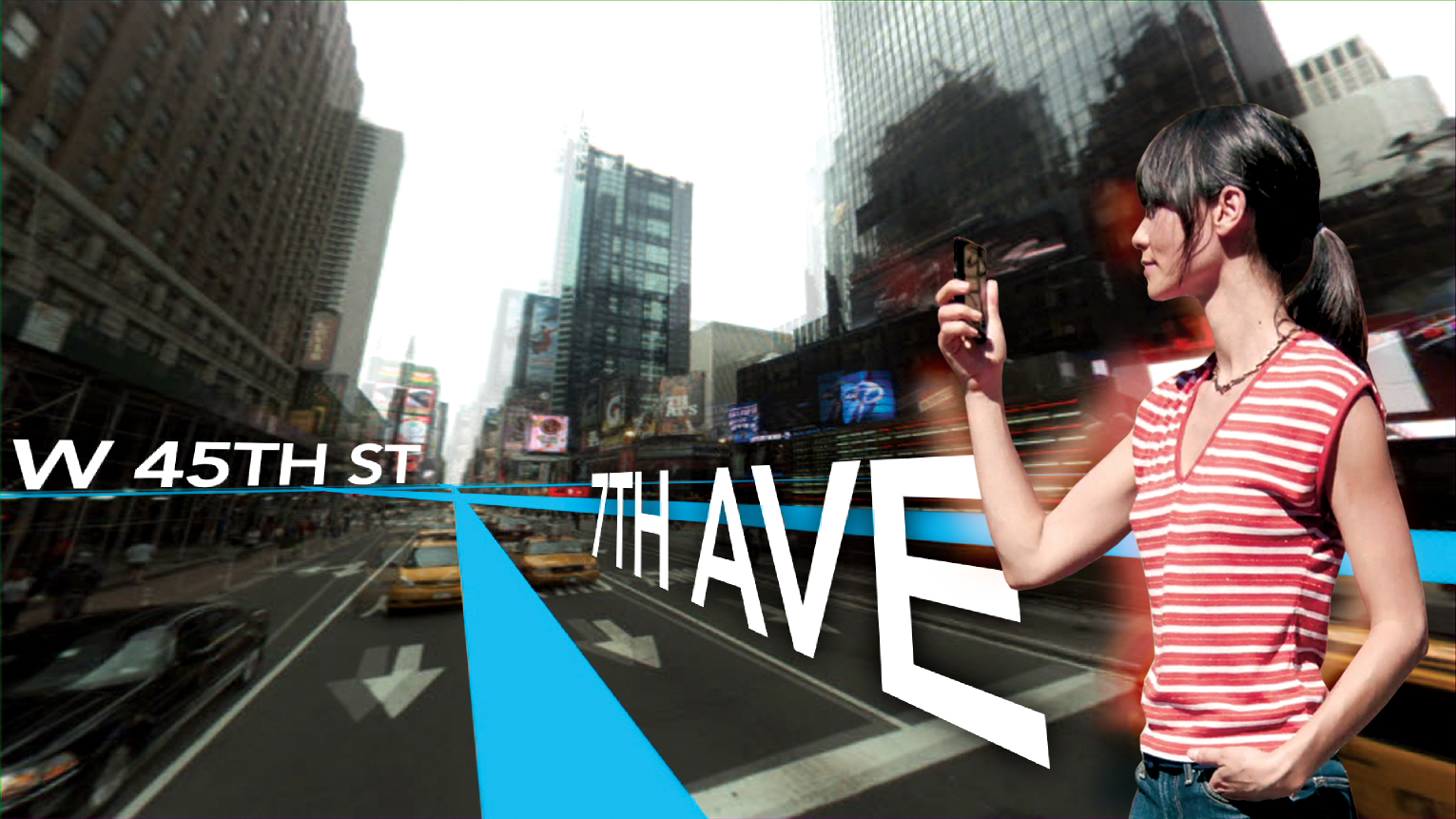
A new episode of Penn State’s “Geospatial Revolution” project was released today. With the tagline “the location of anything is becoming everything” the Geospatial Revolution series is produced by Penn State’s public broadcasting group and described as an “an integrated public service media and outreach initiative about the world of digital mapping and how it is changing the way we think, behave, and interact.” The new episode – part 3 in a 4 part series – focuses on using GIS for public safety and military/defense purposes. Episode 4 is due out on May 1, 2011. See below for the full-length videos for episodes 1, 2 and 3. Videos are also available for individual chapters within each episode.
Episode 1:
httpv://www.youtube.com/watch?v=poMGRbfgp38
Episode 2:
httpv://www.youtube.com/watch?v=GXS0bsR0e7w
Episode 3:
httpv://www.youtube.com/watch?v=OePOK6nzcaY
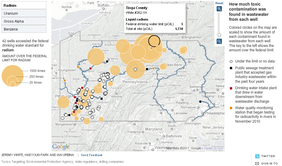
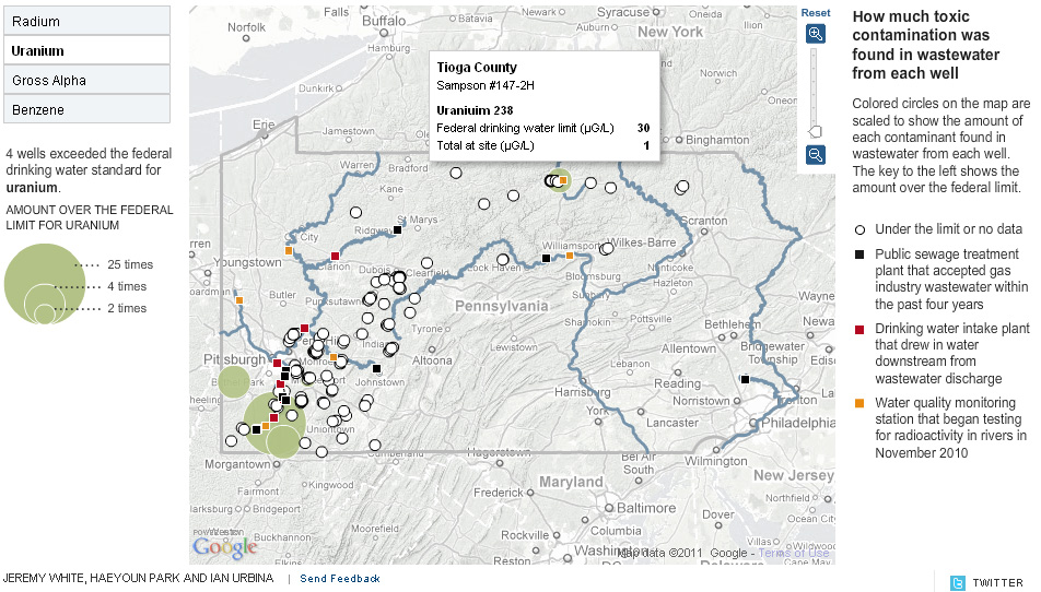
The New York Times has put out a new interactive map graphic that visualizes toxic contamination found in the wastewater from natural gas wells in PA. The data – from 149 wells – is visualized by the type of contaminant (radium, uranium, gross alpha and benzene) and the amount by which each well exceeded the federal drinking water standard. Below are some screenshots from the interactive graphic.
Radium contamination:
Uranium contamination:
Gross alpha contamination:
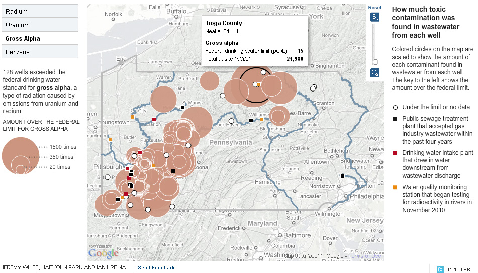
Benzene contamination:

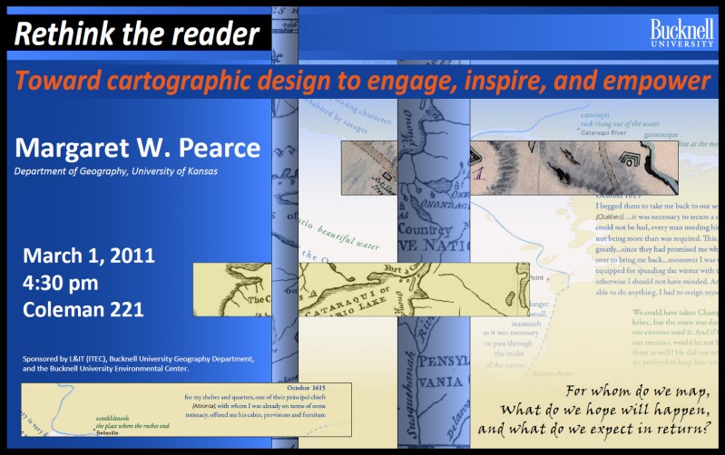
Margaret Pearce, University of Kansas Dept. of Geography, will present a lecture, “Rethink the Reader: Toward Cartographic Design to Engage, Inspire, and Empower” tomorrow (Tues. 3/1) at 4:30 in 221 Coleman Hall.
Dr. Pearce works on cartographic representation of cultural and historical geographies, especially indigenous geographies. Her work stems from, as she describes it, “a love of map design as both a tool for exploring geographical information as well as expressive form for communicating complex geographical ideas, especially ideas about place and experience.” Her work is inspired and influenced by emerging ideas in critical cartography, affective technologies, and Indigenous Studies. She has published in journals such as Cartography and Geographic Information Science, American Indian Culture & Research Journal, and Cartographic Perspectives and has authored a book, Exploring Human Geography with Maps.
Sponsored by L&IT, the Geography Department, and the Bucknell Environmental Center.