Categories
Bucknell/Local Interest Events/Calendar General GIS Videos

Open Lab session on Google spreadsheet mapper, docs, sites and video

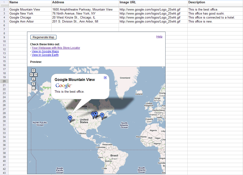
There will be an Open Lab session for faculty in the ITEC office on Tuesday, March 1 from 9am-11am and Wednesday, March 2 from 2pm-4pm. Drop in at any time during the Open Lab hours to learn more about using the Google suite of tools for your teaching or research. The focus next week will be on Google spreadsheet mapper, docs, video and sites. The Open Lab is intended to be an informal workshop setting where you can learn more about tech tools and begin integrating them into your work. Feel free to bring your own data or we can use ours to show you how the tools work.

Categories
Bucknell/Local Interest Data Environment General GIS Marcellus Shale

New conservation and Marcellus Shale-related data available on Xanthus GIS Server

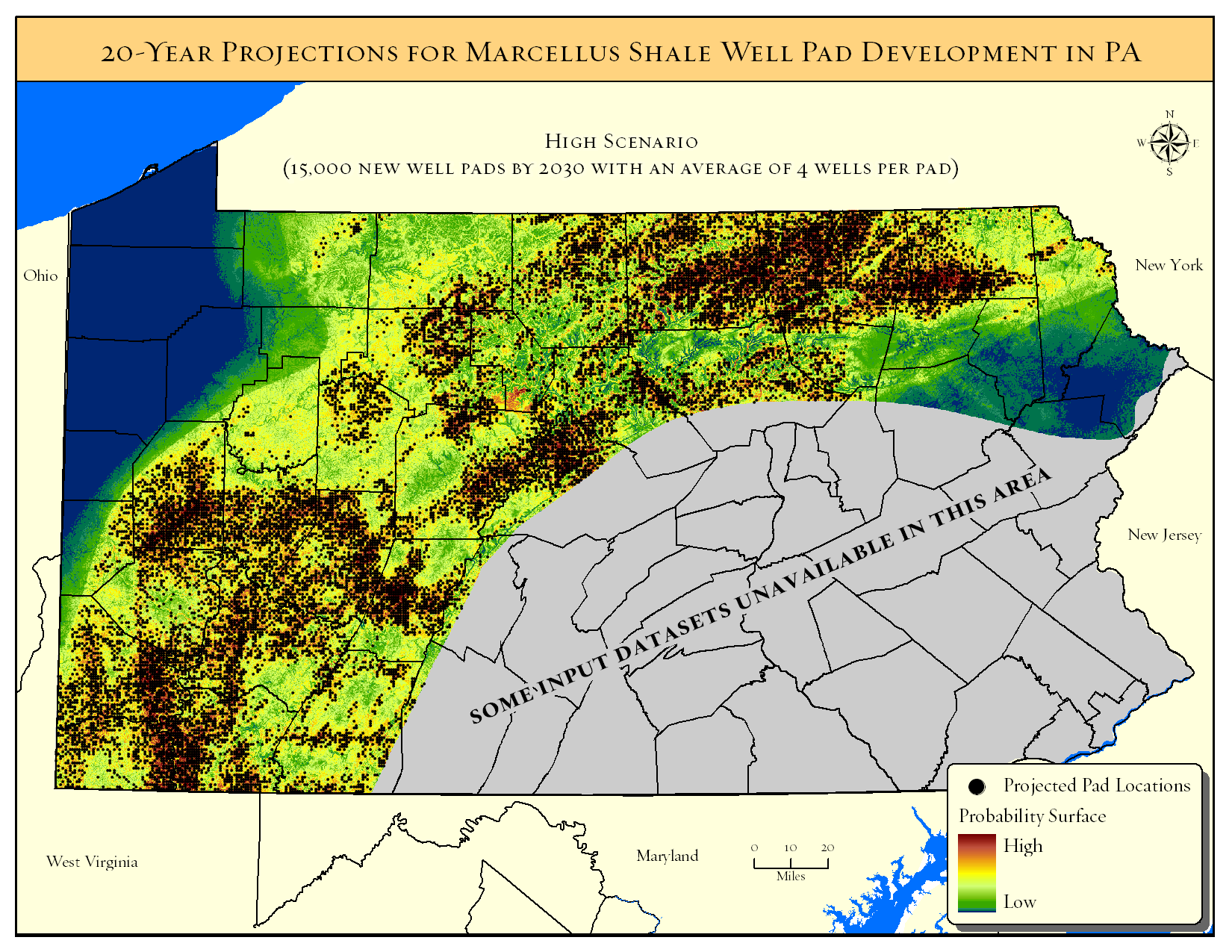
Several new datasets from Platts (an energy consulting firm) and the Nature Conservancy were added to the GIS Data folder on Xanthus last night.  The data includes gas compressor stations for PA, NY and WV along with current and projected locations of Marcellus Shale wells and wind turbines in PA.  Forest patches and landscape blocks are also included in the data from the Nature Conservancy . Full metadata is available on Xanthus. Bucknell faculty and students – please contact me for access and/or additional information on the new datasets.

Data from Platts:

Gas compressor station locations for PA, NY and WV.
Datasets from TNC’s Pennsylvania Energy Impacts Assessment:

Projections by The Nature Conservancy and Western Pennsylvania Conservancy

  • Probability surface of conversion to Marcellus Shale development
  • Projected Marcellus Shale pad locations under low, medium, and high development scenarios

Marcellus Shale drilling permits from the PA Department of Environmental Protection (PA DEP)

  • Drilled, valid, and expired Marcellus well permits as of January 2011
  • Drilled Marcellus Shale wells only as of January 2011

Projections by The Nature Conservancy and Western Pennsylvania Conservancy

  • Probability surface of conversion to wind energy development

—> Original model output at 30-meter resolution
—> Re-sampled raster at 60-meter resolution with exclusionary areas removed

  • Projected wind turbine locations under low, medium, and high development scenarios

Case information from the Federal Aviation Administration (FAA)

  • Built and proposed wind turbines and meteorological towers
  • Built large-scale wind turbines only
Categories
Bucknell/Local Interest Environment General GIS Slideshow

Bucknell awarded $520,000 Mellon grant to support environmental studies, GIS integration

Bucknell has been awarded a $520,000 Mellon grant (the largest Mellon grant ever received by BU) to support the development of courses and initiatives related to environmental studies.  Click here to read the announcement on the BU home page. In addition to providing stipends to faculty who create new courses that include environmental connections, the grant will also support the development of GIS technology as a tool in teaching, learning and research related to environmental topics. Specifically, the grant will:

  • provide stipends to faculty who attend GIS workshops
  • fund GIS Student Research Assistants
  • fund development of course materials – labs, lecture materials, datasets, web-based course modules, etc. – that integrate GIS with environmental studies content

Contact me with any questions or ideas you might have about the GIS part of this grant.

Categories
Bucknell/Local Interest Environment Events/Calendar General GIS Marcellus Shale Slideshow

Presentation by the Nature Conservancy – Monday, April 4th at 4:30pm

Save the date – April 4th at 4:30pm.  Tamara Gagnolet, GIS Analyst and Conservation Data Manager for the Pennsylvania chapter of the Nature Conservancy, will be at Bucknell on April 4th, 2011 to discuss her work in using GIS to analyze potential impacts of Marcellus Shale gas drilling in Pennsylvania. The Nature Conservancy recently released part 1 of its ‘Pennsylvania Energy Impacts Report’ – focusing on environmental impacts of Marcellus Shale gas-drilling and wind energy. Ms. Gagnolet’s presentation will focus on how GIS and spatial analysis were used to project how much energy might be developed in PA during the next 20 years, where that development is more or less likely to occur and what types of strategies might need to be employed to mitigate potential habitat impacts.

Presentation details: April 4th, 2011 at 4:30pm in the Bertrand Library Traditional Reading Room. Refreshments will be served.

Click here to read an earlier post about the Nature Conservancy report.

Categories
Bucknell/Local Interest Digital Humanities Environment General GIS GIS in History GIS in Humanities Marcellus Shale Slideshow

Ask the expert: Katie Faull on maps, Moravian diaries and Native American history

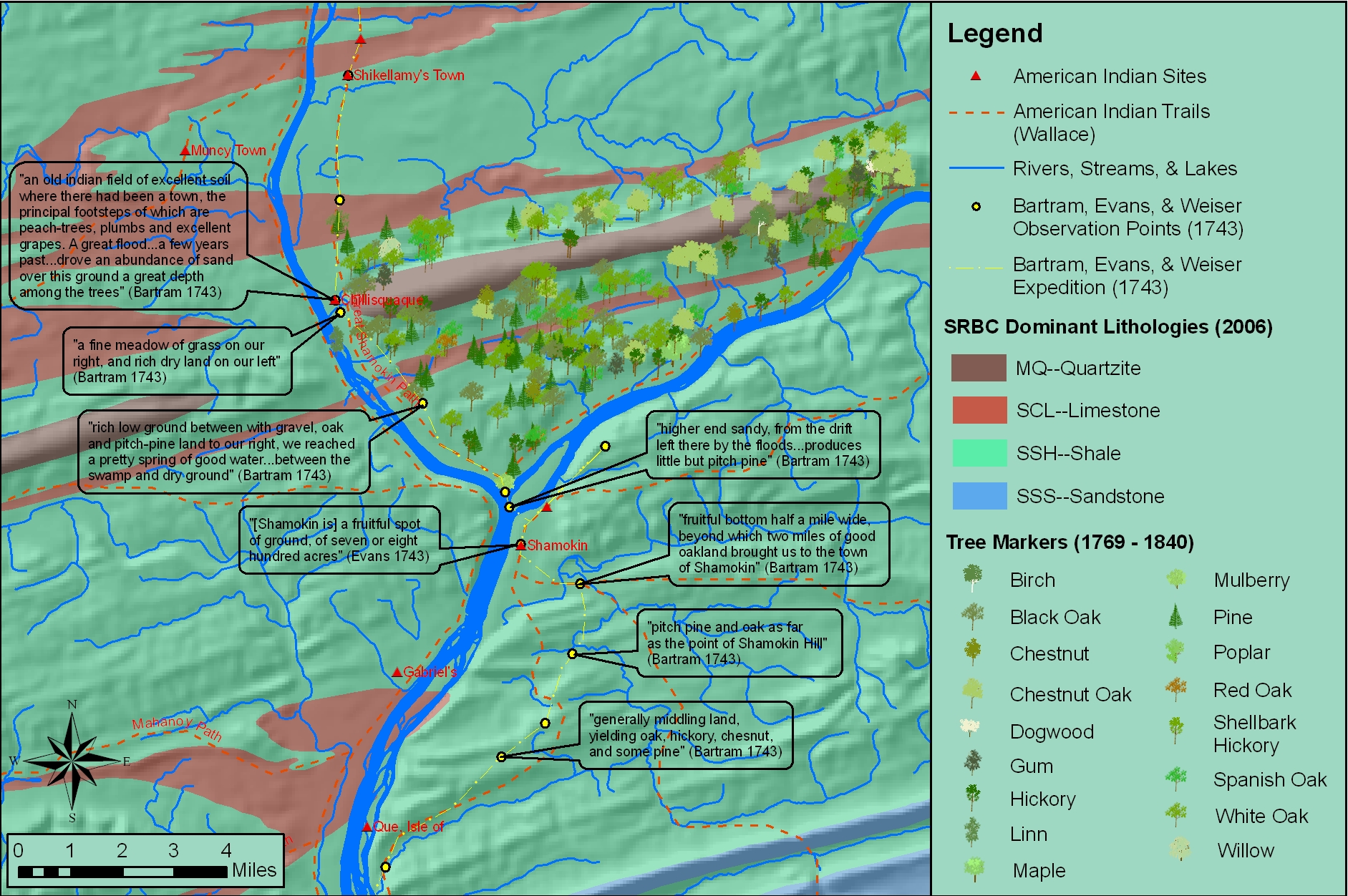
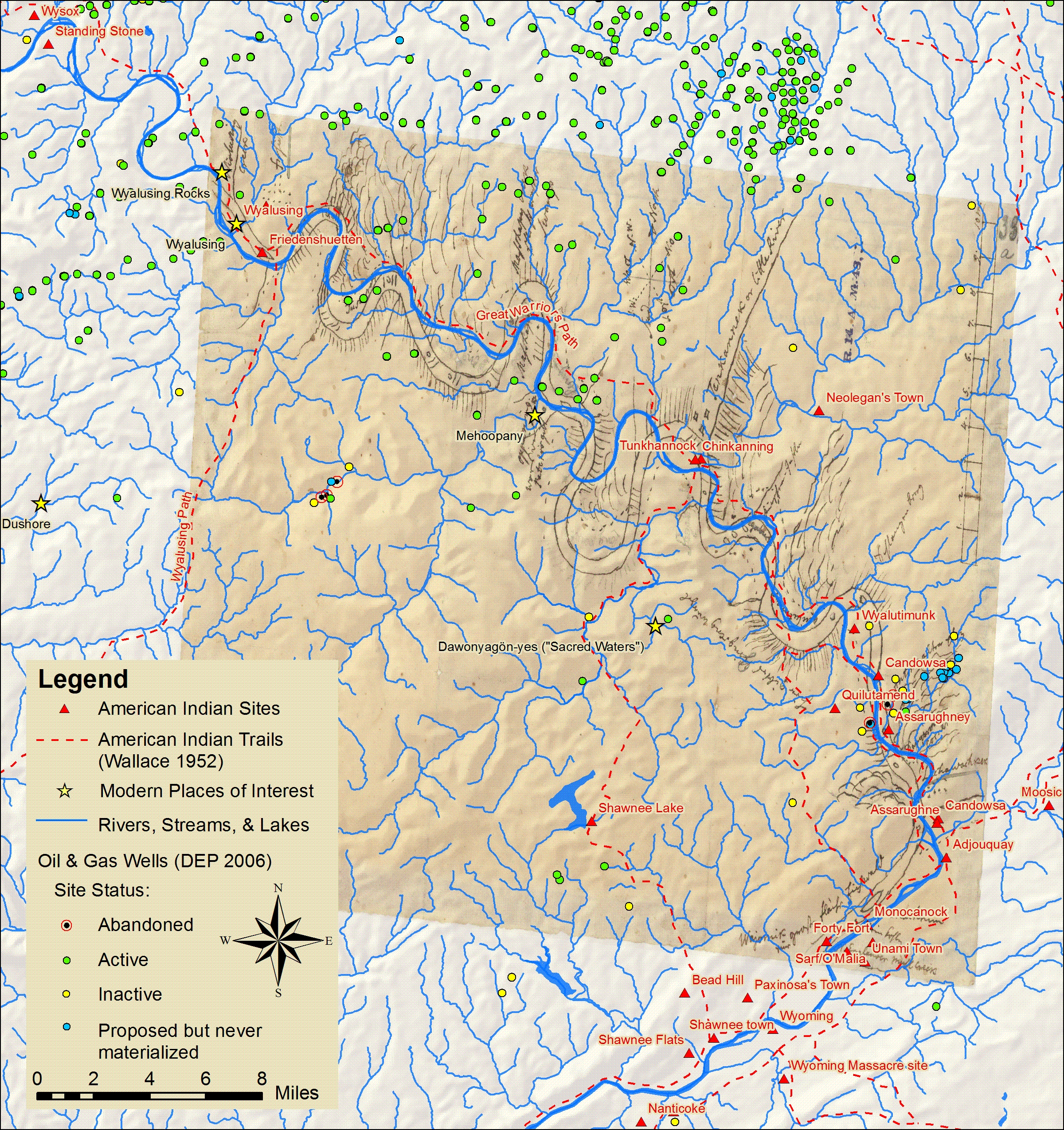
In the BU homepage’s February ‘Ask the Expert’ interview, Prof. Katie Faull discusses her research on the 18th Century Moravian settlers and Native Americans who inhabited the Susquehanna watershed region. With the help of her research assistant, Emily Bitely ’11, Prof. Faull has made extensive use of GIS in reconstructing 18th Century landscapes of the Susquehanna.  Read the interview here.

Sample map constructed from witness tree markers and georeferenced historic maps:

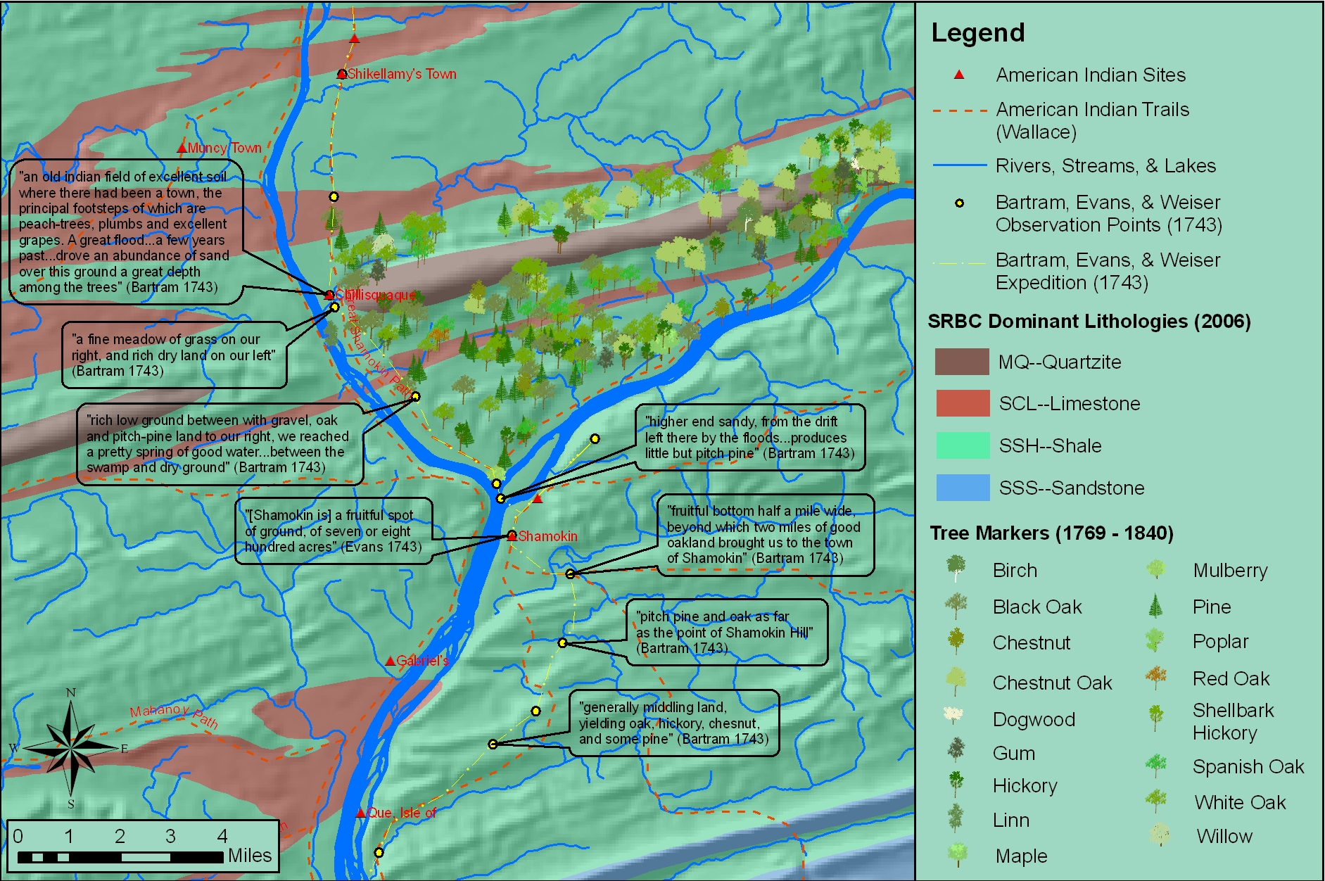
Sample map showing locations of Native American sites, trails and sacred places in relation to Marcellus Shale gas drilling.