Categories
General GIS GIS in Geography Slideshow

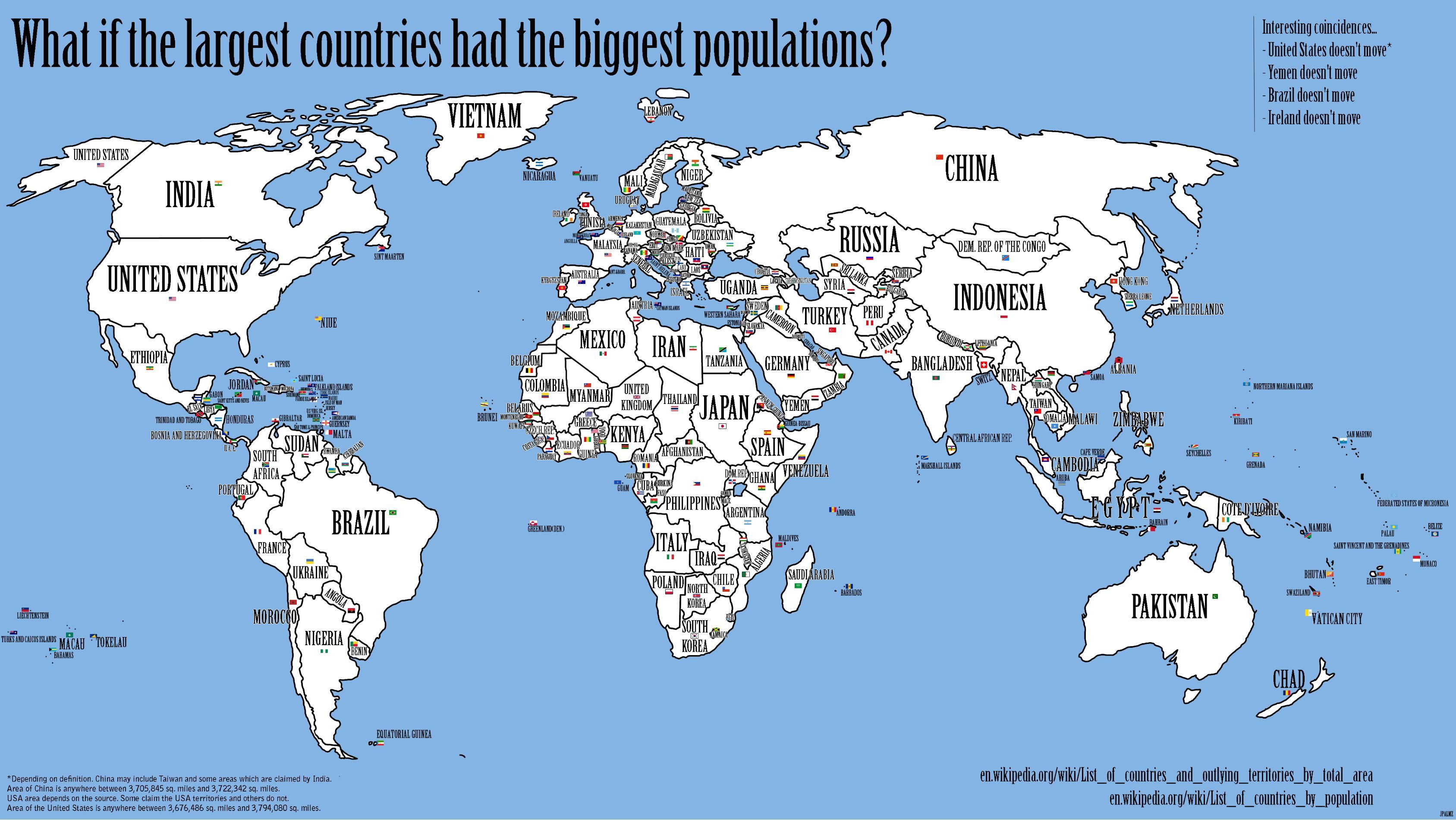
What if the largest countries had the biggest populations?

“What if the world were rearranged so that the inhabitants of the country with the largest population would move to the country with the largest area? And the second-largest population would migrate to the second-largest country, and so on?”

An interesting new map featured on the Strange Maps blog addresses this question.

Categories
Bucknell/Local Interest Digital Humanities Environment General GIS GIS in Environmental Studies GIS in Humanities Marcellus Shale Slideshow

Tour the front lines of the Marcellus Shale boom with students from the Susquehanna Valley Summer Writer’s Institute

In Summer 2010, a team of five Bucknell undergrads participated in the Susquehanna Valley Summer Writer’s Institute with the goal of collecting and reporting stories of how the Marcellus Shale gas-drilling boom is transforming communities and cultural landscapes. Given how central geography is to the story of the Marcellus Shale boom, it was quickly agreed that the most powerful way to share this work would be through embedding the emerging, evolving stories into a clickable, interactive map – giving users the ability to interactively explore and engage with the material.  The map for the Summer 2010 project was built using the Google Maps API but plans are underway to implement ArcGIS Server technology to add additional functionality and interactivity.  Thanks to Mike Weaver from ITEC for his work in building the Google Maps site!
Categories
Bucknell/Local Interest General GIS GIS in Geography Slideshow

Award-winning poster

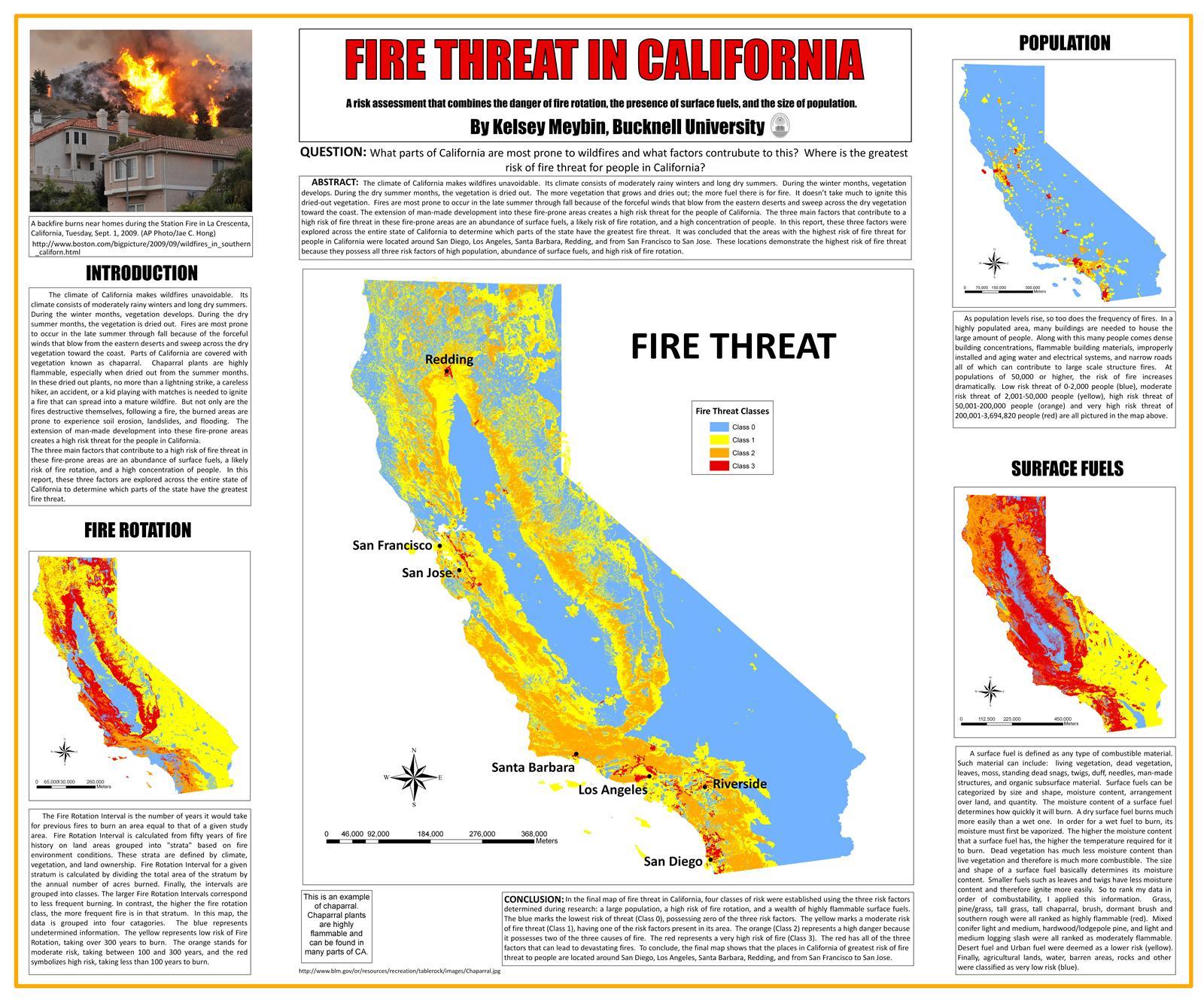
Congratulations to junior Civil Engineering student Kelsey Meybin for her award-winning map! Kelsey’s map – “Fire Threat in California” – recently won both the People’s Choice Award for Cartography and the Panel of Judges Award for Communications in Higher Education at the National Council for Geographic Education conference. Congratulations to Kelsey for this tremendous achievement!

Categories
Bucknell/Local Interest Events/Calendar General GIS Slideshow Videos

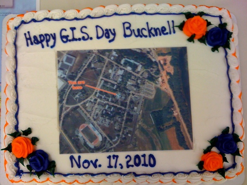
Happy GIS Day, Bucknell!

Yesterday was GIS Day – and Bertrand Library celebrated by hosting a student poster display and serving up slices of ‘map’ cake. In case you missed out on the fun, here’s a YouTube video that was created by students at another school to celebrate the occasion.

httpv://www.youtube.com/watch?v=4mCDUf08YLg