Categories
General GIS Slideshow

Map your Valentine

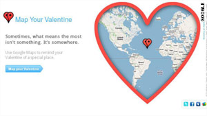
MapYourValentine from Google –  “sometimes, what means the most isn’t something. It’s somewhere.”

Update: to avoid confusing your Valentine, you might want to use the ‘preview’ feature before sending. I just tested the site on myself using ‘Kedainiai, Lithuania’ as my special location and in return I got a Valentine’s Day message with a cute little heart circling a spot in the middle of the Caribbean Sea!
Categories
General GIS GIS in Art Slideshow Videos

From the wilderness downtown to a Grammy win

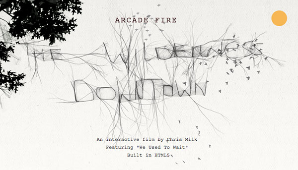
In honor of Arcade Fire’s Grammy win last night for album of the year, here’s a link to their video/interactive map app for song ‘We Used to Wait’ from The Suburbs.  You’ll have to download Google Chrome to experience “The Wilderness Downtown” but it’s worth the couple of seconds it’ll take to do it. As mashable.com put it, “it’s basically one big ball of HTML5/Google Maps/musical goodness.”

Categories
Bucknell/Local Interest Digital Humanities Events/Calendar General GIS Slideshow

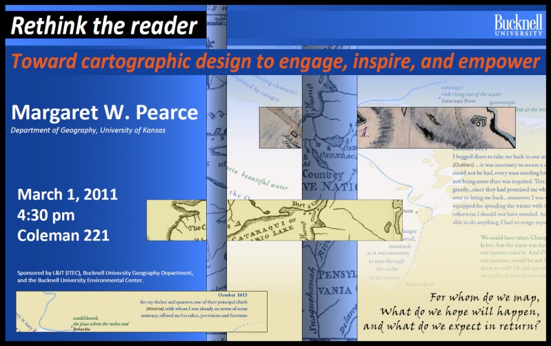
Upcoming lecture by Margaret Pearce

Tuesday, March 1st @ 4:30pm (Coleman 221)

“Rethink the reader: Toward cartographic design to engage, inspire and empower”

Come hear Margaret Pearce from the University of Kansas talk about map visualization and cartographic design.  Dr. Pearce is a geographer who works on cartographic representation of cultural and historical geographies, especially Indigenous geographies.  Her work is inspired and influenced by emerging ideas in critical cartography, affective technologies, and the focus on place in Indigenous studies.  She has published in journals such as Cartography and Geographic Information Science, American Indian Culture & Research Journal, and Cartographic Perspectives, and has co-authored a book, with O. Dwyer, Exploring Human Geography with Maps.

Categories
Bucknell/Local Interest Digital Humanities Environment General GIS GIS in History GIS in Humanities Marcellus Shale Slideshow

Ask the expert: Katie Faull on maps, Moravian diaries and Native American history

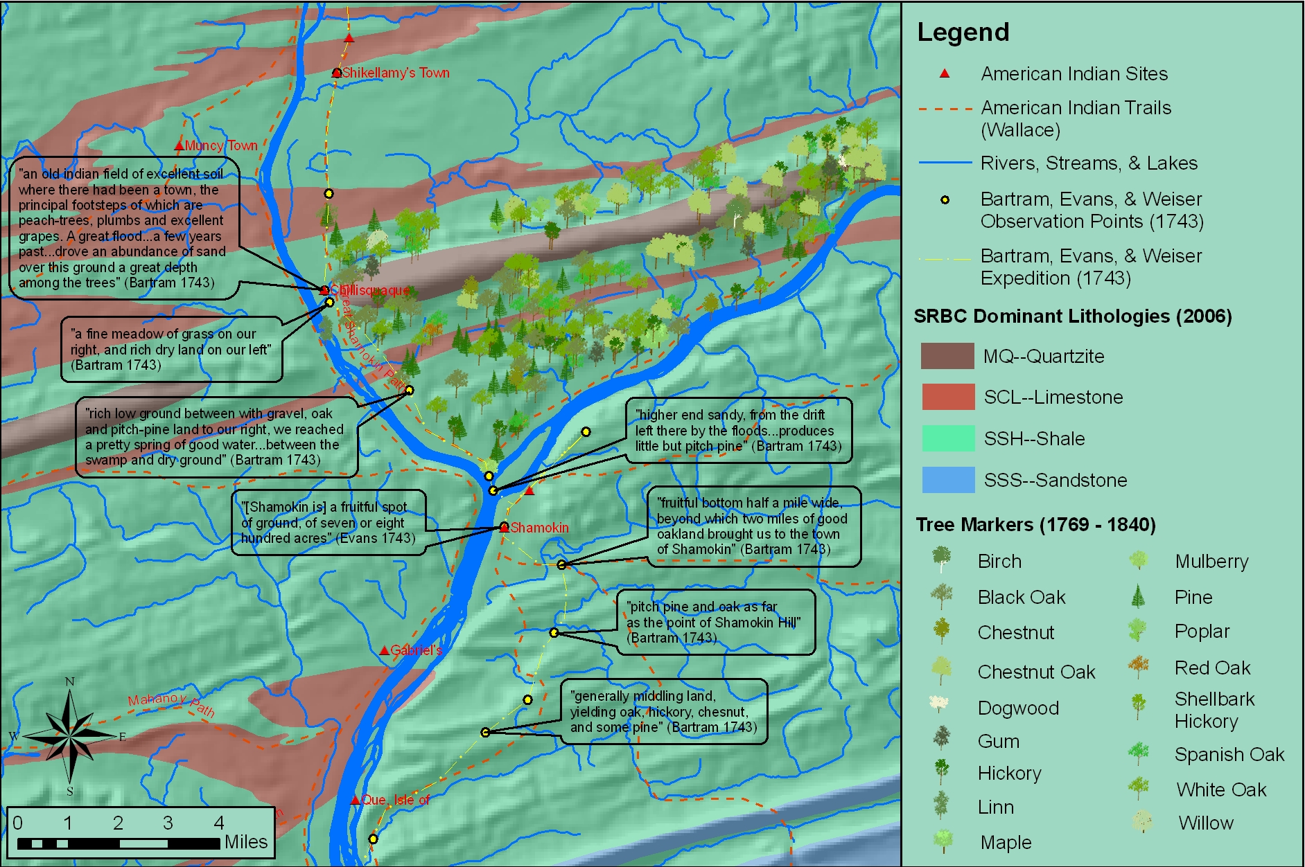
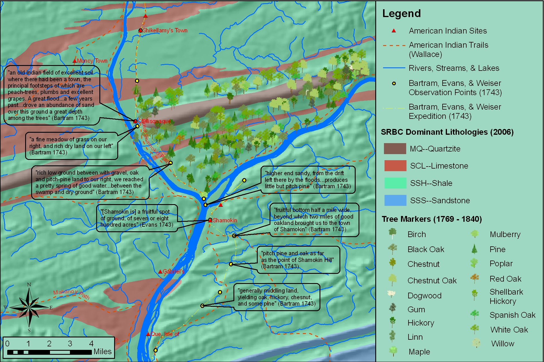
In the BU homepage’s February ‘Ask the Expert’ interview, Prof. Katie Faull discusses her research on the 18th Century Moravian settlers and Native Americans who inhabited the Susquehanna watershed region. With the help of her research assistant, Emily Bitely ’11, Prof. Faull has made extensive use of GIS in reconstructing 18th Century landscapes of the Susquehanna.  Read the interview here.

Sample map constructed from witness tree markers and georeferenced historic maps:

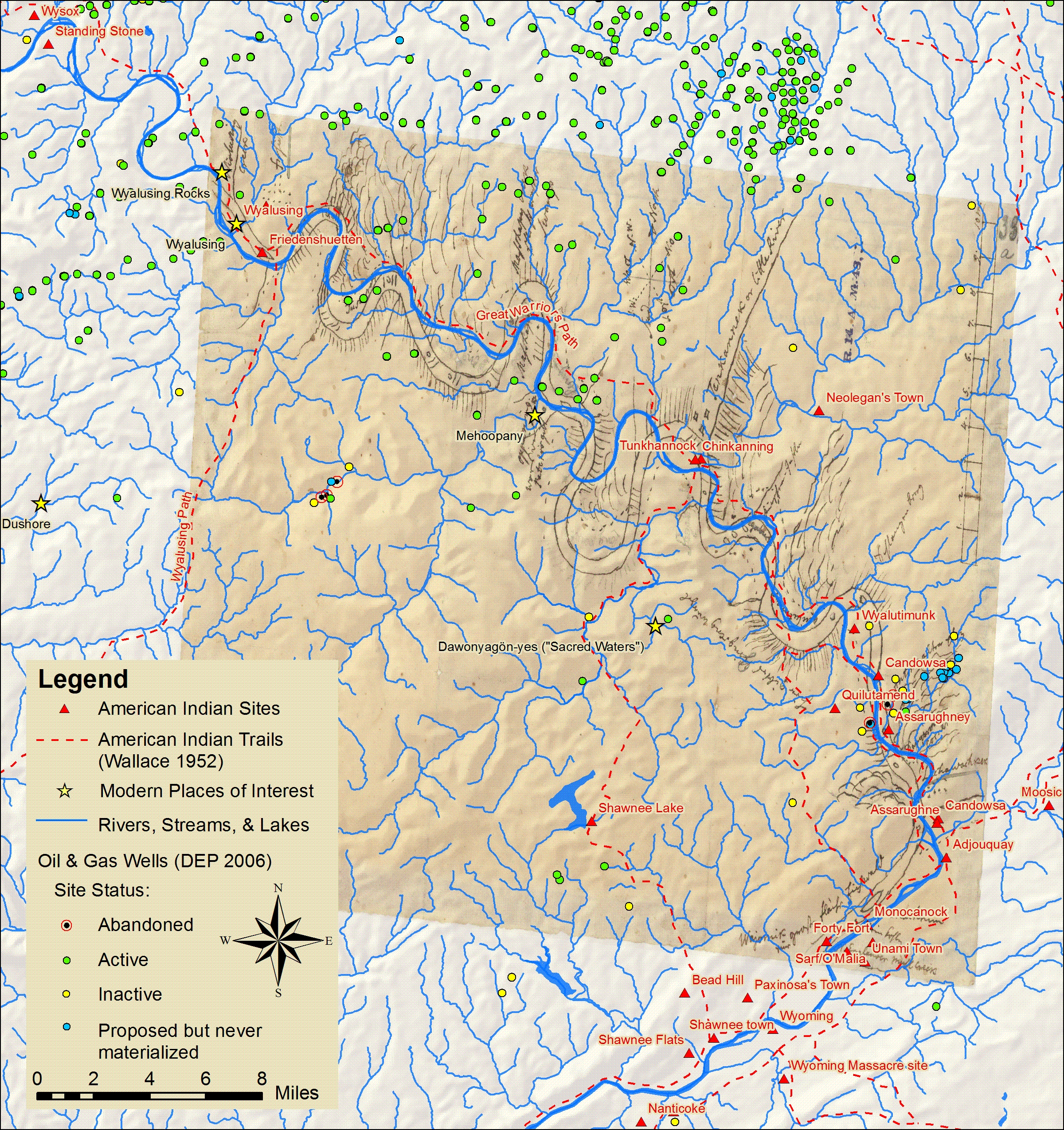
Sample map showing locations of Native American sites, trails and sacred places in relation to Marcellus Shale gas drilling.

Categories
Environment General GIS GIS in Public Health Slideshow

Geomedicine Reveals Cancer Rate Patterns

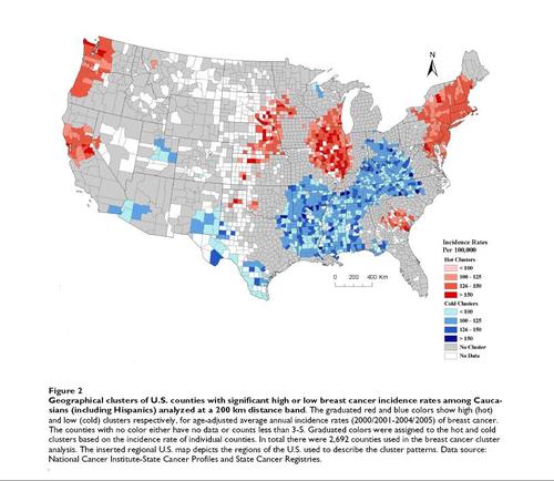
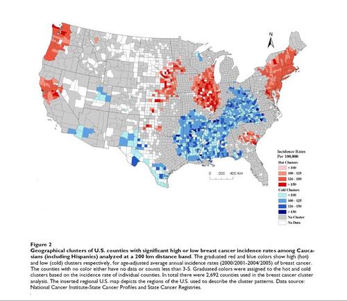
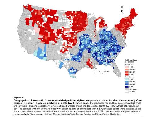
An article from yesterday’s Huffington Post features maps showing geographical clusters of US counties with significantly high or low breast cancer and prostate cancer rates. The maps, from a recently published study reveal distinct geographic patterns – in particular a strong north-south distribution of ‘hot spot’ clusters.

Geographic clusters of US Counties with significant high or low breast cancer incidence rates.

Geographic clusters of US Counties with significant high or low prostate cancer incidence rates.