Categories
Bucknell/Local Interest Data Environment General GIS

New National Land Cover Database (NLCD 2006) Available

The latest edition of the NLCD (2006) is now publicly available, providing updates on land cover change occurring between 2001 and 2006.  I’m working on downloading the data to the GIS data folder on Xanthus so stay tuned for a post telling you when that’s complete.  If you can’t wait, click here to download the data now from the Multi-Resolution Land Characteristics Consortium website.

Categories
Bucknell/Local Interest Events/Calendar General GIS GIS in Public Health

Geography Alumni Conference – Thur., Feb. 17th

Geographers’ Views:  Local Environmental Struggles, Global Context

This week the Geography Department welcomes four distinguished alumni to present their research and participate in a panel discussion on Thursday, February 17th in the Gallery Theatre (ELC). Research talks will be held from 4-6pm with a panel discussion to follow from 6:30-7pm.  Both events are free and open to the public.

Brian King
Bucknell Class of 1995
Assistant Professor of Geography,
Pennsylvania State University
“‘No One Dies of AIDS’: Political Ecologies of Health”

Sonja Pieck
Bucknell Class of 1999
Assistant Professor of
Environmental Studies,
Bates College
“The NGO, the Forest, and the ‘Hyperreal Indian’:
Notes on Transnational Amazonian Politics”

Jacqueline Vadjunec
Bucknell Class of 1997
Assistant Professor of Geography,
Oklahoma State University
“Tapping into ‘Florestania’: New Amazonian Geographies, Changing Land-Use and Emerging Identities in Acre, Brazil”

Joel Wainwright
Bucknell Class of 1995
Assistant Professor of Geography,
Ohio State University
“Climate Leviathan”
Categories
Bucknell/Local Interest Environment Events/Calendar General GIS Marcellus Shale

Upcoming presentation by The Nature Conservancy

Back in December I posted links to a new report and webinar by the Nature Conservancy describing their use of GIS to analyze potential Marcellus Shale impacts in PA.  At some point in April we’ll have the Nature Conservancy team here at Bucknell for a presentation of their work.  Stay tuned for more details…

Categories
Bucknell/Local Interest Environment General GIS Marcellus Shale Slideshow

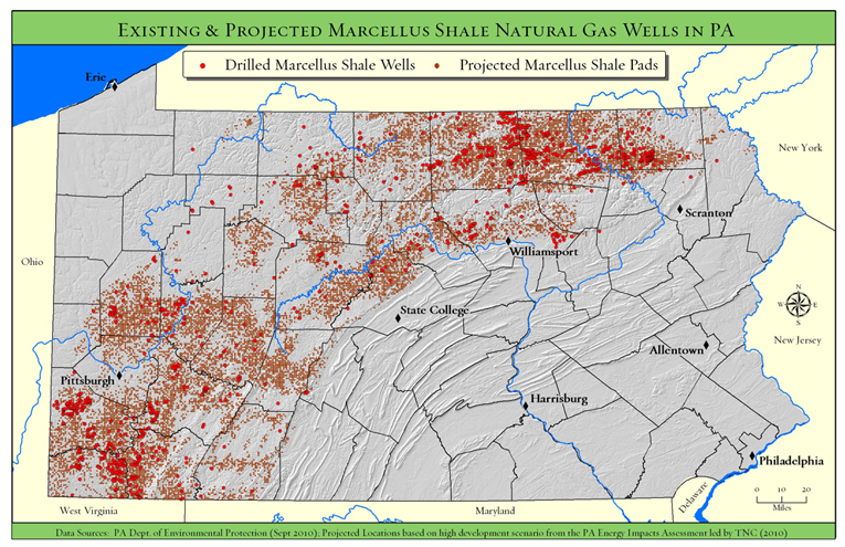
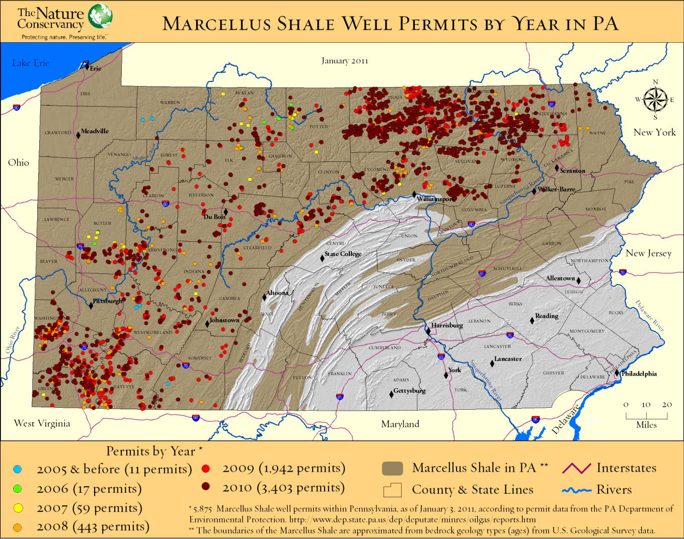
Using GIS to analyze Marcellus Shale impacts in Pennsylvania

The Nature Conservancy recently released a study analyzing potential habitat impacts of energy development – including Marcellus Shale – in Pennsylvania over the next 20 years. Click here to watch a recorded presentation by the two lead researchers on the project. Click here for a copy of the full report.

The presentation includes discussion of how GIS and spatial analysis were used to project how much energy might be developed in PA during the next 20 years and where that development is more or less likely to occur.

Categories
Bucknell/Local Interest Digital Humanities Environment General GIS GIS in Environmental Studies GIS in Humanities Marcellus Shale Slideshow

Tour the front lines of the Marcellus Shale boom with students from the Susquehanna Valley Summer Writer’s Institute

In Summer 2010, a team of five Bucknell undergrads participated in the Susquehanna Valley Summer Writer’s Institute with the goal of collecting and reporting stories of how the Marcellus Shale gas-drilling boom is transforming communities and cultural landscapes. Given how central geography is to the story of the Marcellus Shale boom, it was quickly agreed that the most powerful way to share this work would be through embedding the emerging, evolving stories into a clickable, interactive map – giving users the ability to interactively explore and engage with the material.  The map for the Summer 2010 project was built using the Google Maps API but plans are underway to implement ArcGIS Server technology to add additional functionality and interactivity.  Thanks to Mike Weaver from ITEC for his work in building the Google Maps site!