Categories
Bucknell/Local Interest Environment General GIS Slideshow

Bucknell awarded $520,000 Mellon grant to support environmental studies, GIS integration

Bucknell has been awarded a $520,000 Mellon grant (the largest Mellon grant ever received by BU) to support the development of courses and initiatives related to environmental studies.  Click here to read the announcement on the BU home page. In addition to providing stipends to faculty who create new courses that include environmental connections, the grant will also support the development of GIS technology as a tool in teaching, learning and research related to environmental topics. Specifically, the grant will:

  • provide stipends to faculty who attend GIS workshops
  • fund GIS Student Research Assistants
  • fund development of course materials – labs, lecture materials, datasets, web-based course modules, etc. – that integrate GIS with environmental studies content

Contact me with any questions or ideas you might have about the GIS part of this grant.
Categories
General GIS GIS in Public Health Slideshow

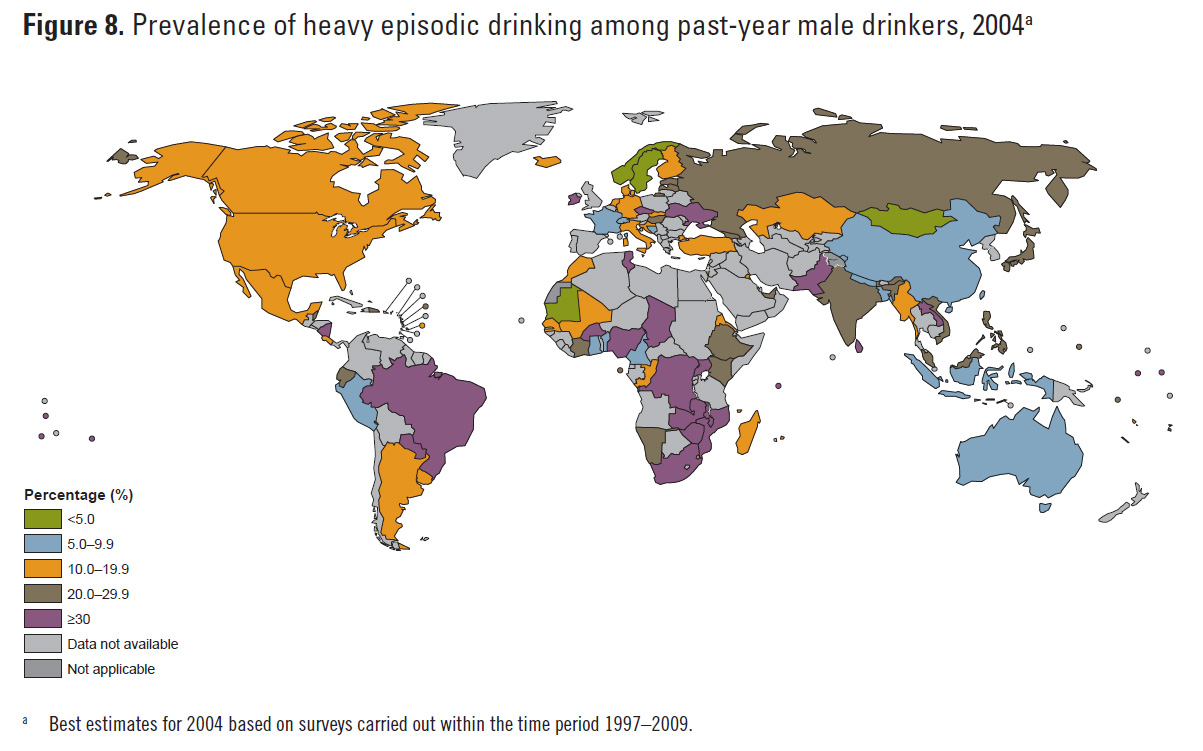
Mapping worlwide alcohol consumption

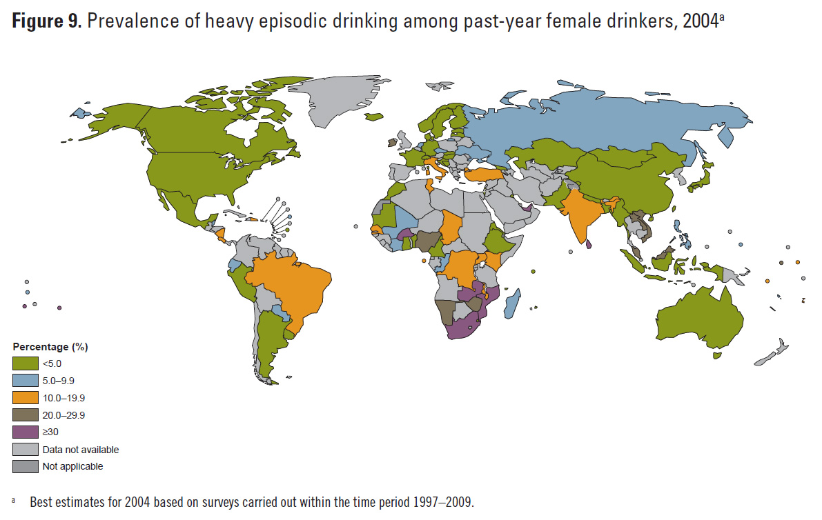
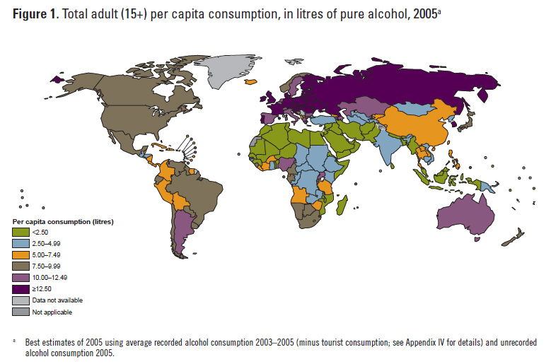
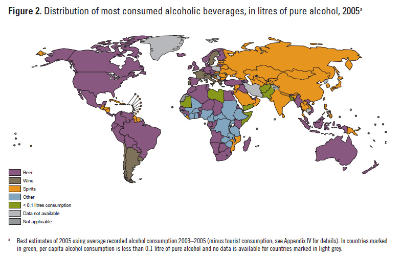
The World Health Organization’s recently released Global Status Report on Alcohol and Health includes some interesting maps on worldwide alcohol consumption. Click here to download WHO data and here to read the full report. Below are a few of the maps included in the report – including some interesting maps on binge drinking patterns.

Categories
Bucknell/Local Interest Digital Humanities General GIS GIS in History GIS in Humanities Slideshow Videos

Digital Gazetteer of the Song Dynasty

There are a million reasons I can think of for wanting to be in Santa Barbara, CA this week but one of them is that I’d love to attend UC Santa Barbara’s ‘Think Spatial’ forum. This week’s presentation features Ruth Mostern from UC Merced discussing her use of Google Earth for teaching undergraduate history courses. In Mostern’s upper division history course about the Silk Road, students read travel narratives and then use Google Earth to create digital atlases about their travelers’ journeys.  Here’s a short video that showcases some of her students’ work:

httpv://www.youtube.com/watch?v=_7I2BJBrLAU

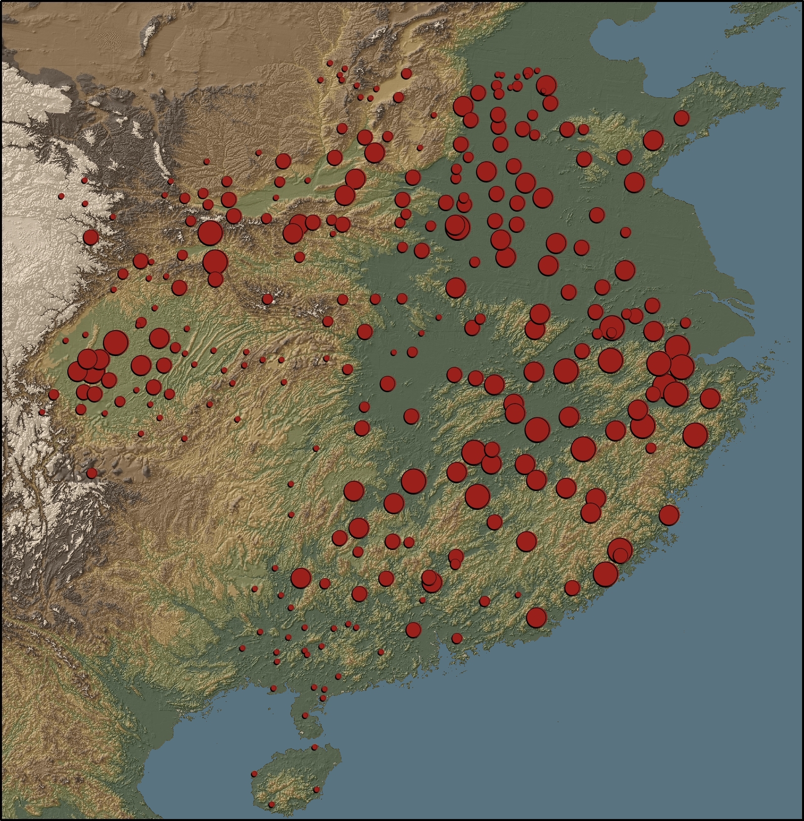
Mostern also makes extensive use of GIS in her research and is co-author of the Digital Gazetteer of the Song Dynasty. The website includes maps and downloadable data for counties and prefectures of the Song Dynasty. A sample map from the gazetteer is shown below.

“This map depicts the ratio of cantons to counties based on the data in the Song history. There is no county-level population data for the Song. The number of cantons in a county is the best proxy for its population. Red areas have a large number of cantons, and blue areas have a small number.”

Categories
General GIS

USAID launches new online map app for disease-tracking

The NY Times recently featured a story on a new online map tool developed by USAID for tracking disease outbreaks that might jump from animals to humans. The online mapping tool, known as Predict “will monitor data from 50,000 Web sites with many types of information, including World Health Organization alerts, online discussions by experts, wildlife trade reports and local news.” Click here to check it out.

Categories
Bucknell/Local Interest Data Environment General GIS

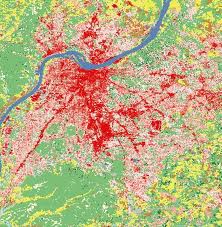
New National Land Cover Database (NLCD 2006) Available

The latest edition of the NLCD (2006) is now publicly available, providing updates on land cover change occurring between 2001 and 2006.  I’m working on downloading the data to the GIS data folder on Xanthus so stay tuned for a post telling you when that’s complete.  If you can’t wait, click here to download the data now from the Multi-Resolution Land Characteristics Consortium website.