Categories
Bucknell/Local Interest General GIS Slideshow Videos

Penn State releases final episode of “Geospatial Revolution” series

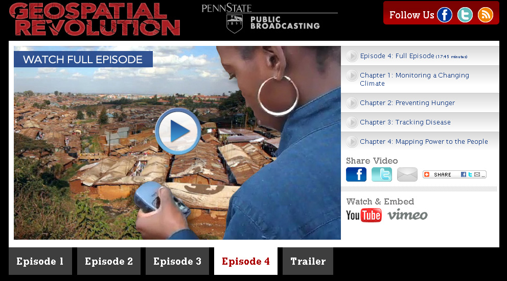
The final installment of Penn State’s “Geospatial Revolution” project was released today.  Click here to learn more about the project and see full-length videos for Episodes 1-3. See below for the full-length video of Episode 4.

Episode 4:

httpv://www.youtube.com/watch?v=9F7z9LLYxf8


Categories
Bucknell/Local Interest Events/Calendar General GIS Slideshow

Additional GIS faculty workshop added – register now for funded seats

Three GIS workshops for faculty will be offered during Summer 2011.

Introductory GIS workshop (3 days) – NEW
Wednesday, June 1st through Friday, June 3rd from 9am-2pm
(lunch provided)

Introductory GIS workshop (4 days)
Monday, August 8th through Thursday, August 11th from 9am-1pm
(lunch provided)

Advanced GIS workshop (2 days)
Monday, August 15th through Tuesday, August 16th
(lunch provided)

These grant supported workshops ($400 for each participant) will enable 12 faculty to engage in a hands-on GIS experience designed to be broadly useful to faculty, regardless of their specific disciplines and areas of research. To make the workshop experience more meaningful and relevant, both the introductory and advanced workshops will feature local data and topics of interest

If you are interested in participating, please click the link below to complete the GIS workshop interest form. Please note – there is a limit of 12 funded seats for the Summer 2011 GIS Workshops. Additional Mellon funded GIS workshop opportunities will be announced prior to summer 2012 and 2013 sessions.

Click here to access GIS workshop interest form.

Categories
Bucknell/Local Interest Events/Calendar Marcellus Shale Slideshow

Presentation Monday, May 2nd, 8pm – “Guinea Pigs Atop the Marcellus Shale”

From a press release from the Bucknell Environmental Center:

Presentation – “Guinea Pigs Atop the Marcellus Shale”
8 – 9:30 pm on Monday, May 2nd at the Union County Government Center, 155 North 15th Street in Lewisburg.

The event is free and open to the public.

Barbara Jarmoska, who serves on the Board of Directors of the Responsible Drilling Alliance (RDA), a grassroots organization based in Williamsport, will be the speaker. RDA is an education and advocacy coalition seeking to educate the public about the truth and consequences of deep shale gas drilling. (www.responsibledrillingalliance.org).   Jarmoska states, “After receiving numerous requests from colleges,
civic groups and organizations asking for someone to come and speak on the topic of gas drilling, I sought the help of local photographers tocreate this slide presentation. It is my hope that this talk will help
people to realize the gravity and scope of what is happening to Pennsylvania as our farm and forest lands are transformed intoindustrial landscapes by multinational energy companies who have moved
in to stake their claim to the gas that lies a mile below the land on which we live, work and play.”

Categories
General GIS GIS in Computer Science Slideshow

GPS vs. Smartphone positional accuracy

Joseph Kerski, part of Esri’s education team had some interesting blog posts last week comparing the accuracy of GPS units to his smartphone and implications that might have for using the SmartPhone for academic purposes

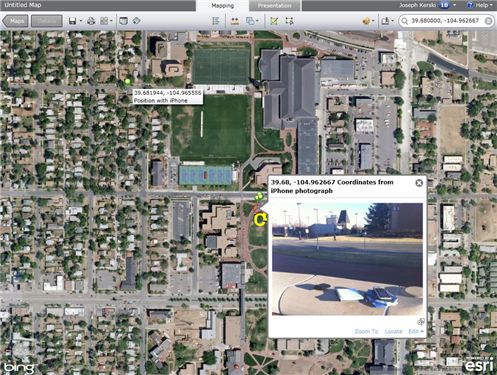
Recently I wrote about techniques to use photographs taken on a SmartPhone as hyperlinks to locations where you have collected field data using ArcGIS Online as your mapping platform. These photographs are geotagged with a latitude-longitude coordinate recorded at the time and location that the photograph is taken. But how accurate are those coordinates, and how do they compare to the accuracy of locations recorded by a GPS receiver? In other words, do I really need my GPS receiver any longer, since modern SmartPhones can capture positions using an embedded GPS chip and even supplement the GPS position by triangulating off cell phone towers?

Click here for part 1 of the blog post.

Click here for part 2 of the blog post.

Categories
General GIS GIS in Computer Science Map Apps Slideshow Videos

Your iPhone is Tracking You

O’Reilly Media published a story yesterday (on the penultimate day of its Where2.0 conference no less…)  describing Alasdair Allan and Pete Warden’s discovery of a hidden file on your iPhone and 3G iPad that keeps a running record of your device’s whereabouts. The file, part of the iOS4 release, records both latitude/longitude and timestamps – making it possible to create a detailed map of any and all movements you’ve made while having the iPhone or 3G iPad on your person.

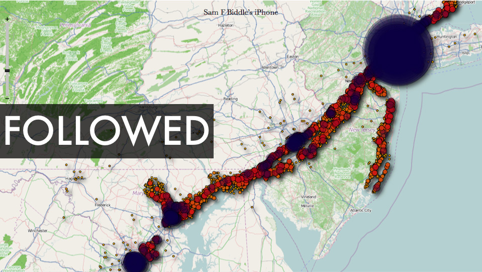
There is a debate underway about both the significance of this finding as well as how new a ”discovery’ it is  (see links below). But I’m kinda on the same page as Alexis Madrigal from the Atlantic – as much as I’m a little disturbed by the idea of a secret log of my whereabouts, I’m also fascinated by the idea of playing around with the data my iPhone has recorded and I’m curious to see what kinds of visualizations could be created out of it. If you’re curious about this too, you can visit Pete Warden’s website to download a free, open source app that will map the data from your iPhone or iPad tracking file.  See below for some sample ‘heat maps’ that were created using the tracking data from various user’s iPhones. Click here to see a video from Pete Warden’s website showing animation of tracking data from Warden’s iphone mapped by location and timestamp.

Story from O’Reilly Media:
Got an iPhone or 3G iPad? Apple is recording your moves

Story from Alex Levinson’s Blog:
Three Major Issues with the Latest iPhone ‘Discovery’

Story from The Atlantic:
My Life According To The iPhone’s Secret Tracking Log

Story from Gizmodo:
iSpy Conspiracy: Your iPhone is Secretly Tracking Everywhere You’ve Been, All the Time

Story from zdnet.com
Your iPhone is Tracking You (And Has Been for Awhile)

Two O’Reilly media researchers, Alasdair Allan and Pete Warden, caused quite a stir yesterday when they published an article about a hidden file in iOS 4 that regularly records the position of your device. All iPhones running iOS 4.0 or later log your location to a file called “consolidated.db” (a plain SQL file) which contains latitude-longitude coordinates and a timestamp.

Story from The Guardian:
iPhone Tracking Prompts Privacy Fears

Security researchers have discovered that Apple‘s iPhone keeps track of where you go – and saves every detail of it to a secret file on the device which is then copied to the owner’s computer when the two are synchronised. The file contains the latitude and longitude of the phone’s recorded coordinates along with a timestamp, meaning that anyone who stole the phone or the computer could discover details about the owner’s movements using a simple program.For some phones, there could be almost a year’s worth of data stored, as the recording of data seems to have started with Apple’s iOS 4 update to the phone’s operating system, released in June 2010.

YouTube Video of Pete Warden and Alastair Allan discussing the iPhone tracker at Where2.0:

httpv://www.youtube.com/watch?v=GynEFV4hsA0&p=0B2FEB8AACD826BE

Sample ‘heat map’ of Alexis Madrigal’s movements (created from data in the iPhone tracker file):
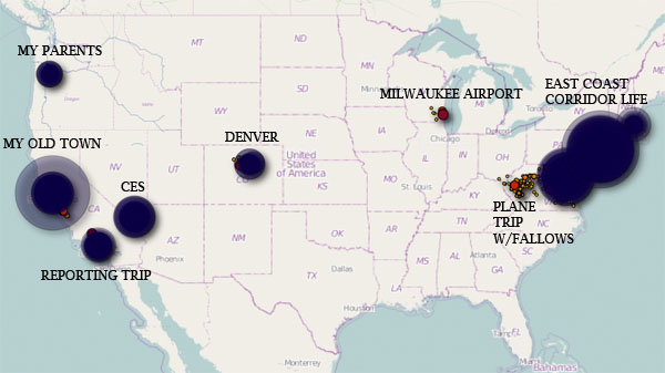
 

Sample ‘heat map’ from Sam Biddle’s iPhone: