Joseph Kerski, part of Esri’s education team had some interesting blog posts last week comparing the accuracy of GPS units to his smartphone and implications that might have for using the SmartPhone for academic purposes
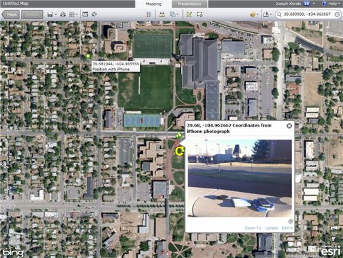
Recently I wrote about techniques to use photographs taken on a SmartPhone as hyperlinks to locations where you have collected field data using ArcGIS Online as your mapping platform. These photographs are geotagged with a latitude-longitude coordinate recorded at the time and location that the photograph is taken. But how accurate are those coordinates, and how do they compare to the accuracy of locations recorded by a GPS receiver? In other words, do I really need my GPS receiver any longer, since modern SmartPhones can capture positions using an embedded GPS chip and even supplement the GPS position by triangulating off cell phone towers?
Click here for part 1 of the blog post.
Click here for part 2 of the blog post.