Categories
Bucknell/Local Interest Events/Calendar General GIS GIS in Public Health

Geography Alumni Conference – Thur., Feb. 17th

Geographers’ Views:  Local Environmental Struggles, Global Context

This week the Geography Department welcomes four distinguished alumni to present their research and participate in a panel discussion on Thursday, February 17th in the Gallery Theatre (ELC). Research talks will be held from 4-6pm with a panel discussion to follow from 6:30-7pm.  Both events are free and open to the public.

Brian King
Bucknell Class of 1995
Assistant Professor of Geography,
Pennsylvania State University
“‘No One Dies of AIDS’: Political Ecologies of Health”

Sonja Pieck
Bucknell Class of 1999
Assistant Professor of
Environmental Studies,
Bates College
“The NGO, the Forest, and the ‘Hyperreal Indian’:
Notes on Transnational Amazonian Politics”

Jacqueline Vadjunec
Bucknell Class of 1997
Assistant Professor of Geography,
Oklahoma State University
“Tapping into ‘Florestania’: New Amazonian Geographies, Changing Land-Use and Emerging Identities in Acre, Brazil”

Joel Wainwright
Bucknell Class of 1995
Assistant Professor of Geography,
Ohio State University
“Climate Leviathan”
Categories
Bucknell/Local Interest General GIS

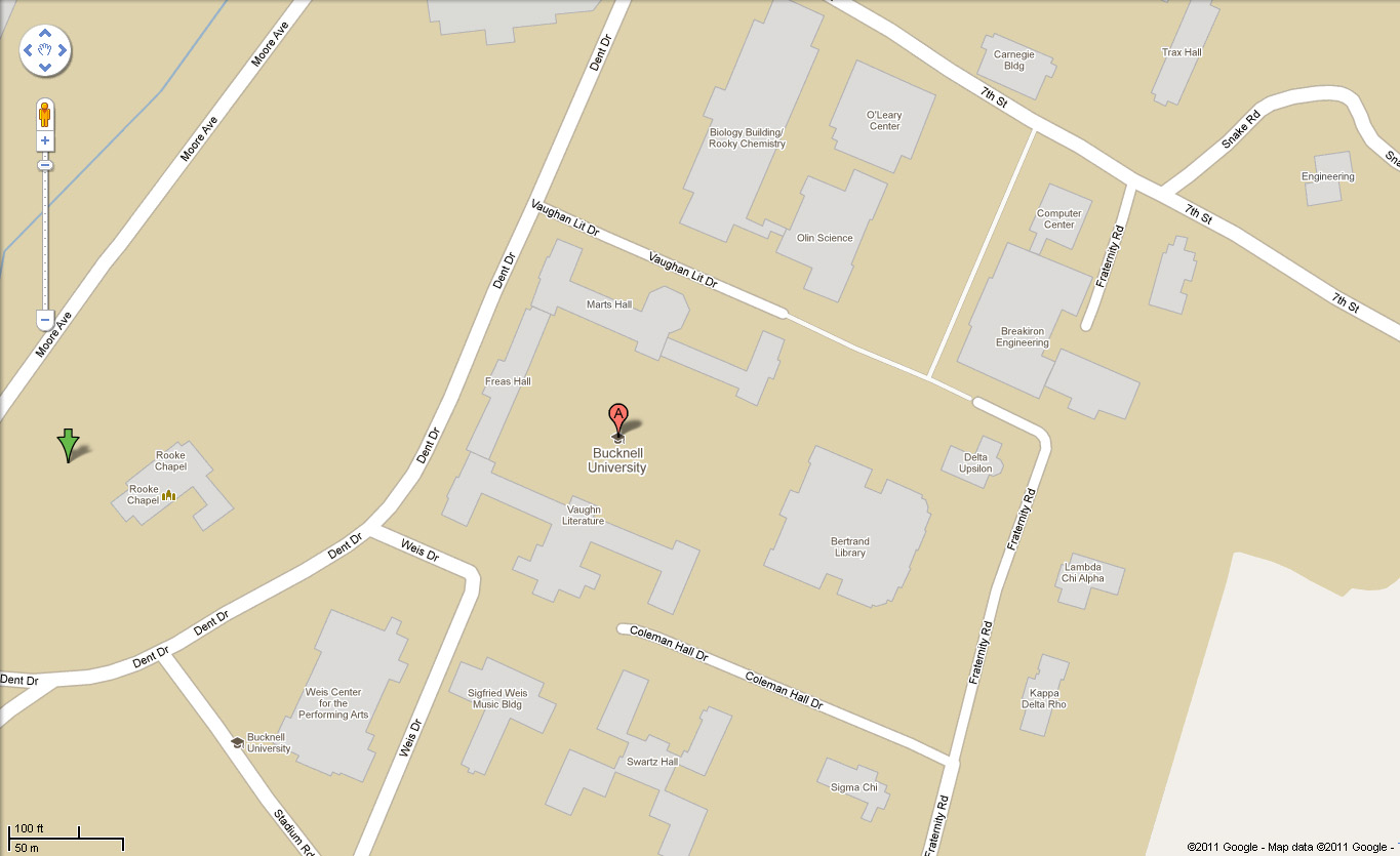
Bucknell campus buildings on Google Maps basemap

In other Google-related news, you can now see Bucknell’s campus buildings on the Google Maps basemap. Thanks to Dan Mancusi and Lisa Veloz for their help with this!  And to Google for finally getting around to adding it…

Check it out here.  You may notice… that the one building that’s mis-labelled is Coleman Hall, the home of the Geography Department…. More evidence of Google’s infamous sense of humor? Your guess is as good as mine – but we are working on the problem.

Categories
Bucknell/Local Interest Events/Calendar General GIS GIS in Computer Science

iExplorePAtrails Mobile Competition

Harrisburg University and the PADCNR recently announced the iExplorePAtrails Mobile Competition. The contest encourages developers from PA universities and beyond to develop mobile applications that combine data on PA trails with other data and user content. The goal is to create ‘mash-ups’ that encourage use of Pennsylvania’s 1,000s of miles of trails and enhance the fun that trail users can have. The contest deadline is April 15th – click here for more information.

Categories
Bucknell/Local Interest Data General GIS Slideshow

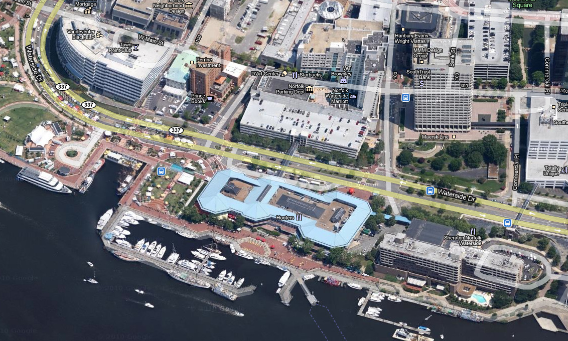
Google releases new oblique imagery in Google Maps

From the LatLong blog:
“We’re now well into the new year, and to kick off 2011, the Geo Imagery team has just rolled out some refreshed 45° imagery for a number of places in the United States. So whether you already miss the places you may have visited over the holiday season, or you’re looking for new vacation spots to travel to this year, you can now escape the winter weather and check them out virtually from the comfort of your warm and dry home.”
Check out some samples of the new data here.
Imagery from Norfolk, VA:
Categories
Bucknell/Local Interest Environment Events/Calendar General GIS Marcellus Shale

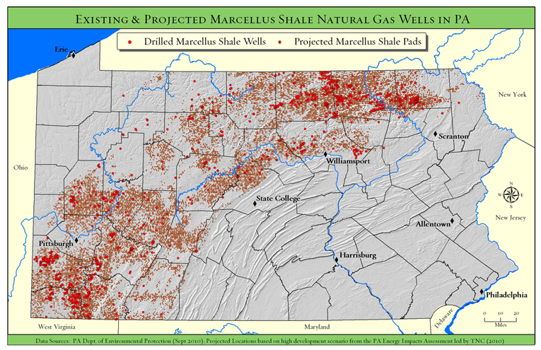
Upcoming presentation by The Nature Conservancy

Back in December I posted links to a new report and webinar by the Nature Conservancy describing their use of GIS to analyze potential Marcellus Shale impacts in PA.  At some point in April we’ll have the Nature Conservancy team here at Bucknell for a presentation of their work.  Stay tuned for more details…