Categories
Bucknell/Local Interest Events/Calendar General GIS Slideshow

Call for faculty participation in LIT and Mellon-funded summer GIS workshops

Call for faculty participation in LIT and Mellon funded summer GIS Workshops

Two GIS workshops for faculty will be offered during Summer 2011.
* Introductory GIS workshop (4 days)
Monday, August 8th through Thursday, August 11th from 9am-1pm*
(lunch provided)

* Advanced GIS workshop (2 days)
Monday, August 15th through Tuesday, August 16th*
(lunch provided)

*Additional workshop dates (e.g. end of May/early June) may be added depending on faculty interest. If you are interested in attending, but can’t join us during the August workshop dates, please click on the link below to suggest alternate dates.

These grant supported workshops ($400 for each participant) will enable 12 faculty to engage in a hands-on GIS experience designed to be broadly useful to faculty, regardless of their specific disciplines and areas of research. To make the workshop experience more meaningful and relevant, both the introductory and advanced workshops will feature local data and topics of interest

If you are interested in participating, please click the link below to complete the GIS workshop interest form. Please note – there is a limit of 12 funded seats for the Summer 2011 GIS Workshops. Additional Mellon funded GIS workshop opportunities will be announced prior to summer 2012 and 2013 sessions.

Click here to access GIS workshop interest form.
Categories
Bucknell/Local Interest Events/Calendar General GIS Marcellus Shale Slideshow

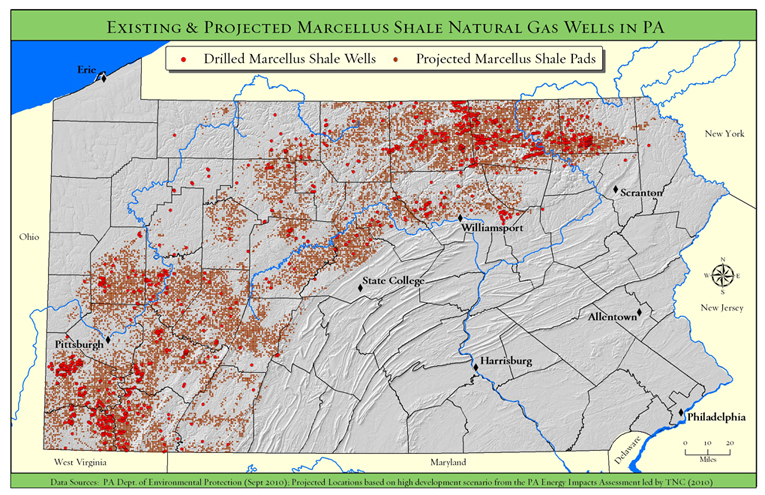
TNC Presentation on Marcellus Shale – Monday, April 4 @ 4:30pm

What: Presentation by The Nature Conservancy on Marcellus Shale/PA Energy Impacts
When: Monday, April 4th at 4:30pm
Where: Bertrand Library, Traditional Reading Room

Refreshments will be served.

Come and hear Tamara Gagnolet, GIS Analyst and Conservation Data Manager for the Pennsylvania chapter of the Nature Conservancy, discuss her work in using GIS to analyze potential impacts of Marcellus Shale gas drilling in Pennsylvania. Ms. Gagnolet’s presentation will focus on how GIS and spatial analysis were used to project how much energy might be developed in PA during the next 20 years, where that development is more or less likely to occur and what types of strategies might need to be employed to mitigate potential habitat impacts.

Students are welcome and encouraged to attend.

Categories
Bucknell/Local Interest Events/Calendar GIS in Public Health Slideshow

Upcoming webinar: GIS and research innovations at Penn State’s GeoVISTA Center

Join me next Tuesday, March 22nd at 2pm for a webinar about GIS research innovations at Penn State’s GeoVISTA Center.  Directions Magazine is hosting the event.  Click here to register and participate on your own – or come by my office in 107a, Research Services, Bertrand Library to watch.  More info from the Directions Magazine ad for the event:

Join Dr. Alan MacEachren, Dr. Alex Klippel and Dr. Krzysztof Janowicz of Penn State’s GeoVISTA Center as they discuss cutting-edge research across the breadth of “GIScience from spatial cognition, through formal geo-information representation, to spatial analysis, cartography and visual analytics. The focus [of the Center] is on developing powerful human-centered methods and technologies that allow scientists and decision makers to solve scientific, social, and environmental problems through computer-supported, visually-enabled analysis of the growing wealth of geospatial data.”

The research projects presented will have real-world ramifications for GIS practitioners whose work involves synthesizing large quantities of data and presenting information in a useful form.

During this webinar, you will learn:
• How academic research in geovisualization and visual analytics is applied in public health and crisis management
• How human factors, such as spatial thinking and cognition, impact the design and development of GIS tools
• How research in the Semantic Geospatial Web, sensor networks, and mobile computing will advance the integration of information

Who Should Attend
This webinar is appropriate for anyone interested in how GIScience research affects the geospatial technology of the near future.


Categories
Bucknell/Local Interest Digital Humanities Events/Calendar General GIS

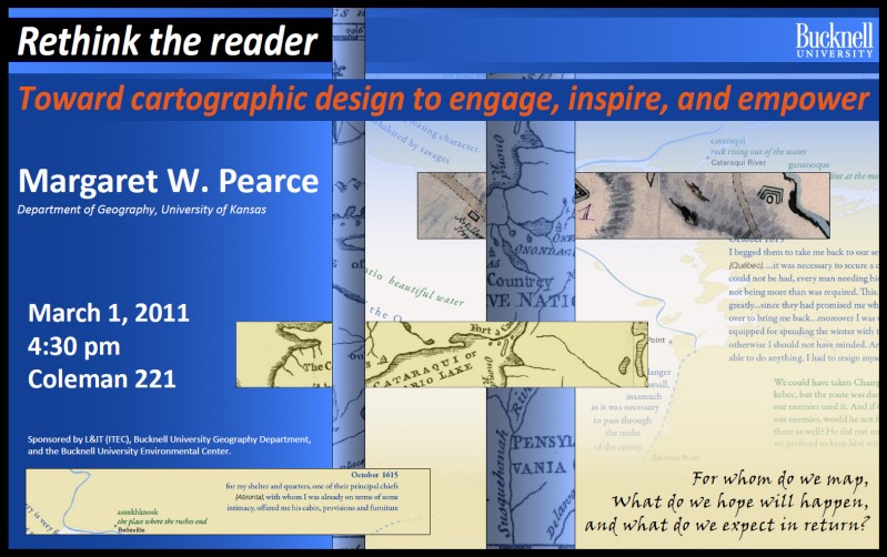
Reminder: Margaret Pearce cartography presentation tomorrow, Tues. 3/1

Margaret Pearce, University of Kansas Dept. of Geography, will present a lecture, “Rethink the Reader: Toward Cartographic Design to Engage, Inspire, and Empower” tomorrow (Tues. 3/1) at 4:30 in 221 Coleman Hall.

Dr. Pearce works on cartographic representation of cultural and historical geographies, especially indigenous geographies. Her work stems from, as she describes it, “a love of map design as both a tool for exploring geographical information as well as expressive form for communicating complex geographical ideas, especially ideas about place and experience.” Her work is inspired and influenced by emerging ideas in critical cartography, affective technologies, and Indigenous Studies. She has published in journals such as Cartography and Geographic Information Science, American Indian Culture & Research Journal, and Cartographic Perspectives and has authored a book, Exploring Human Geography with Maps.

Sponsored by L&IT, the Geography Department, and the Bucknell Environmental Center.

Categories
Bucknell/Local Interest Events/Calendar General GIS Videos

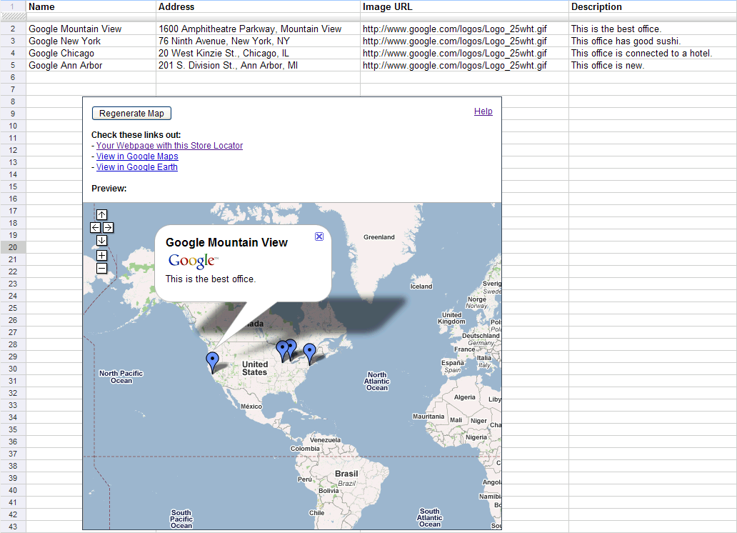
Open Lab session on Google spreadsheet mapper, docs, sites and video

There will be an Open Lab session for faculty in the ITEC office on Tuesday, March 1 from 9am-11am and Wednesday, March 2 from 2pm-4pm. Drop in at any time during the Open Lab hours to learn more about using the Google suite of tools for your teaching or research. The focus next week will be on Google spreadsheet mapper, docs, video and sites. The Open Lab is intended to be an informal workshop setting where you can learn more about tech tools and begin integrating them into your work. Feel free to bring your own data or we can use ours to show you how the tools work.