Several new datasets from Platts (an energy consulting firm) and the Nature Conservancy were added to the GIS Data folder on Xanthus last night. The data includes gas compressor stations for PA, NY and WV along with current and projected locations of Marcellus Shale wells and wind turbines in PA. Forest patches and landscape blocks are also included in the data from the Nature Conservancy . Full metadata is available on Xanthus. Bucknell faculty and students – please contact me for access and/or additional information on the new datasets.
Data from Platts:
Gas compressor station locations for PA, NY and WV.
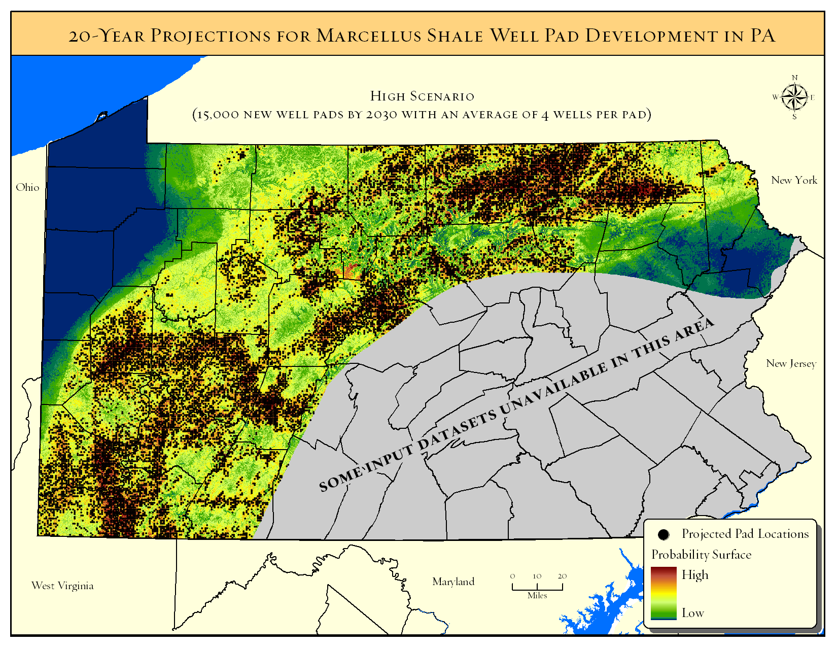
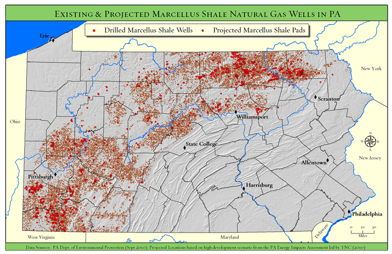
Datasets from TNC’s Pennsylvania Energy Impacts Assessment:
Projections by The Nature Conservancy and Western Pennsylvania Conservancy
- Probability surface of conversion to Marcellus Shale development
- Projected Marcellus Shale pad locations under low, medium, and high development scenarios
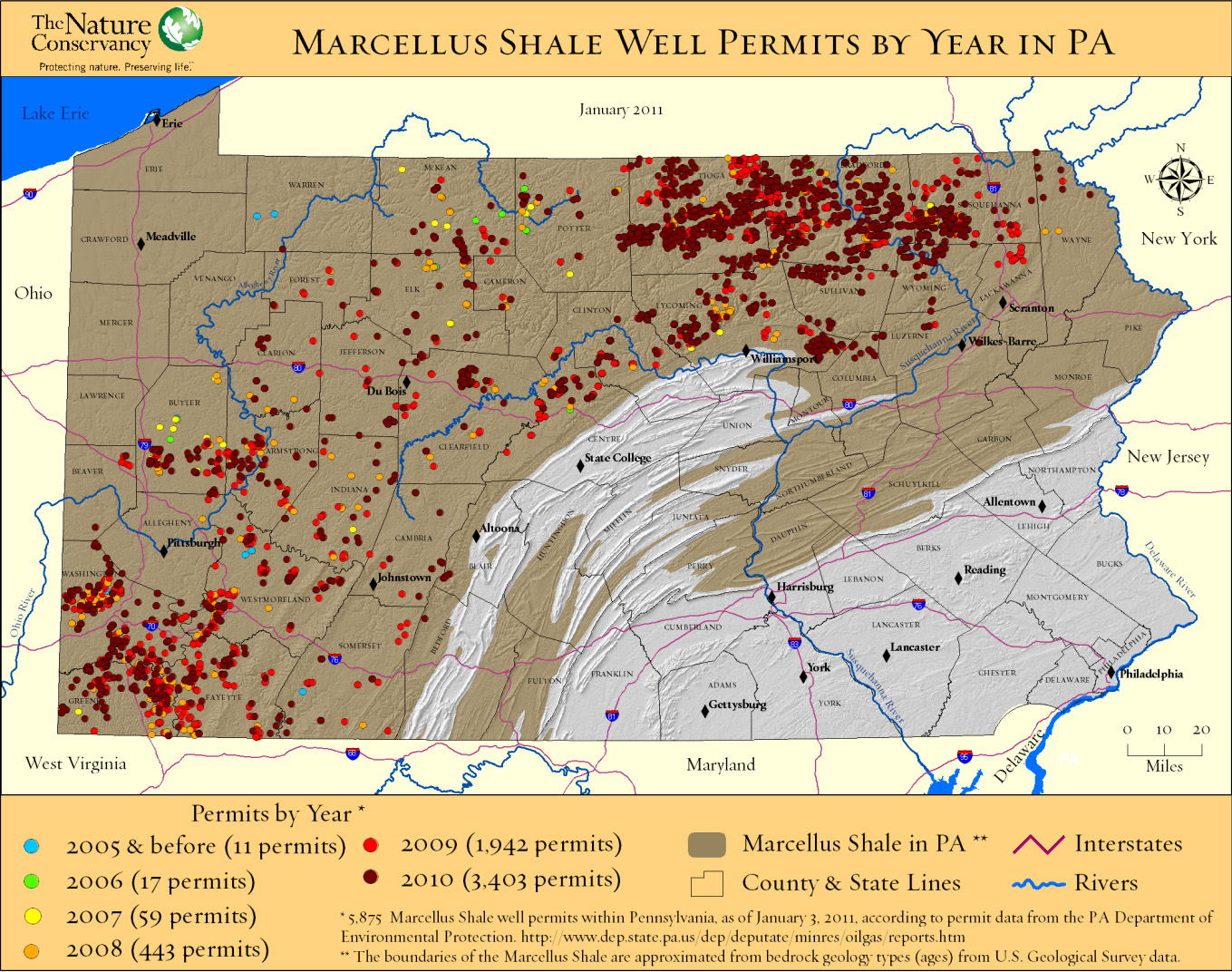
Marcellus Shale drilling permits from the PA Department of Environmental Protection (PA DEP)
- Drilled, valid, and expired Marcellus well permits as of January 2011
- Drilled Marcellus Shale wells only as of January 2011
Projections by The Nature Conservancy and Western Pennsylvania Conservancy
- Probability surface of conversion to wind energy development
—> Original model output at 30-meter resolution
—> Re-sampled raster at 60-meter resolution with exclusionary areas removed
- Projected wind turbine locations under low, medium, and high development scenarios
Case information from the Federal Aviation Administration (FAA)
- Built and proposed wind turbines and meteorological towers
- Built large-scale wind turbines only