Categories
Bucknell/Local Interest Digital Humanities General GIS Slideshow Videos

GIS and Digital Humanities – the History Engine and Hypercities

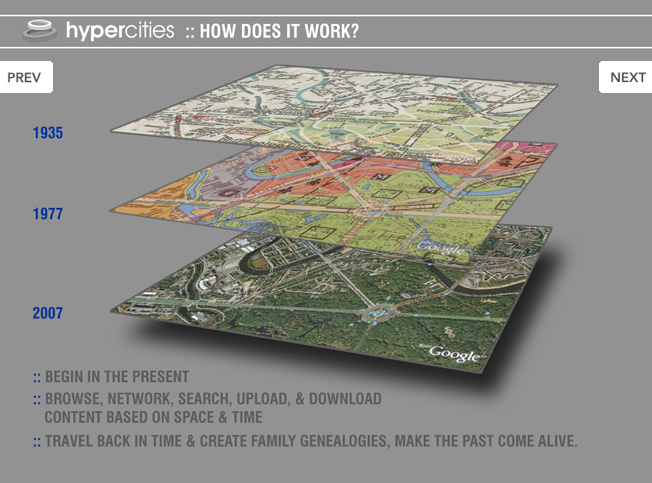
Click here (click on link for ‘Archived Program Recording’ in upper right hand corner) to watch a recorded presentation about two exciting digital humanities projects that have been built around GIS and other geospatial technologies.

The presentation, part of the NITLE next Digital Scholarship Seminar Series includes presentations by Scott Nesbit (Assoc. Director of the Digital Scholarship Lab) and Todd Presner (Director, Germanic Languages, Comparative Literature, and Digital Humanities, UCLA) onThe History Engine and Hypercities projects, respectively.
Categories
Bucknell/Local Interest Digital Humanities Environment General GIS GIS in Environmental Studies GIS in Humanities Marcellus Shale Slideshow

Tour the front lines of the Marcellus Shale boom with students from the Susquehanna Valley Summer Writer’s Institute

In Summer 2010, a team of five Bucknell undergrads participated in the Susquehanna Valley Summer Writer’s Institute with the goal of collecting and reporting stories of how the Marcellus Shale gas-drilling boom is transforming communities and cultural landscapes. Given how central geography is to the story of the Marcellus Shale boom, it was quickly agreed that the most powerful way to share this work would be through embedding the emerging, evolving stories into a clickable, interactive map – giving users the ability to interactively explore and engage with the material.  The map for the Summer 2010 project was built using the Google Maps API but plans are underway to implement ArcGIS Server technology to add additional functionality and interactivity.  Thanks to Mike Weaver from ITEC for his work in building the Google Maps site!