O’Reilly Media published a story yesterday (on the penultimate day of its Where2.0 conference no less…) describing Alasdair Allan and Pete Warden’s discovery of a hidden file on your iPhone and 3G iPad that keeps a running record of your device’s whereabouts. The file, part of the iOS4 release, records both latitude/longitude and timestamps – making it possible to create a detailed map of any and all movements you’ve made while having the iPhone or 3G iPad on your person.
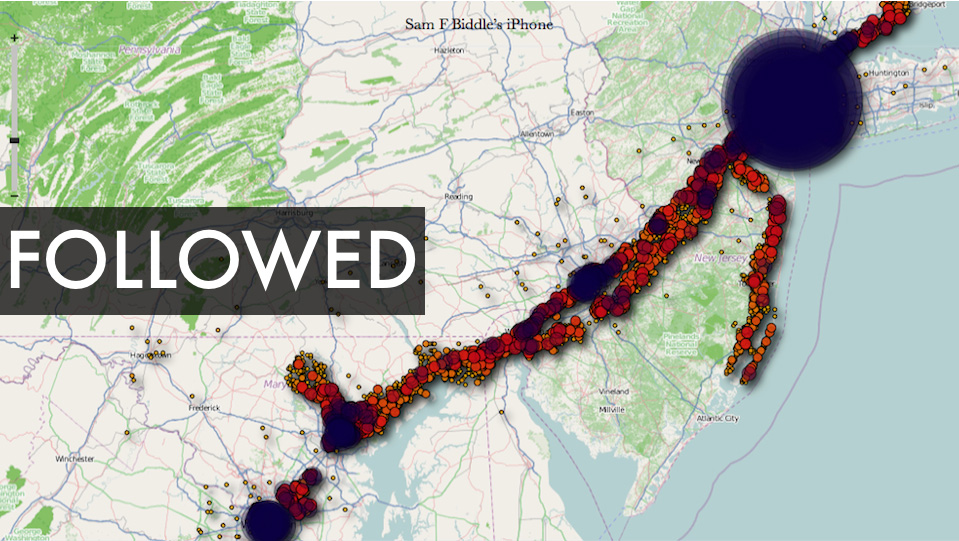
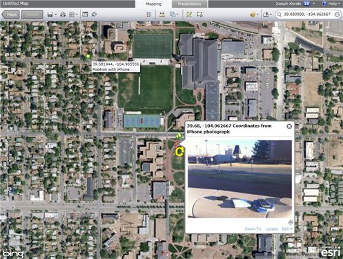
There is a debate underway about both the significance of this finding as well as how new a ”discovery’ it is (see links below). But I’m kinda on the same page as Alexis Madrigal from the Atlantic – as much as I’m a little disturbed by the idea of a secret log of my whereabouts, I’m also fascinated by the idea of playing around with the data my iPhone has recorded and I’m curious to see what kinds of visualizations could be created out of it. If you’re curious about this too, you can visit Pete Warden’s website to download a free, open source app that will map the data from your iPhone or iPad tracking file. See below for some sample ‘heat maps’ that were created using the tracking data from various user’s iPhones. Click here to see a video from Pete Warden’s website showing animation of tracking data from Warden’s iphone mapped by location and timestamp.
Story from O’Reilly Media:
Got an iPhone or 3G iPad? Apple is recording your moves
Story from Alex Levinson’s Blog:
Three Major Issues with the Latest iPhone ‘Discovery’
Story from The Atlantic:
My Life According To The iPhone’s Secret Tracking Log
Story from Gizmodo:
iSpy Conspiracy: Your iPhone is Secretly Tracking Everywhere You’ve Been, All the Time
Story from zdnet.com
Your iPhone is Tracking You (And Has Been for Awhile)
Two O’Reilly media researchers, Alasdair Allan and Pete Warden, caused quite a stir yesterday when they published an article about a hidden file in iOS 4 that regularly records the position of your device. All iPhones running iOS 4.0 or later log your location to a file called “consolidated.db” (a plain SQL file) which contains latitude-longitude coordinates and a timestamp.
Story from The Guardian:
iPhone Tracking Prompts Privacy Fears
Security researchers have discovered that Apple‘s iPhone keeps track of where you go – and saves every detail of it to a secret file on the device which is then copied to the owner’s computer when the two are synchronised. The file contains the latitude and longitude of the phone’s recorded coordinates along with a timestamp, meaning that anyone who stole the phone or the computer could discover details about the owner’s movements using a simple program.For some phones, there could be almost a year’s worth of data stored, as the recording of data seems to have started with Apple’s iOS 4 update to the phone’s operating system, released in June 2010.
YouTube Video of Pete Warden and Alastair Allan discussing the iPhone tracker at Where2.0:
httpv://www.youtube.com/watch?v=GynEFV4hsA0&p=0B2FEB8AACD826BE
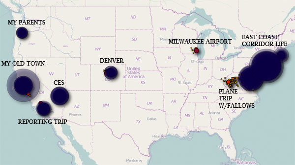
Sample ‘heat map’ of Alexis Madrigal’s movements (created from data in the iPhone tracker file):
Sample ‘heat map’ from Sam Biddle’s iPhone: