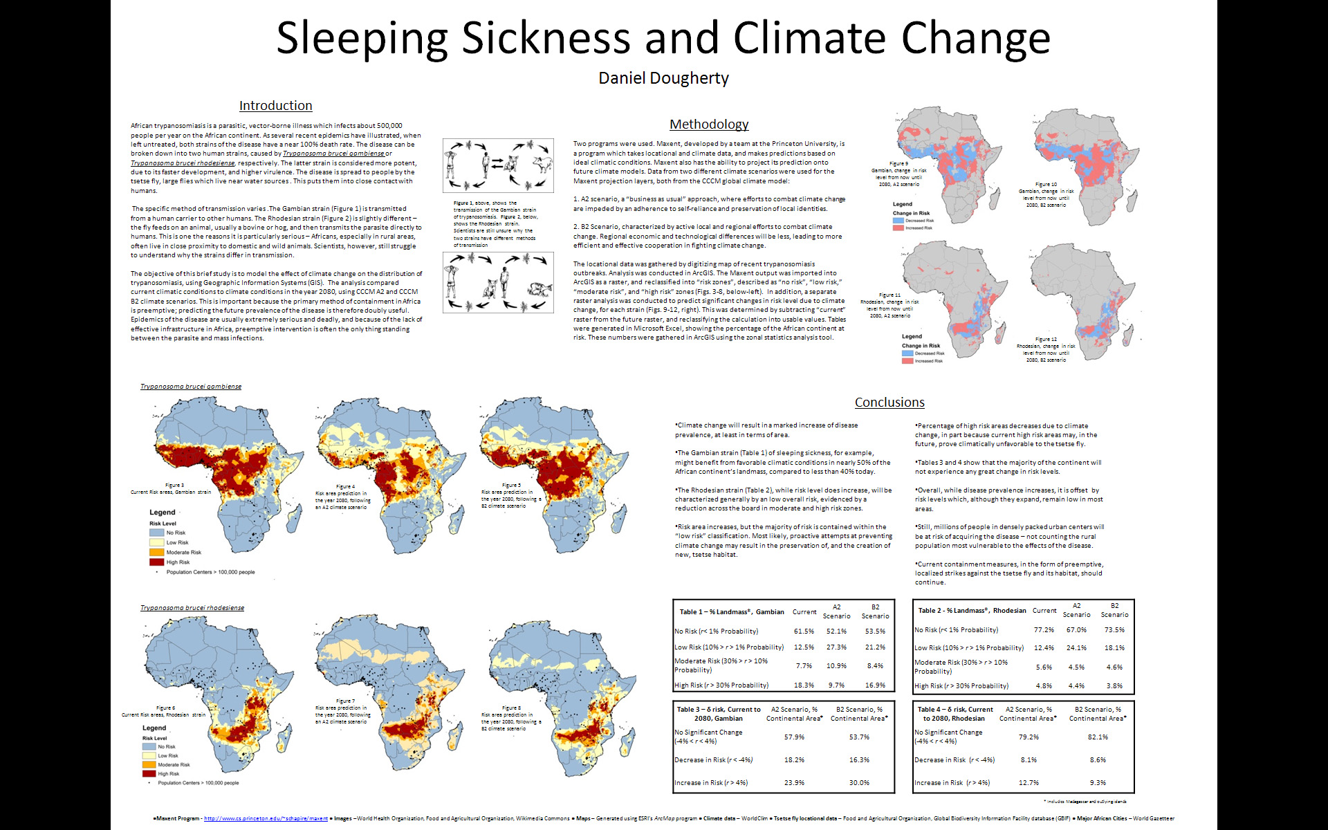
Below is an interview with Daniel Dougherty ’12, a History and Geography major, discussing his use of GIS for an analysis of the impact of climate change on sleeping sickness. The research project was conducted as part of Prof. Duane Griffin’s Geography 204 course Applied GIS. In the interview, Dougherty describes the data and methodology he used for the project and talks about some of the conclusions he drew from his analysis.
httpv://www.youtube.com/watch?v=UsJf29_Mujw
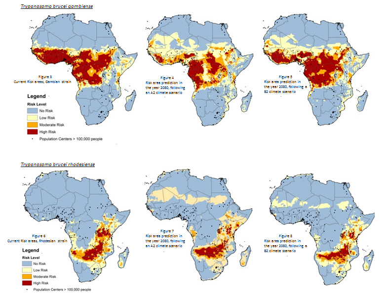
The images below show some of the maps Dougherty was able to produce using ArcGIS, MaxEnt and data from WorldClim.