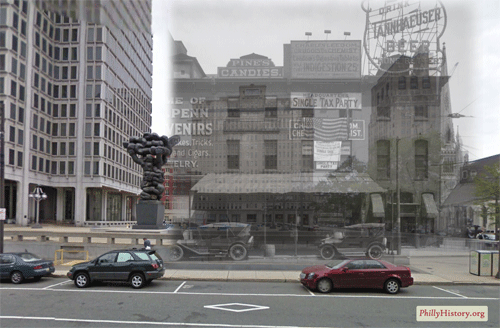
This is the first in a series of posts about several exciting new projects that my old friends and Philly GIS happy hour buddies are up to at Azavea. The first is funded by an NEH Digital Humanities Start-Up Grant that was awarded to the Philadelphia Department of Records to create a smartphone app that will enable users to view historic photos from PhillyHistory.org draped over the current modern-day landscape.
If the research proved successful, users would be able to point their smartphones, using the camera view, at a building or other location and see historic images of that same location. The photos would be accompanied by descriptive information from PhillyHistory.org with additional explanatory text provided by local historians. This combination of technology and history could be a powerful tool for showing the lengthy and interesting history of Philadelphia.
Click here to read more about the project. Azavea expects to make the app (for iPhones and phones running Android) available as a free download sometime in the next few months. A white paper about the project will also be released this spring and could hopefully serve as both inspiration and a springboard for faculty and/or student projects at Bucknell (where we have a wealth of historical images and GIS data for Lewisburg). Click here to read a blog post from Azavea Atlas about other examples of the use of augmented reality in cultural institutions.
