Categories
Bucknell/Local Interest Environment GIS in Engineering GIS in Environmental Studies GIS Jobs, Internships, Scholarships & Grad Programs Slideshow

GIS in research (and the classroom): modeling sea level rise inundation

During Summer 2012, Prof. Michelle Oswald (Civil Engineering) and student Christian Treat ’13 (Animal Behavior) used GIS to model seal level rise inundation and identify vulnerable transportation infrastructure in the Philadelphia metropolitian area. Christian’s stipend for this summer research project was paid for out of Bucknell’s GIS student assistant fund (funded in part by the Mellon grant we got a few years ago… stay tuned for details on summer 2013 paid research opportunities).

Over the course of the 2012-13 academic year, Christian has continued developing this research project as an independent study and is listed as a co-author in an upcoming publication in the Journal of Public Transportation. At some point this spring I’ll post an interview with Christian discussing his work on this project – but for now, you can check out the poster he presented at last November’s ‘GIS & Spatial Thinking‘ conference.
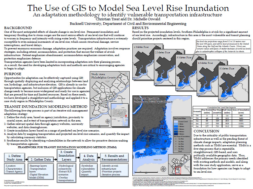
 

¨Christian Treat ’13 (Animal Behavior)/Prof. Michelle Oswald (Civil Engineering) (Bucknell), ‘Using GIS to Model Seal Level Rise Inundation’

SLR_Treat

By Janine Glathar

Janine Glathar joined the Digital Pedagogy & Scholarship team in 2009 to fill the newly-created role of GIS Specialist at Bucknell. She has worked in the field of geospatial technologies for more than 15 years as research specialist, technical analyst and software trainer. Prior to joining L&IT at Bucknell, Janine spent seven years doing applied GIS research in Philadelphia’s non-profit social services sector as the GIS Senior Analyst for Philadelphia Safe & Sound and the Greater Philadelphia Urban Affairs Coalition. Before transitioning to the social services research world, Janine worked for the GIS software company ESRI as a trainer and education/non-profit coordinator. She earned a B.A. in European History and Russian Language/Literature at the University of Pennsylvania. If you ask Janine where she’s from, she’ll tell you she’s a Navy brat and will probably offer to show you a map of all of the various places she’s lived over the years.

Areas of expertise:
ArcGIS, Digital Pedagogy, Digital Scholarship, GIS, Google Earth, Spatial Thinking