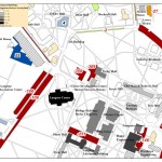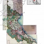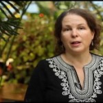
In the BU homepage's February 'Ask the Expert' interview, Prof. Katie Faull discusses her research on the 18th Century Moravian settlers and Native Americans who inhabited the Susquehanna watershed region. With the help of her research assistant, Emily Bitely '11, Prof. Faull has made extensive use of GIS in reconstructing 18th Century landscapes of the Susquehanna. Read the … [Read more...]
Upcoming presentation by The Nature Conservancy
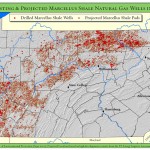
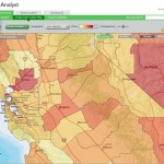
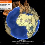
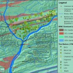
Back in December I posted links to a new report and webinar by the Nature Conservancy describing their use of GIS to analyze potential Marcellus Shale impacts in PA. At some point in April we'll have the Nature Conservancy team here at Bucknell for a presentation of their work. Stay tuned for more details... … [Read more...]
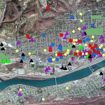
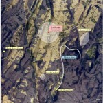
Using GIS to analyze Marcellus Shale impacts in Pennsylvania
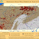
The Nature Conservancy recently released a study analyzing potential habitat impacts of energy development - including Marcellus Shale - in Pennsylvania over the next 20 years. Click here to watch a recorded presentation by the two lead researchers on the project. Click here for a copy of the full report. The presentation includes discussion of how GIS and spatial analysis … [Read more...]
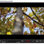
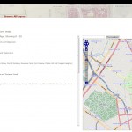
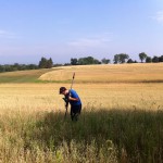
Tour the front lines of the Marcellus Shale boom with students from the Susquehanna Valley Summer Writer’s Institute
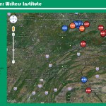
In Summer 2010, a team of five Bucknell undergrads participated in the Susquehanna Valley Summer Writer's Institute with the goal of collecting and reporting stories of how the Marcellus Shale gas-drilling boom is transforming communities and cultural landscapes. Given how central geography is to the story of the Marcellus Shale boom, it was quickly agreed that the most … [Read more...]