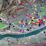
Tuesday, March 1st @ 4:30pm (Coleman 221) "Rethink the reader: Toward cartographic design to engage, inspire and empower" Come hear Margaret Pearce from the University of Kansas talk about map visualization and cartographic design. Dr. Pearce is a geographer who works on cartographic representation of cultural and historical geographies, especially Indigenous … [Read more...]
Ask the expert: Katie Faull on maps, Moravian diaries and Native American history
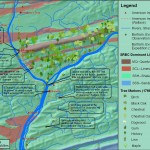
In the BU homepage's February 'Ask the Expert' interview, Prof. Katie Faull discusses her research on the 18th Century Moravian settlers and Native Americans who inhabited the Susquehanna watershed region. With the help of her research assistant, Emily Bitely '11, Prof. Faull has made extensive use of GIS in reconstructing 18th Century landscapes of the Susquehanna. Read the … [Read more...]
GIS and Digital Humanities – the History Engine and Hypercities
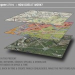
Click here (click on link for 'Archived Program Recording' in upper right hand corner) to watch a recorded presentation about two exciting digital humanities projects that have been built around GIS and other geospatial technologies. The presentation, part of the NITLE next Digital Scholarship Seminar Series includes presentations by Scott Nesbit (Assoc. Director of the … [Read more...]
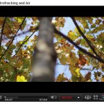
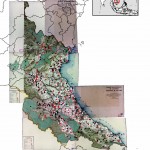
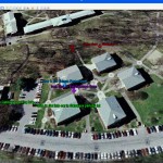
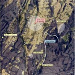
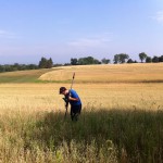
Tour the front lines of the Marcellus Shale boom with students from the Susquehanna Valley Summer Writer’s Institute
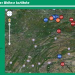
In Summer 2010, a team of five Bucknell undergrads participated in the Susquehanna Valley Summer Writer's Institute with the goal of collecting and reporting stories of how the Marcellus Shale gas-drilling boom is transforming communities and cultural landscapes. Given how central geography is to the story of the Marcellus Shale boom, it was quickly agreed that the most … [Read more...]