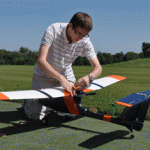
Come hear Nick Urban, Computer Science '12, talk about designing, building and flying the remote-controlled Flying Bison drone. Nick will be presenting on Monday, 9/26 at noon (Olin 364) as part of the Physics department's coffee talk series. He'll have the plane with him and will be showing some new video that will be captured by the drone in test flights he's conducting this … [Read more...]
Keystone Edge story about the Flying Bison

The online journal, Keystone Edge, recently picked up the story of Nick Urban and the Flying Bison drone. Published by Issue Media Group, the Keystone Edge ... tells the story of the new economy in Pennsylvania--a narrative of creative people and businesses, new development, cool places to live, and the best places to work and play. Each Thursday, the Web site and weekly … [Read more...]
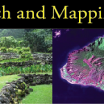
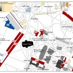
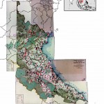
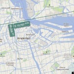
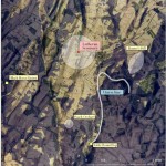
Williamsport and Lycoming County Asset Mapping
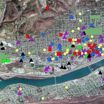
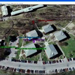
Guest post by Dan Ladd, Middlebury College ’14 One of the major projects the GIS team worked on for much of the early part of the summer was mapping community assets in Williamsport and Lycoming County. This project was requested by Professors Ben Marsh (Geography) and Carl Milofsky (Sociology). Chad Lawlis (Environmental Studies '11) and I worked on putting together the … [Read more...]
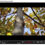
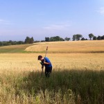
Computer science major builds aerial drone for a bird’s-eye view of local stream
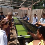
Bucknell communications recently published an article on the work that Nick Urban and the other GIS student assistants did this summer for the Miller Run Restoration project. Excerpt below - click here to read the full article. LEWISBURG, Pa. - As the son of an aircraft mechanic, Nick Urban learned a thing or two about planes. The rising senior at Bucknell University … [Read more...]
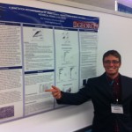
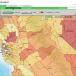
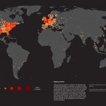
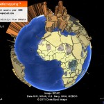
Using G.I.S. to Help Analyze and Visualize Disasters
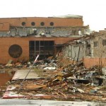
Guest post by Michael Grasso, Environmental Studies '13 G.I.S. has an extremely large variety of applications. With G.I.S. one could map an area affected by a natural disaster in order to analyze the extent of the damage, the value of the property damaged, and how different areas were affected differently. G.I.S. can even be used just to help someone visualize the totality … [Read more...]